Download
1 / 21
230 likes | 396 Views
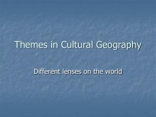
Ms. Soles Social studies: Geography. Lesson 3 Map Practice. What are the basic parts of a map?. Hints Gives it a “name”! “Directs” you! Helps ”unlock” the map’s pictures, colors, lines, etc. It really doesn’t “weigh” anything, but it sounds like it might!. The Basic Parts of a Map.

E N D
Ms. SolesSocial studies: Geography Lesson 3 Map Practice
What are the basic parts of a map? Hints • Gives it a “name”! • “Directs” you! • Helps ”unlock” the map’s pictures, colors, lines, etc. • It really doesn’t “weigh” anything, but it sounds like it might!
The Basic Parts of a Map • Compass Rose • Map Legend or Key • Scale • Title
Cartographer Arthur H. Robinson, an American cartographer influential in thematic cartography, stated that a map not properly designed "will be a cartographic failure." He also claimed, when considering all aspects of cartography, that "map design is perhaps the most complex."[19] Robinson codified the mapmaker's understanding that a map must be designed foremost with consideration to the audience and its needs. Illustrated map
Topography A topographic map is primarily concerned with the topographic description of a place, including (especially in the 20th century) the use of contour lines showing elevation. Terrain or relief can be shown in a variety of ways (see Cartographic relief depiction). Relief map
Reading a map Practice http://video.about.com/geography/Read-a-Map.htm
Geography Activities http://education.nationalgeographic.com/education/multimedia/world-physical-mapmaker-kit
Maps can show details of the Earth’s surface.Present Day Earth Topography
Mapping and Technology In cartography, technology has continually changed in order to meet the demands of new generations of mapmakers and map users, such as you!
Advances in electronic technology in the 20th century ushered in another revolution in cartography. Ready availability of computers and peripherals such as monitors, plotters, printers, scanners, and analytic stereo plotters, along with computer programs for visualization, image processing, spatial analysis, and database management, have democratized and greatly expanded the making of maps.
Mapping can be done with GPS and laser rangefinder directly in the field (for example by Field-Map technology). Real-time map construction improve productivity and quality of mapping. Image is showing mapping of forest structure (position of trees, dead wood and canopy)
In seismology an isoseismal map is used to show lines of equal felt seismic intensity, generally measured on the Modified Mercalli scale. Such maps help to identify earthquakeepicenters, particularly where no instrumental records exist, such as for historical earthquakes. They also contain important information on ground conditions at particular locations, the underlying geology, radiation pattern of the seismic waves and the response of different types of buildings
A locator map, sometimes referred to simply as a locator, is typically a simple map used in cartography to show the location of a particular geographic area within its larger and presumably more familiar context. Depending on the needs of the cartographer, this type of map can be used on its own or as an inset or addition to a larger map.
thematic map of a city (or part of a city) created to enable the fastest possible orientation in an urban space. The graphic representation of objects on a city map is therefore usually greatly simplified, and reduced to generally understood symbology. Depending upon its target group or market, a city map will include not only the city's transport network, but also other important information, such as city sights or public institutions. City Maps
What else can a map provide for you? http://www.bing.com/maps/default.aspx?q=&mkt=en-us&FORM=BYFD#
Goodbye for now!Let’s take a quick trip with Google Earth before I go! http://www.GoogleEarth.com
Resources http://wikkipedia.com http://GoogleEarth.com http://www.bing.com/maps/default.aspx?q=&mkt=en-us&FORM=BYFD# http://video.about.com/geography/Read-a-Map.htm http://education.nationalgeographic.com/education/multimedia/world-physical-mapmaker-kit