Download
1 / 41
410 likes | 525 Views
" Integration of biodiversity data recording and information management systems for environmental sustainability: a call for EU ASEAN collaboration ” ASEAN-EU Science, Technology & Innovation (STI) Bangkok, Thailand 21-23 January 2014. i s a partner of .

E N D
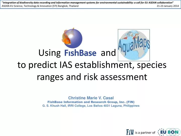
"Integration of biodiversity data recording and information management systems for environmental sustainability: a call for EU ASEAN collaboration” ASEAN-EU Science, Technology & Innovation (STI) Bangkok, Thailand 21-23 January 2014 is a partner of Using FishBase and aMapsto predict IAS establishment, species ranges and risk assessment Christine Marie V. Casal FishBase Information and Research Group, Inc. (FIN)G. S. Khush Hall, IRRI College, Los Baños 4031 Laguna, Philippines
Fish demand growth rate (2007-2015) From: Cai (2011)
2050 2010 Climate change modifies species ranges SEA Species Richness Maps (P>0.5) Tropics are highly vulnerable, fish would be migrating to their comfortable temperatures, some commercial species would be lost (moved).
Fishes which have been introduced and established in the ASEAN Competed and/or preyed on indigenous species OreochromismossambicusL.Lovshin ClariasgariepinusR. Green From FishBase 2014 ParachromismanaguensisB.Y. Tang
FishBase and AquaMaps 32,700 Species (finfish), 302,100 Common names, 53,400 Pictures, 49,500 References, 2,090 Collaborators. 700,000 Visits/Month (version 12/2013) www.fishbase.org Standardized distribution maps for over 17,300 species of fishes, marine mammals and invertebrates (version 8/2013) www.aquamaps.org
Information in FishBase and SeaLifeBase Morphology & PhysiologyMetabolism ●Gill area Vision ●Disease Brain ● AbnormalitiesEcotoxicology ●Swim mode Distribution Occurrence ● FAO areas Country ● Ecosystem Introductions Genetics & AquacultureElectrophoresis Heritability ●Strains Reproduction & Life HistoryMaturity ●Spawning ●Eggs Larvae ●Broodstock ●Fry nurseryLarval dynamics ●Larval speed Trophic Ecology Ecology ●Predators Food items Diet composition Food consumption Ration Fish as FoodProcessing ●Ciguatera FAO catches Aquaculture (production) Population Dynamics Growth/Mortality ●L/W relations Maximum sizes ●RecruitmentL/L relations ●Length frequency Other Tables Pictures ●References Biblio ● Keys ●Sounds
PteroisvolitansJ. E. Randall Predicting species ranges using environmental envelopes Now reported in the Bahamas, Belize, Bermuda, Colombia, Costa Rica, Cuba, Dominican Republic, Haiti, Honduras, Jamaica, Mexico, Nicaragua, Panama, Puerto Rico, Venezuela and most of the Caribbean. In the US, from Texas, Louisiana, Florida, North and South Carolina Virginia and as far north as New York and Rhode Island. Native range Suitable habitat
Minimum Information • Depth range – min-max; common depth • Environment – adult feeding and breeding environment • Occurrence – point data (geographic coordinates) • Bounding box coordinates – northernmost, southernmost, westernmost and easternmost limits of native range Decapterus maruadsi Japanese scad Galunggong Chia, B. • FAO areas – fishery statistical areas (FAO) where found/collected Species and online point databases are primary sources of key minimum input data.
2010 2050 Relative probabilities of occurrence: Decapterusmaruadsi Japanese scad Galunggong Species Environmental Envelopes: Maps are produced by the CMAR Hosted at http://www.obis.org.au
2050 2010 SEA Species Richness Maps (P>0.5) AquaMaps for different species can be analyzed together to illustrate patterns in marine biodiversity for different species groups.
Map of predicted drop in species counts in SEA by the year 2050 (based on IPCC SRES A1B)
Risk assessment for invasive species The Invasiveness page Information in FishBase • Species introductions (~5000 records) • Natural distribution • Establishment • Use (aquaculture or ornamental) • Biological characteristics Preliminary table risk assessment based on information from 800 published documents and contributions from collaborators. • reports species which may be able to establish in natural waters of a country. • excludes species which are native or endemic to the country.
Fishes introduced and established in waters of the Philippines Incomplete 30 of the 46 species listed here have been predicted by the invasiveness tool
Fishes which have been predicted to establish in the ASEAN 104 fish species have established in the ASEAN, however this is incomplete.
Of the 42 species listed, 21 are established in ASEAN waters!
Possible area for collaboration: improve the coverage of information for all important fish species in the ASEAN, e.g. life history
Invite scientists/researchers to share pdfs • Invite scientists/researchers to review and to fill up information (through remote data entry (RDE)) • provide information on species’ parental care, etc. • Use proxy data (from congeners) upon advise of experts • E.g. species with similar maximum lengths under same genera may have similar longevity • Collaborative projects (species biology, etc.) • Citizen science activities (training, distribution information, devt. of IEC materials, etc.) Strategies to accumulate data
Collaboration with EU BON • Contribute to: • efforts to harmonize the European taxonomic backbone (on fishes) • gap analysis on information for marine fishes and identify priorities for filling gaps • the advertisement of EU BON and dissemination of its outputs
Collaboration with EU BON • AquaMaps • contribute AquaMaps model and layers to efforts to develop hybrid models of species distribution scenarios; along side this is developing a forum for collaborative expert review of the mapsto improve them and likewise make the expert inputs available to inform other distribution models developed under EU BON • contribute AquaMaps layers to analyses of uncertainty (model algorithm, data sources, etc.) • provide visualization tools for viewing biodiversity information according to needs of stakeholders by improving delivery of our AquaMaps tools for --marine and some fwAquaMaps-- (e.g., species richness maps, latitudinal/longitudinal species richness transects, species checklist by country/LME/ecoregion, wizard-assisted interface for user created/edited AquaMaps, etc.); and contributing to porting these to EU BON Portal as needed
Thank You For clarifications and collaboration do contact: Christine Marie V. Casal c.casal@fin.ph
AquaMaps Citations • 1. ACB Terminal Report: • Aquatic Biodiversity Informatics Office/The WorldFish Center (2010). Hotspots of marine biodiversity in the Southeast Asian Sea: Mapping current locations and climate change impacts. (Terminal Report). Los Baños, Laguna: Bailly, N., Kesner-Reyes, K. and Casal, C.V. • 2. PowerPoint Presentation • Kesner-Reyes, K., Bailly, N. and Casal, C.V. (2011). Predicting species distributions and potential impacts of climate change on marine biodiversity in Southeast Asia. International Conference on Biodiversity and Climate Change. Manila.
Key points: • FishBasehandles fishes - marine, brackish and fresh • Developing countries with limited funds for biodiversity assessment/monitoring and management much less risk assessments would benefit from the information available in the databases. Developing tools to assist countries (developing) in their reporting accountabilities to the CBD and other such fora is also important. The tools which we are trying to develop are to fill the void of these types of knowledge in these countries. • We are looking towards building tools to improve the capacity of the resource managers and decision-makers. We are aware that the tools we have developed could be further improved with more collaborative efforts (data and tool design) with more partners both in the developing and developed countries. • Keeping information updated/current and freely available to all has a cost and through the years it has become more and more difficult to secure funding to continue the work.
Selecting “Good Point Data” Distribution: Indo-West Pacific: South China Sea to the Hawaiian Islands; north to south Japan and south to Australia; Marshall and Mariana Islands. Reported occurrence in southern Africa could not be confirmed (Ref. 3197). • Occurrence points within bounding box or known FAO areas Bounding box or FAO area limits serve as independent verification of the validity of occurrence records.
Extracting Environmental Parameters Global grid of 259,200 half degree cells Good cells are used to extract the of environmental parameters within the species’ native range.
Calculating Environmental Envelopes Decapterus maruadsi The environmental envelopes describe tolerances of a species with respect to each environmental parameter.
Pc = Pbathymetrycx Ptemperaturec x Psalinitycx Pprimary productioncxPice concentrationcx Pland distancec Predicting Probability of Occurrence Probabilities of species occurrence are computed by matching the species environmental envelope against local environmental conditions to determine relative suitability of a given area.