Download
1 / 25
250 likes | 415 Views
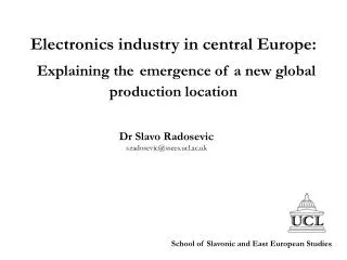
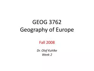
Current SDI development topics in Central Europe with respect to S patial P lanning and Geoinformation P olicies Ji ří Hiess KGI UPOL University Palackeho , Olomouc, cathedra of geoinformatics (CZ) hiess2@ gmail.com. 2013: Central Europe in EU 28.

E N D
StatGISConference, Olomouc, 18. – 22. 11. 2013 • Current SDI development topics in Central Europe with respect to SpatialPlanningand Geoinformation Policies • Jiří Hiess • KGI UPOL • University Palackeho, Olomouc, cathedraof geoinformatics (CZ) • hiess2@gmail.com
StatGISConference, Olomouc, 18. – 22. 11. 2013 • 2013: CentralEurope in EU 28
Whatare barriersandchallengesofspatialplanningandregionaldevelopment? What are currentapproaches to overcome these? • Infrastructure: state-of-play • Data > Geo-Data > GIS > SDI > INSPIRE (2007)… • Spatial Data Infrastructures> SDSI(+ Services, Sambura 2011)… • Networksandcloudsof(geo)information • Shared complex geospatial infrastructure • Informationforplanning & decisionmakingprocess: • PSI Directive(from 2003) + Free Data + Open Source=> newenvironment, potentialfordeeperdemocratization &bettercompetitiveness • How do specialiseddisciplines(spatialplanning, geoinformatics, cartography)andtheirtheory, research, andpracticereflectthisamountoffacts, ideas, achievements,mistakes, experience? • UNDERESTIMATED!
StatGISConference, Olomouc, 18. – 22. 11. 2013 Examplesthenew data sources andinputsin planning processes require much more than pure existence, access to disposable, repositories and latest technology only!
COMPLEX, PUBLIC, ACCESSIBLE SPI (spatialplaninginformation) 1 : 40.000theredbold line representsCZ/AT stateborder, colouredpolygons show Urban Planzonesof Vranov nad Dyji - a villagewhichgavename to the VRANOV dam; itslakefills a 30 km longrivervalley, theriver DYJE flowsfromherethroughthebi-lateralNational park Podyji-Thayatalandrepresentsthenaturalstateborder.
Disposableaccuracyprovideslargescale DETAIL, BUT (!) the public administrationoftenforget (is qualifiedenough ?) to generalize, workin alternatives, makenewdeeperandsmartanalysis, argue in wisedecisionmaking 1 : 5.000generalizedurbanplanof Vranov nad Dyji,intelligent geodata aboveorthophotoand cadastralmap (refernceGMVScomponents). This geoportal provides basic OWS + export ofselecteddatasets to externalcustomers (e.g. contractor, urbandesigner, architect, enterpreneur, citizen, tourist). Thisportalwaslaunched in 2006 and is continuouslydeveloped.
Currently: digital analytical planning backgrounds example: conflict of dumping prices, weak experience of staff, barriers to collect (or effectively protect?) corporate and infrastructural data
StatGISConference, Olomouc, 18. – 22. 11. 2013 • Visualisation, harmonisation, standardisation, accessibility data qualitycatalogization • … in progress
New GIT applications > lessneedofhumanresourcemass, a higherqualificationof HR is expected(thisexamplewasdevelopedat UPOL)
StatGISConference, Olomouc, 18. – 22. 11. 2013 INSPIREd GI Policies • EU Directivewasexcellent impuls • Annexes II + III relevant to spat. planning! • 30000 pagesofimplementingRULES! • TheconceptofEuropeanSDI…ELF - EuropeanLoc. Framework, GMES, GNSS, … USAGE!
Spa-ce.net 2013 at IÖR Dresden • From INSPIRE rules to planning practice : GeoModeler app. (J. Hollenbach, P. Korduant, DE, 2013)
HR goal: surreal androanimaloid ? • Does technology determinate the progress? Is ICT omnipotent ?
Spa-ce.net 2013 at IÖR Dresden • Surprise:What has happenupstairs?
UAVoctoptera live demonstrationforspatialplannersatUP-GIS 2013
Spa-ce.net 2013 at IÖR Dresden • UAV as accessible source of immediate spatial (planning) data and operational part of complex information for territorial planning and management
Many from ICT dreamsbecomerealisticguidelinesfor our future(F. HarveyatAGIT 2013, Salzburg)
AchievementsSomedreamsbecame reality in last decade! StatGISConference, Olomouc, 18. – 22. 11. 2013 • Fromislandsof GIS > to interconnectednodesofdistributedSDSI(btw. in planning, DSS, e.g. CentropeMAP) • Massprofessional Geodata production (fromdigitalization > quality, collaboration, GNSS) • OWSprogress: • WMS as standard, • WFS? < licensing, pricing! • CWS – principlechanges in data production • WPS – fromtestsandpilots to routinepractice • Returnofinvestment, efficiency, competitiveness: SDSI + Digital Planning/DSS = comparativeadvantage • Progress „engines“: Academic(UMN),Commercial(GoogleEarth),Volunteers(OpenStreetMap) < more creativepeoplethaninstitutions! • Europeanspecifics • Multilinguality, Unifying & integrationprocess~ European diversity • Wellindicatedproblems = futureopportunities!
Spa-ce.netconference 26. – 27. 9. 2013 atIÖR, Dresden FromtheSPA-CE.netDeclaration 2013:Better spatial planning for better life(the Network of Spatial Research and Planning Institutes in Central, Eastern and South Eastern Europe) • …To guarantee sustainability of the development and continuity of accumulated knowledge and information in public spatial research institutes, and their accessibility for broad public, professionals and decision makers…
Challenges(i) What to do next at the edge of Spatial planning and GIS? StatGISConference, Olomouc, 18. – 22. 11. 2013 • New interconnectedsuperstructuresrepresent much more than GIS composedfromGISs. Theyinvolvenewspecialisedsegments, newcopmrehensivequality, are based on multidimensional relations, not flatlinearorganization. Theygeneratenewdemand, requirements, expectations, tasks > PLANNING & DSSPROCESSES MORE FLEXIBLE AND COLLABORATIVE • To adapttheubiquityofinformationnetworksand modelling limits, theworldofsimulationsandconceptsmustbewise, andeffective > DEEPLY ANALYSE, WORK IN ALTERNATIVES, MORE SIMULATIONS, MODELS • Geoportals andsimple 3D modelling cannotbeenough > Currentspatialplanningabovelargegeo-databaseswithhistoryrequiresambitious solutions withTEMPORALITY, GI ENCAPSULATION, ON-LINE DYNAMICS!
Challenges(ii) StatGISConference, Olomouc, 18. – 22. 11. 2013 • Geoinformation technologies (GIT) are integrativetool > simplifytheprocessof geodata production fromheterogenousprovidersthroughevaluations, analysis, andharmonizationup to newsynthetic geoinformation; • Physicalandvirtualworldsmerge, thespace/time experience, increasingmobility, andmodesofinteractivityrepresentthenewopportunities more thanrisks! > Spatialplanning has to defineup-to datedemandsboth to GI researchand GI industry. • INSPIRE implementationbrought not onlyaddedvalues, itinvokednewinvestmentstoo > expertsmustdefineOWNrequirements; INSPIRE willexpire in severalyears! • In ongoinginterdisciplinarycompetitionenforcethenewtasksintoprograms, plans, politicallyapprovedGeoinformation Policies
StatGISConference, Olomouc, 18. – 22. 11. 2013 Challenges (iii) • To develop, implement, andsucessfullyselltheadvanced GI-encapsulatedproducts > even in spatialplanninganddecisionspherewehave to changebarriers in our brains, eliminatebrakes in existingorganizationalstructures, createnewcollaborativeenviroment, accessrules... • Internationallysharedprofessional LLL in wellfittedgeomaticcoursesforpostgraduatedpractitioners > ProfessionallyconductedandcertifiedLife-longlearing is thekey to HumanResourcesimprovement. • GI knowledge - of expert users, of live population, specialskills, understandability, GI intelligence – all thatrepresents much more than „googling“, itexceedsthestilltraditionalbordersofeducational systém > knowledge in brainscombinedwithnewcompetencies are importantforthebettereffectivityof GI use, includingplanning.
Conclusion:CooperativePlanning • Technology + GeointelligenceINFRASTRUCTURE + KNOWLEDGE ! • Synergies in theintegratingEuropeanSpatial Data andServicesInfrastructure • Innovationsjave to bringcomparativeadvantage, remarkablecompetiteveness!
StatGISConference, Olomouc, 18. – 22. 11. 2013 Do wehavecommoninterests, goals?Beproactive!INVITATIONS: 05/2014 -UP-GIS conference, 20th anniversaryspatialplanningprogressbased on GI achievements, Cross-borderCooperation, maintopic in 2014: Borders… (http://www.upgis.cz) 06/2014 - StatGeoconference in Olomouc international Workshop on Practical Aspects of Geochemical Exploration and Mapping with LogratioTechniques (http://statgis.upol.cz)
StatGISConference, Olomouc, 18. – 22. 11. 2013 Barriers? Problems? = Onlycamouflagedopportunities! Thanksforyourattention! Comments? Questions? hiess2@gmail.com