Download
1 / 69
690 likes | 695 Views
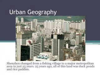
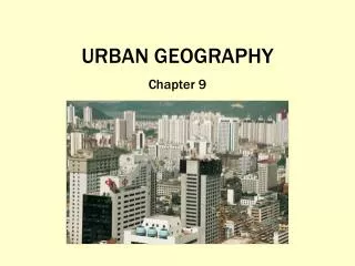
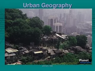
Urban Geography. Chapter 9. When and Why did People Start Living in Cities?. Cities. City – an agglomeration of people and buildings clustered together to serve as a center of politics, culture, and economics. An urban settlement that has incorporated into an independent self-governing unit.

E N D
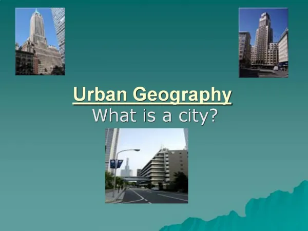
Urban Geography Chapter 9
Cities • City – an agglomeration of people and buildings clustered together to serve as a center of politics, culture, and economics. • An urban settlement that has incorporated into an independent self-governing unit
Urban: The buildup of the central city and the suburban realm – the city and the surrounding environs connected to the city.
Gateway cities today… • Cities that, because of their geographic location, act as ports of entry and distribution centers for large geographic areas.
Agricultural Villages • Before urbanization, people often clustered in agricultural villages – a relatively small, egalitarian village, where most of the population was involved in agriculture. About 10,000 years ago, people began living in agricultural villages.
The First Urban Revolution Two components enable the formation of cities: 1. an agricultural surplus 2. social stratification (a leadership class, or urban elite)
The innovation of the city is called the First Urban Revolution, and it occurred independently in five separate hearths, a case of independent invention.
Five Hearths of Urbanization In each of these hearths, an agricultural surplus and social stratification created the conditions necessary for cities to form and be maintained.
Five Hearths of Urbanization • Mesopotamia, 3500 BCE • Nile River Valley, 3200 BCE • Indus River Valley, 2200 BCE • Huang He (Yellow) and Wei (Yangtzi) River Valleys, 1500 BCE • Mesoamerica, 1100 BCE
The Sixth Hearth (Who knew?) • Peru, 900BCE • Chavin settlement in the Andean highlands
Diffusion of Urbanization The Greek Cities by 500 BCE, Greeks were highly urbanized. • Network of more than 500 cities and towns • On the mainland and on islands • Each city had an acropolis and an agora
Athens, Greece the agora the Acropolis
Diffusion of Urbanization The Roman Cities a system of cities and small towns, linked together with hundreds of miles of roads and sea routes. • Sites of Roman cities were typically for trade • A Roman city’s Forum combined the acropolis and agora into one space. • Roman cities had extreme wealth and extreme poverty (between 1/3 and 2/3s of empire’s population was enslaved)
The Roman Forum Aqueducts in Nimes, France
During the mercantile era, the cities that thrived were embellished by wealthy merchant families, who built ornate mansions, patronized the arts, participated in city governments, and supported the reconstruction of city centers. Genoa, Italy
Historically, urbanization reached its highest point during the Greece-Roman era.
The Second Urban Revolution Late 1800’s A large scale movement of people to cities to work in manufacturing. Made possible by: 1. second agricultural revolution that improved food production and created a larger surplus 2. industrialization, which encouraged growth of cities near industrial resources
During the second half of the 20th century… Nature of manufacturing changed and locations changed, too. Many factories have been abandoned, creating “rust belts” out of once-thriving industrial districts. Duisburg, Germany
Because of this change in industry, the Sun Belt region in the United States has seen the most population growth since 1945.
Site and situation explain cities are planned and why they thrive or fail. • Different size cities have different trade areas—an adjacent region within which its influence is dominant • Three components---population, trade area, and distance
Site and Situation Site * absolute location of a city * a city’s static location, often chosen for trade, defense, or religion. * The physical qualities of the original location of a city Situation * relative location of a city * a city’s place in the region and the world around it.
Rank-Size Rule: in a model urban hierarchy, the population of the city or town will be inversely proportional to its rank in the hierarchy. For example: largest city = 12 million 2nd largest = 6 million (1/2) 3rd largest = 4 million (1/3) 4th largest = 3 million (1/4) * This rule does not work when you consider all the other cities in any given country in today’s world.
Primate City The leading city of a country. The city is disproportionately larger than the rest of the cities in the country. It is usually a city that serves as the focus of a country and its culture. For example: London, UK Mexico City, Mexico Paris, France Copenhagen, Denmark - the rank-size rule does not work for a country with a primate city
Central Place Theory Walter Christaller developed a model to predict how and where central places in the urban hierarchy would be functionally and spatially distributed. * main purpose of a settlement or market town is to furnish goods and services to the surrounding markets Assumed: surface is flat with no physical barriers soil fertility is the same everywhere population and purchasing power are evenly distributed region has uniform transportation network from any given place, a good or service could be sold in all directions out to a certain distance
C = city T = town V = village H = hamlet * Large cities are economic hubs with radiating connectors for commerce According to Christaller, the range or maximum distance a consumer will travel to buy a good is proportional to the cost of obtaining the good. Hexagonal Hinterlands
Hinterland • The hinterland is described as the outlying area serviced by an urban center
Urban Morphology The layout of a city, its physical form and structure. Berlin, Germany With wall (above) And without wall (right)
Functional Zonation The division of the city into certain regions (zones) for certain purposes (functions). Cairo, Egypt Central city (above) Housing projects (right)
Zones of the City • Central business district (CBD) • Central City (the CBD + older housing zones) • Suburb (outlying, functionally uniform zone outside of the central city)
Modeling the North American City • Concentric zone model (Ernest Burgess) • Sector model (Homer Hoyt) • Multiple Nuclei Model (Chauncy Harris and Edward Ullman)
Concentric Zone Model- Burgess • Series of rings • Outermost ring is the commuter zone • Closest ring is the zone of transition where the housing stock is most deteriorated and a sizeable percentage of residents are immigrants • Provided a way for urban residents to gradually move up economically and socially by allowing them to migrate progressively away from the CBD. • This model can be used in countries where there is more than one CBD. • Perhaps there are different ethnic and/or religious populations in the country that live separately from one another.
Sector Model- Hoyt • Lower income neighborhoods are usually located adjacent to the industrial and transportation corridor • High-class residential areas don’t change much over time • In the future, geographers using the Hoyt Model would suggest that low-income populations would most likely live close to the high-speed rail lines.
Multiple Nuclei Model- Harris and Ullman • They developed their model during a time when many people began using cars to navigate cities more easily. • 1940s • A city could be lacking a CBD if their different industries were located throughout the city. • Broken up by the different nodes of activities • Examples: Universities, Hospitals, Airport and transportation, and the CBD
Urban Realms Model Each realm is a separate economic, social, and political entity that is linked together to form a larger metro framework. Most American cities are similar to this model
Gravity Model • Used to calculate the bonds between different urban centers. • It assumes that two cities located close together would attract more people that two cities located far apart.
Modeling the Cities of the Global Periphery and Semiperiphery • Latin American City (Griffin-Ford model) • African City (de Blij model) • Southeast Asian City (McGee model)
Latin American Model • The elite residential section is located on either side of the main blvd that leads to the CBD • Squatter settlements dominate on the periphery • Contains a distinct residential spine proceeding outward from the center city along the main blvd
Disamenity sector –very poorest parts of the city eg. the favelas of Rio de Janeiro, Brazil
The African City – de BlijMost African cities have three separate business districts due to colonialism.
Edge Cities- A large node of office and commercial land use outside the central city with more jobs than residents Suburban downtowns, often located near key freeway intersections, often with: - office complexes - shopping centers - hotels - restaurants - entertainment facilities - sports complexes - Since the 1980s, there has been a trend to build suburbs and edge cities within the US that are farther and farther away from the Central City. - Residents of edge cities and suburban areas have long depended on cars and public transportation to access jobs in large cities.
Powerful social and cultural forces shape the character of a city and create the cultural landscape of the city. Angola- clear difference between rich and poor Japan- very large middle class in a densely populated Tokyo