Download
1 / 25
250 likes | 265 Views
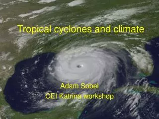
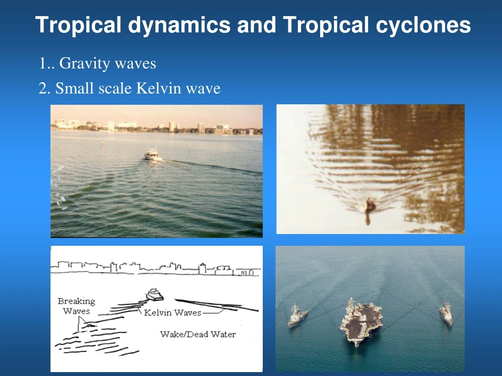
Tropical dynamics and Tropical cyclones. 1.. Gravity waves. 2. Small scale Kelvin wave. 3. Large-scale Kelvin wave. In a rotating frame, large-scale kelvin wave must be: a. a boundary wave. b. propagating with the boundary on its right in the North. hemisphere.

E N D
Tropical dynamics and Tropical cyclones 1.. Gravity waves 2. Small scale Kelvin wave
3. Large-scale Kelvin wave In a rotating frame, large-scale kelvin wave must be: a. a boundary wave. b. propagating with the boundary on its right in the North. hemisphere. c. a trapped wave decaying from the boundary. 4. Equatorial Kelvin wave P C P C North South X X
4. El Niño and La Niña El Niño is characterized by unusually warm ocean temperatures in the Equatorial Pacific, as opposed to La Niña, which characterized by unusually cold ocean temperatures in the Equatorial Pacific. El Niño is an oscillation of the ocean-atmosphere system in the tropical Pacific having important consequences for weather and climate around the globe. 2011 El Niño
5. Walker circulation
6. Delayer oscillator theory Eastern Pacific Western Pacific cold warm El Niño year Thermocline Normal year upwelling Rossby wave upwelling downwelling Kelvin wave Equator downwelling Rossby wave upwelling upwelling thermocline
Vertical temperature anomalies along the equator during 1997-1998 El Niño event. February 1997 160W 80W January 1998
8. Southern Oscillation Darwin Tahiti 1958-1998 Sea level pressure anomaly at Tahiti and Darwin
Southern Oscillation Index (SOI): defined as the pressure difference between Tahiti in the southeast Pacific and Darwin in the western Pacific. Negative SOI corresponds to El nino Positive SOI corresponds to La nina. (ENSO)
Impact of ENSO on Global Climate Rainfall anomaly during 1997-1998 El nino East Europe California East China Florida India Indonesia Amazon Southern Africa East Africa Northern Australia Uruguay Why an anomaly, such as ENSO in the equatorial region, can affect climate thousand miles away in mid and high latitude?
1. Where does a hurricane come from? Africa (easterly) jet Very strong temperature gradient Thermal wind Dynamic Instability Barotropic Instability Easterly (tropical) wave
2. How can a hurricane maintain its strength? Pressure grad. force Centrifugal force Pressure grad. force Centrifugal force Secondary circulation Frictional force Inflow Pressure grad. force Centrifugal force Boundary layer Ekman pumping
Hurricane Vortex Pressure grad. force Coriolis force L Centrifugal force Converging Spin up Diverging Spin down Buoyancy X Ekman Pumping Boundary Layer It is the convective clouds that generate spin up process to overcome the spin down process induced by the Ekman pumping
Where do energy and moisture come from to foster a large amount of convection in a hurricane? Warm ocean What process is responsible for bringing the energy and moisture taken from the ocean surface to the atmosphere? Boundary layer turbulent transport process
4. Why we cannot accurately predict the track of a hurricane sometimes? Where the storm is heading to? ? Sensitive dependence on initial conditions, butterfly effect
How to improve hurricane forecasting? Ensemble forecasting
Issues with numerical forecasts Newton’s law of motion governs hurricane movement. Initial value problem • British scientist L. F. Richardson Weather Prediction by Numerical Process, 1922 • American meteorologist J. G. Charney Quasi-geostrophic model, 1950 What causes the failure of Richardson’s numerical simulation?
In the 50s, people are optimistic about numerical weather forecast due to: • Global observational network of the atmosphere has been established, which can provide more accurate initial fields. • Great success of numerical calculation in other fields, such as calculating the trajectories of planetary orbits and long-range missals. • The accuracy of numerical forecast improved dramatically during the 60s, 70s, and 80s. • But unfortunately, improvement slowed nearly to a standstill beginning around 90s. Why?
Sub-grid scale (SGS) processes Scale (km) 1800 180 18 1.8 0.18 0.018 Van de Hoven (1957) 10 – 100 km