Download
1 / 75
750 likes | 1.06k Views
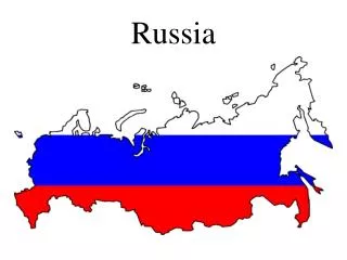
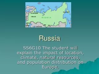
RUSSIA. Prepared by Elena V. Fedorova VSUE Vladivostok,2005. RUSSIAN FEDERATION. Russia on the map of the world. A MAP OF THE COUNTRY. General Information. Area : total: 17,075,200 sq km land: 16,995,800 sq km water: 79,400 sq km Common borders with

E N D
RUSSIA Prepared by Elena V. Fedorova VSUE Vladivostok,2005
RUSSIAN FEDERATION
General Information • Area : total: 17,075,200 sq km land: 16,995,800 sq km water: 79,400 sq km • Common borders with * Norway, Finland, Estonia, Latvia and Lithuania in the Northwest; * Belarus and Poland in the West; * Ukraine in the Southwest; * Georgia, Azerbaijan and Kazakhstan in the South; * China, Mongolia and North Korea in the Southeast. Coastline: 37,653 km • Russia is washed by * the Arctic Ocean - the Barents, Beloye (White). Kara, Laptev, East Siberian and Chukchi Seas in the North; * the Baltic Sea in the Northwest; * the Black, Azov and Caspian Seas in the Southwest; * the Bering Sea and the Seas of Okhotsk and Japan in the East.
General Information Contd. • The territory of Russia * 11 time belts - from the 2nd to the 24th. * From north to south: 4,000 kilometers * From east to west - 9,000 kilometers. * The overall borderline of the RF is 60,932.8 kilometers. Russia occupies one-eighth of the Earth'sland surface and more than 3/4 of the territory of the former USSR.
General Information Contd. • Climate:steppes; tundra; subarctic. • Terrain:broad plain with low hills; vast coniferous forest and tundra;uplands and mountains. • Elevation extremes: • lowest point: Caspian Sea -28 m • highest point: Gora El'brus 5,633 m
General Information Contd. • Natural resources: * oil, natural gas, coal, timber • Land use: • arable land: 7.33% • permanent crops: 0.11% • other: 92.56% (2001) Irrigated land: 46,630 sq km (1998 est.)
General Information Contd. • Natural hazards:volcanic activity; volcanoes and earthquakes; spring floods and summer/autumn forest fires. • Environment - current issues:air pollution from heavy industry; industrial, municipal, and agricultural pollution of inland waterways and seacoasts; deforestation; soil erosion; soil contamination from improper application of agricultural chemicals; scattered areas of sometimes intense radioactive contamination; groundwater contamination from toxic waste; urban solid waste management; etc.
People • Population: 143,420,309 (July 2005 est.) • Age structure:0-14 years: 14.6% (male 10,704,617/female 10,173,313) 15-64 years: 71.3% (male 49,429,716/female 52,799,740) 65 years and over: 14.2% (male 6,405,027/female 13,907,896) (2005 est.) • Population growth rate: -0.37% (2005 est.) • Birth rate: 9.8 births/1,000 population (2005 est.) • Death rate: 14.52 deaths/1,000 population (2005 est.)
People Contd. • Ethnic groups:Russian 79.8%, Tatar 3.8%, Ukrainian 2%, Bashkir 1.2%, Chuvash 1.1%, other or unspecified 12.1% (2002 census) • Religions: Russian Orthodox, Muslim, other • Languages: Russian, many minority languages • Literacy: • total population: 99.6% • male: 99.7% • female: 99.5% (2003 est.)
THANK YOU FOR ATTENTION AND EMOTIONAL SUPPORT, FRIENDS!
General Information Contd. • Russia includes: * 21 autonomous republics, * 49 "oblasts" (regions), * 6 "krais" (territories), * 10 autonomous "okrugs" (districts), * 1 autonomous "oblast," * 2 capital cities - Moscow and St. Petersburg
COUNTRY PROFILE • Geography • Languages • Constitution • People • Religions • National
Political Administrative System • Central federal district • Northwestern federal district • Volga federal district • Southern federal district • Ural federal district • Siberian federal district • Far-Eastern federal district
Central Federal District • Belgorod Region • Bryansk Region • Ivanovo Region • Kaluga Region • Kostroma Region • Kursk Region • Lipetsk Region • Moscow • Moscow Region • Ryazan Region • Smolensk Region • Tambov Region • Tula Region • Tver Region • Vladimir Region • Voronezh Region • Yaroslavl Region
The Central Federal District consists of 17 regions: Belgorod, Bryansk, Vladimir, Voronezh, Ivanov, Kaluga, Kostroma, Kursk, Lipetsk, Moscow, Oryol, Ryazan, Smolensk, Tambov, Tver, Tula and Yaroslaval. Moscow is the capital city of the CFD.The CFD covers an area of 650.7 thousand square kilometers. It borders Belarus and Ukraine in the west, the Northwestern Federal District in the north, the Volga Federal District in the east and the Southern Federal District in the south.The CFD has the country's largest population - 37,309,000. Most of the people live in the cities.The CFD accounts for 40.5% of Russia's prospected iron ores (Kursk Magnetic Anomaly).Non-ferrous mineral resources include peat, tripoli, gypsum, limestone, chalk; glass, mold, building and ballast sand, brick earth, claydite, refractory clay, mineral paints and others. There are two major phosphorite deposits. The large Ulyanovsk deposit of quality refractory clays (16% of Russia's explored resources) plays an important role in the District's metallurgy. The CFD has the country's biggest deposits of raw carbonate. Precious and non-ferrous metals, rare-earth elements, glauconites, zeolites and medicinal and table mineral water have also been discovered in the CFD.The CFD holds leading positions in the country's industrial production. The most important industries are ferrous metallurgy, electricity generation, chemical and petrochemical industries, engineering and metalworking, the production of building materials, and the food-processing industry.Plenipotentiary Envoy - Georgy S. Poltavchenko
North Western Federal District • Arkhangelsk Region • Kaliningrad Region • Komi Republic • Leningrad Region • Murmansk Region • Nenets Autonomous Area • Novgorod Region • Republic of Karelia • Vologda Region
The North Western Federal District includes 2 republics (Karelia, Komi), 7 regions (Archangel, Vologda, Kaliningrad, Leningrad, Murmansk, Novgorod, Pskov), 1 autonomous area (Nenets), and the city of St. Petersburg.Center: St. Petersburg.Area: 1,700,000 square kilometers. In the north, the NWFD borders on Norway and Finland and is washed by the White, Barents, and Kara seas; in the west, it borders on Estonia, Latvia and Belarus; in the south, on the Volga Federal District, and in the east on the Ural Federal District. Kaliningrad Region is an enclave on the southern coast of the Baltic Sea and borders on Poland and Lithuania.Population: 14,500,000, mostly urban. Ethnic composition: more than 100 different ethnic groups.The District includes one of Russia's more developed mining areas (Murmansk Region) boasting major effective sources of mineral raw materials at the federal level. It also has powerful mining and metallurgical industries, which fill the predominant part of national requirements in phosphates, phlogopite, nepheline and ceramic raw materials, nickel, iron, copper, cobalt, and other rare earth elements. There are considerable reserves of clays, limestone, timber, peat, gravel--and-sand mixtures, coal, and high-quality rock salt.Geological prospecting has revealed deposits of diamonds, bauxites, oil, gas, gas condensate, carbonate raw materials, industrial and building stone, fresh and mineral water sources. Confirmation has been received of promising amounts of oil and gas likely to be found on the Barents Sea shelf. Active exploration is in progress, with Prirazlomnoye oil field being prepared for development.The District boasts a unique commercial deposit of amber (Kaliningrad Region) accounting for over 90% of the world reserves.Plenipotentiary Representative Viktor V. Cherkesov.
Volga Federal District • Chuvashia Republic • Khabarovsk territory • Kirov Region • Komi-Permyak Autonomous Area • Nizhni Novgorod Region • Orenburg Region • Penza Region • Perm Region • Republic of Bashkortostan • Republic of Mariy-El • Republic of Mordovia • Republic of Tatarstan • Samara Region • Saratov Region • Udmurt Republic • Ulyanovsk Region
The Volga Federal District (VFD) consists of 15 subjects of the Russian Federation, including six republics (Bashkortostan, Marii-El, Mordovia, Tatarstan, Udmurtia and Chuvashiya), eight regions (Kirov, Nizhny Novgorod, Orenburg, Penza, Perm, Samara, Saratov, and Ulyanovsk) and one autonomous region (Komi-Permyak). Nizhny Novgorod is the capital city of the Volga Federal District.The VFD borders the Northwestern Federal District in the north, the Ural Federal District in the east, the Southern Federal District in the southwest, the Central Federal District in the west and Kazakhstan in the south. The area of the VFD accounts for 7.27% of the territory of the Russian Federation (1,038,000 square kilometers).The VFD is the second largest federal district in terms of population. Its multi-ethnic population accounts for 22.1% of Russia's total (32,156,000). Most of its people live in the cities. Its population includes Russians (more than 70%), Tartars, Bashkirs, Chuvashis, Udmurts, Mordvinians, Maris, Komi-Permyaks and representatives of other ethnic groups.The VFD accounts for the biggest share of Russia's industrial production (23.9%). Engineering and the fuel and energy industry hold leading positions in its industry. Farming, chemicals and consumer goods also represent a sizable share of its industrial production. The share of agricultural produce accounts for just over 25% of Russia's total.Plenipotentiary Envoy is Sergei V. Kiriyenko
Southern Federal District • Astrakhan Region • Kabardin-Balkar Republic • Karachai-Cherkes Republic • Krasnodar Territory • Republic of Adygea • Republic of Daghestan • Republic of Ingushetia • Republic of Kalmykia • Republic of North Ossetia - Alania • Rostov Region • Stavropol territory • Volgograd Region
The Southern Federal District consists of 13 subjects of the Russian Federation: 8 republics (Adygeya, Daghestan, Ingushetia, Kabardino-Balkaria, Kalmykiya, Karachai-Circassian Republic, North Osetia-Alania, Chechnya); 2 territories (Krasnodar, Stavropol) and 3 regions (Astrakhan, Volgograd, Rostov). The capital city is Rostov-on-Don.The SFD covers an area of 589.2 thousand sq. km. In the west it borders the Black Sea and the Azov Sea, in the north - Ukraine and the Central Federal District, in the east - the Caspian Sea, the Volga Federal District and Kazakhstan and in the south - Azerbaijan and Georgia.The population (21,625,000) consists of more than 120 ethnic groups: Russians, Ingushis, Osetians, Circassians, Abazins, Nogais, Karachayevs, Chechens, Kabardins, Balkars, Kalmyks and others.The District's sources of raw materials include oil and gas (the Krasnodar Territory is Russia's oldest oil-producing region - since 1864), brick earth, loams, sand and gravel, construction gypsum, construction sand and high-quality limestone.The mountains are rich in molybdenum, tungsten, heavy spar, polymetals, rare-earth metals, silver, gold, marble and marbleized building materials, dolomites and limestone pebble.The Rostov region is the main source of coal in the North Caucasus. It holds more than 6.5 billion tons of coal reserves. New coal mines could be built on the basis of explored deposits amounting to more than 1.5 billion tons of coal.Europe's largest reservoir of subterranean sources of fresh water - the Azov-Kuban reservoir - has a significant reserve of thermal and mineral water.The District's industries include engineering, non-ferrous industry, and chemical, petrochemical and woodworking industries.Farming and the food industry are well developed due to favorable climatic conditions and fertile soils (Krasnodar and Stravropol Territories).Plenipotentiary Envoy - Viktor Kazantsev
Ural Federal District • Chelyabinsk Region • Khanty-Mansi Autonomous Area • Kurgan Region • Sverdlovsk Region • Tyumen Region
The Ural Federal District includes 2 autonomous areas (Khanty-Mansi, Yamalo-Nenets) and 4 regions (Kurgan, Sverdlovsk, Tyumen, Chelyabinsk). Its center is in the city of Yekaterinburg.Area: 1,789,400 square kilometers. In the south, the UFD borders on Kazakhstan; in the west, on the Volga and North Western Federal Districts; in the east, on the Siberian Federal District. In the north, it is washed by the Kara Sea.Population: 12,563,000 (8.7% of Russia). Ethnic composition: over 120 ethnic groups, including small Northern peoples.The Ural Federal District accounts for almost 17% of national industrial output and 15% of federal budget revenues. It boasts almost one-third of all explored mineral fuel reserves, one-sixth of iron ores, 4.5% of non-ferrous metals, and almost 10% of timber. It produces nearly 90% of all Russian gas, having within its borders Russia's biggest oil and gas condensate fields (Samotlor, Fedorovskoye, Mamontovskoye, Priobskoye).The UFD is the location of the Surgut power system and the main enterprises of Russia's biggest oil companies - LUKOIL, YUKOS, Tyumen Oil Company, Surgutneftegaz - as well as major gas industry outfits: OAO Gazprom, AO "Noyabrskneftegaz," and AO "Rosneft-Purneftegaz."The UFD possesses almost unlimited reserves of building stone, building sand, brick clays, and ornamental stone. There are numerous shows of raw gems: industrial stone, jewellery-grade industrial stone, semi-precious and precious stone.The District is distinguished by a number of unique mineral deposits: Upper Ural ore province; one of the world's biggest Satka magnesite field; Europe's biggest Koelginskoye white marble deposit; Russia's only Zhuravliny Log deposit of China clay used in the production of fine stoneware, china, earthenware, paper, etc.Iron-and-steel, machine-building, metal-working, fuel-and-power, nuclear, and agricultural industries are important.Plenipotentiary Representative Pyotr M. Latyshev.
Siberian Federal District • Altai Territory • Chita region • Evenki Autonomous Area • Irkutsk Region • Kemerovo Region • Krasnoyarsk Territory • Novosibirsk Region • Omsk Region • Republic of Altai • Republic of Buryatia • Republic of Khakassia • Republic of Tyva • Taimyr Autonomous Area • Ust-Ordynsk Buryat Autonomous Region
The Siberian Federal District consists of 16 subjects of the Russian Federation, including 4 republics (Altai, Buryat, Tyva and Khakas), 2 territories (Altai, Krasnoyarsk), 6 regions ((Irkutsk, Kemerovo, Novosibirsk, Oms, Tomsk, Chita) and 4 autonomous regions (Aginsk, Buryat, Taimyr (Dolgano-Nenetsk) and Ust-Orda (Buryat, Evenk). Novosibirsk is the capital city of the SFD.The SFD covers an area of 6,770,400 square kilometers. It borders China, Mongolia and Kazakhstan in the south, the Far-Eastern Federal District in the east and the Ural Federal District in the west. In the north it borders on the Kara Sea and the Laptev Sea.Most of the District's population (21,512,900) lives in the countryside. The Kemerovo region is the exception. It is one of Russia's most densely populated and urbanized regions where 87% of the population lives in the cities.The SFD has considerable mineral resources: polymetallic ores, salt, mirabilite, iron ore, tungsten, molybdenum, berillium, tin, fluor-spar, chrysotile asbestos, precious metals, apatite, phosphorite, boron, graphite, zeolite, bentonite, pearlite and other deposits. Altai is famous for its unique deposits of jasper, porphyry, marble, granite, thermal mineral and drinking water and curative mud. Some of the deposits have not yet been industrially developed.Most of the ore deposits contain composite ores carrying valuable additives such as bismuth, indium, scandium and others. Titanium ores have been discovered in gravel deposits at Tugansk and Georgiyevsk. The Tugansk deposit holds 5.1 million tons of quartz sand and rare earth elements.The SFD also has oil and gas fields (Tomsk and Omsk regions). Work is underway to implement a program for the development of gas fields and deposits of gas condensate in the Tomsk region.The fuel and energy industry plays a key role in the development of the District's economy, with coal and electricity production forming its basis. Estimates put the potential of the Angara and the Yenisei at 600 billion kWh of low-cost electricity annually (40% of the country's total resources). When the Boguchansk hydropower station is commissioned, it will be able to produce 110-115 billion kWh, just over one sixth of the potential production of the Angara-Yenisei hydroelectric system.Forestry is represented by lumbering and woodworking enterprises (including sawmills and pulp-and-paper mills).Plenipotentiary Envoy - Leonid V. Drachevsky
Far Eastern Federal District • Amur Region • Chukotka Autonomous Area • Jewish Autonomous Region • Kamchatka Region • Koryak Atonomous Area • Magadan Region • Maritime Territory • Republic of Sakha (Yakutia) • Sakhalin Region
The Far Eastern Federal District comprises 10 subjects of the Russian Federation, including 2 Territories (Khabarovsk, Maritime), 5 Regions (Amur, Kamchatka, Magadan, Sakhalin, Jewish Autonomous), 2 Autonomous Areas (Koryak, Chukot), and the Republic of Sakha (Yakutia).The FEFD borders on Japan (in La Perouse Strait, Proliv Izmeny, and Sovetsky Proliv) and on China. In the north, it is washed by the East Siberian Sea and the Chukchi Sea, and in the east by the Bering Sea, Sea of Okhotsk, Sea of Japan, and the Pacific. In the west, the FEFD borders on the Siberian Federal District.Area: 6,215,000 square kilometers.Population: 7,345,000, mostly urban. Ethnic composition: more than 100 ethnic groups, including Russians, Ukrainians, Yakuts, the Nanai, the Udeghe, small Northern peoples, as well as representatives of other nations, nationalities and ethnic groups.Mineral resources: major deposits of tin (Komsomolskiy and Khingan-Olonoyskiy ore areas), mercury, apatite ores (Dzhugdzhur and Baladensky nassifs); considerable commercial reserves of noble, non-ferrous, and rare metals (gold, platinum, silver, tungsten, copper, molybdenum, polymetallic ores), chromatic and ornamental stone; combustible minerals (coal, oil, gas), all intensely produced (coal reserves in the main fields are due to last for the next 49 to 90 years); raw materials for the chemical and cemen industries; commercial reserves of building materials.Sakhalin oil and gas are transported via a system of long-distance pipelines. The carrying capacity of the Okha-Komsomolsk main pipeline is five million tons of oil a year.The Far Eastern Federal District possesses huge water reserves, both surface and subterranean and is a leading area on the national scale in terms of fresh water reserves. It is also the only area boasting practically the full spectrum of the main balneologic mineral water groups.The District's biological resources are on the world scale and unique both numerically and quality-wise. The Sakhalin-Kurile basin is one of Russia's biggest fishery areas. The overall biomass of the local commercial fish species is more than 6.3 million tons, the authorized production rate being over 1 million tons a year, including over 800,000 tons of fish, about 285,000 tons of invertebratae, and about 300,000 tons of algae. Prospectively, it may serve as a basis for a thriving bio-pharmaceutical industry.Its border location, non-freezing seaports, rich raw material reserves, and the existing industrial and social potential create favorable conditions for the District's cooperation with nations of the Asia-Pacific Region.Plenipotentiary Representative Konstantin B. Pulikovsky.
The area of the globe is divided into 24 time belts for the convenience of determining current time. Common time is established for each belt. The width of a time belt is 15 degrees in longitude. The first belt is the one in the middle of which the zero (Greenwich) meridian runs.In reality, on the ground the borderlines between the time belts run not along meridians but along the borders of the countries that are close to the meridians. For large countries crossed by several time belts, the borderline between the belts usually runs along the lines of administrative-territorial division of those countries.The territory of the Russian Federation includes 11 time belts - from the 2nd to the 24th. The time difference between Moscow and Petropavlovsk-Kamchatski is 9 hours.The difference between Moscow and West European cities is not very big. It is three hours between Moscow and London and two hours' difference with Paris, Rome, Vienna and Berlin. The time difference with America is greater, ranging from 8 hours with New York to 13 hours with Hawaii.In Russia, like in many other countries, there is "winter" time introduced for saving electricity during a few months and "summer" time. Going over from winter to summer time usually occurs on the last Sunday of March, and going back to winter time is on the last Sunday of October. When such a change is made, clocks and watches are put one hour ahead from the winter time.Because it is difficult to change one local time into another, it was agreed to use common world time in many spheres of human activity (in particular, in radio communication). It is time that corresponds to the zero (Greenwich) meridian, that is, to the first time belt. World time is called Universal Time (UT), and in scientific and technical literature a more exact name is used - UT1. The time scale used in practice in different countries and associated with world time is called Universal Time Coordinated (UTC).Greenwich Mean Time (GMT) is the outdated name for world time.
The Russian Language • In accordance with Article 68 of the Russian Constitution, the Russian language is a state language in Russia's territory. It is taught as first language in educational institutions, official documents are published in Russian, and Russian is used in the country's legislative, executive and judicial institutions. However, the fact that Russian is a state language throughout the Russian Federation does not mean that subjects of the Federation cannot designate ethnic languages as a state language in their territory.Russian is one of the world's commonest languages. In 1990 there were more than 250 million Russian-speaking people in the world. Russian is the mother tongue of more than 100 million people.Russian is the working language of the executive bodies of the Commonwealth of Independent States and the Russia-Belarus Union state. It has the status of a working language at the World Customs Organization and is used in the harmonized system of commodity description and encoding. Russian is one of the six official languages of the United Nations.Russian belongs to the Eastern group of Slavonic languages of the Indo-European family of languages. The written language is based on the Russian alphabet. As distinct from Romanic and Germanic languages, the article and perfect verbal forms are absent from the Russian language. Its case system is much more developed, and the Russian sentence has a looser word order. With a reform of the Russian language in the offing, a draft bill On the Russian Language and a style sheet and orthographic rules are being studied by research institutions and the Russian Language Council under the government.
We, the multinational people of the Russian Federation, united by a common fate on our land, establishing human rights and freedoms, civic peace and accord, preserving the historically established state unity, proceeding from the universally recognized principles of equality and self-determination of peoples, revering the memory of ancestors who have conveyed to us the love for the Fatherland, belief in the good and justice, reviving the sovereign statehood of Russia and asserting the firmness of its democratic basic, striving to ensure the well-being and prosperity of Russia, proceeding from the responsibility for our Fatherland before the present and future generations, recognizing ourselves as part of the world community, adopt the CONSTITUTION OF THE RUSSIAN FEDERATION.
Russia is a multinational country inhabited by representatives of more than a hundred nationalities and ethnic groups. The majority of them is classified as indigenous peoples and ethnic groups of the country since Russia is the main or even only place of their habitat. Besides that, in the Russian Federation there are also representatives of more than 60 nationalities whose main place of residence is outside Russia.The indigenous peoples constitute approximately 93% of the country's overall population, out of which more than 80% are Russians.More than 6% of the population is made up of peoples of the former Soviet republics (for example, Ukrainians, Belorussians, Armenians and others make up 5%) and foreign countries (for example, Germans, Koreans and others). Ethnographers classify the indigenous peoples of Russia into several regional groups that are close to each other both from the point of view of geography and, to a certain extent, culture and history. Less than 8% of the country's overall population is made up of the peoples living in the Volga River basin and the Urals area - Bashkirs, Kalmyks, Komis, Maris, Mordovans, Tatars, Udmurts and Chuvash. Out of this number, almost half are Tatars - the second largest nationality in Russia in terms of numbers. The traditional religion of Tatars and Bashkirs is Islam, Kalmyks - Buddhism, the rest - Orthodoxy.The peoples living in the North Caucasus: Abazians, Adygeis, Balkars, Ingushetians, Kabardins, Karachayevs, Ossetians, Cherkessians, Chechens, the peoples in Dagestan (Avars, Aguls, Dargins, Kumyks, Laks, Lezgins, Nogays, Rutuls, Tabasarans and Tsakhurs) make up less than 3% of the population of Russia. Besides the majority of Ossetians being Christians, the peoples of the North Caucasus profess Islam.The peoples living in Siberia and the Far North - Altais, Buryats, Tuvas, Khakass, Shors, Yakuts and almost three dozen of the so-called "small" peoples in the Far North constitute 0.6% of the entire population. The Buryats and Tuvas are Buddhists, the rest - Orthodox. There are also pagans among the peoples in the Far North.The last time trustworthy data concerning the ethnic composition of the population of Russia were obtained during the national census in 1989. Much later data of the same trustworthiness does not exist. However, bearing in mind that during this interim the ethnic composition of the country could not change, specialists have attempted to estimate the numerity of various peoples living in Russia by calculations based on current statistics, summarizing the natural and migration increment of the population.Numerity based on 1989 census (thousands): total population - 147022, Russians - 119866 (81.53%), Tatars - 5522 (3.76%), Ukranians - 4364 (2.97%), Chuvash - 1774 (1.21%), Peoples of Dagestan - 1749 (1.19%), Bashkirs - 1345 (0.92%), Belorussians - 1206 (0.82%), Mordovans - 1073 (0.73%), Chechens - 899 (0.61%), Germans - 843 (0.57%).Numerity in 1999 (thousands): total population: 146370, Russians - 117884 (80.58%), Tatars - 5821 (3.98%), Chuvash 1837 (1.26%), Peoples of Dagestan - 2122 (1.45%), Bashkirs - 1473 (1.01%), Belorussians - 1152 (0.79%), Mordovans - 1027 (0.70%), Chechens - 1085 (0.74%), Germans - 585 (0.40%)
Nationalities in the population of Russia • Bashkirs • Byelorussians • Chechens • Chuvash • Germans • Mordva • Peoples of Daghestan • Russians • Tatars • Ukrainians