Download
1 / 37
380 likes | 467 Views
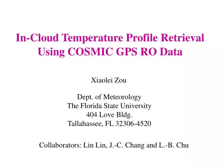
In-Cloud Temperature Profile Retrieval Using COSMIC GPS RO Data. Xiaolei Zou. Dept. of Meteorology The Florida State University 404 Love Bldg. Tallahassee, FL 32306-4520. Collaborators: Lin Lin, J.-C. Chang and L.-B. Chu. Motivations.

E N D
In-Cloud Temperature Profile Retrieval Using COSMIC GPS RO Data Xiaolei Zou • Dept. of Meteorology • The Florida State University • 404 Love Bldg. • Tallahassee, FL 32306-4520 Collaborators: Lin Lin, J.-C. Chang and L.-B. Chu
Motivations • Satellite observations of radiance provide cloud-top height and cloud-top temperature. In-cloud temperature profiles and cloud base height are not available. Contribution of liquid water content to GPS RO observations is negligible and GPS retrieval within cloud becomes a well-posed problem. • Hurricane initialization • TC structures • Moisture parameterization in NWP models • Global distribution of cloud parameters GPS ROs
Contents • Retrieval Algorithm • Data Selection • Numerical Results • In-cloud temperature profile • Determining cloud base height • Sensitivity to cloud top pressure • Summary and Future Work
Retrieval Algorithm - Above Cloud Atmospheric refractivity for dry air Hydrostatic equation Equation of state for dry air
Retrieval Algorithm - Within Cloud Equation of state for water vapor: Virtual temperature: Saturation specific humidity:
Retrieval Algorithm - Within Cloud Three variables:,P,T
Retrieval Algorithm - Within Cloud (cont.) Determine cloud-top height (z0)based on satellite(MODIS, AIRS) cloud-toptemperature and pressure (T0, P0): Satellites Obs. Input (Kursinski et al. 1997) Output
Retrieval Algorithm - Within Cloud (cont.) Starting from cloud top, at the mth level, input m=m+1 Hydrostatic equation Hydrostatic equation Atmospheric refractivity for moist air output
Data Selection COSMIC (Constellation Observing System for Meteorology, Ionosphere and Climate) 5 May ~ 9 Sept. 2006 0oN~50oN,80oE~140oE About250,000soundings MTSAT (Multi-functional Transport Satellite) 0.5 hours 297 in-cloud soundings MODIS (MODerate Resolution Imaging Spectroradiometer) 0.5 hours distance < 30km 31 soundings
Cloud Top Temperature and Altitude NCEP MODIS
Preliminary Numerical Results • In-cloud temperature profiles • Cloud bases • Impact of uncertainty in cloud top pressure
GPS Saturated Temperature Retrieval 02 07 04 29 21 26 In-cloud retrieval NCEP-reanalysis COSMIC retrieval
Cloud Base -- Characteristics • A sudden change of the density scale height, which • is related to the vertical derivative of the logarithm of refractivity ( ) according to: 2. A temperature gradient ( ) inversion 3. A local minimum of relative humidity ( ) Cloud base is determined based on a simultaneous occurrence of these three features.
Sounding 7 (2006.07.01.0601) 17.6oN, 114.57oE IR VIS -30 0 30 60 90 120 150
Sounding 26 (2006.09.01.0219) 45.25oN,144.35oE IR VIS -30 0 30 60 90 120 150
Temperature retrieval Sounding 07 Cloud -30 0 30 60 90 120 150 Sounding 26 Cloud -30 0 30 60 90 120 150
Dropsonde Observations for Hurricane Rita (2005) 750 dropsonde 800 NCEP 850 20:52 900 950 1000 750 800 850 900 18:10 950 1000
Cloud top Cloud base Cloud thickness * The lowest height where Max(Tcloud –TNCEP)>0 Max(Tcloud –TNCEP)in cloud (Tcloud –TNCEP)cloudbase Sounding Numbers
Accuracy of Satellite-Determined Cloud Top Pressure(P0) Radiosonde data Lidar data Comparisons to (Wylie and Menzel, 1989) Determining cloud top based on radiosonde moisture profiles: Radiosonde moisture profiles sometimes show a dramatic change from a saturated or nearly saturated layer to a dry layer as the sonde emerges from the cloud top. The dewpoint temperature will drop from near saturation to 20K depression.
The average deviation from radiosonde-determined cloud top is 40mb for all comparisons. (within 100 km and 1 hr)
On average, the cloud top heights were 70mb lower than the cloud top reported by the lidars and within 80mb RMS. (within 50km and 0.5hr)
Assessing Impact of Input Uncertainty in P0 Wylie and Menzel (1989) concluded: cloud top height is reliable within 50mb. Perturbing cloud top pressure: where Cloud top height
Uncertainty in Cloud Top Height 1.34 z0 z0 -1.30 0.67 -0.61
Uncertainty in T Retrievals with InputUncertainty inp0 P=0 T (oC) T (oC) Sounding 07
Uncertainty in T Retrievals with InputUncertainty inp0 T (oC) T (oC) Sounding 26
Cloudy Layers where the GPS temperature is significantlywarmer(colder) than the NCEP analysis Tcloud-TNCEP>(T) max>0 Tcloud-TNCEP<(T) min<0
The Atmospheric Infrared Sounder (AIRS) AIRS Level 2 standard product (AIRX2RET) provide 3D maps of cloud properties including: Cloud layer number (up to 2 layers) Cloud top pressure Cloud top temperature Launch date: May 4, 2002 Spectral channels: 2378 Horizontal resolution: 13.5 km Temporal resolution: Twice daily Spatial coverage: Global
AIRS Daily Coverage daytime nighttime http://www-airs.jpl.nasa.gov///Technology/AIRScoverageaccuracy/
Time period: June 1, 2006 to September 30, 2006 Available GPS ROs: 300,000 Selection criteria: AIRS cloud top information available within 0.5 hour and a spatial distance < 30km Selected GPS ROs: 6290 COSMIC Cloudy Data Selection
Geographical distribution of COSMIC GPS ROs located within one-layer (2514) and two-layer(3776) clouds, respectively.
Summary • GPS dry temperature retrieval has a cold bias at the cloud top. Such a bias is larger for lower cloud. • The GPS temperature cloud retrieval is warmer (cloder) than NCEP analysis within cloud (at and near the cloud base). • Dropsonde data for Hurricane Rita (2005) suggests the same bias of the NCEP analysis within clouds. • Criteria for determining cloud base altitude using GPS wet retrieval seemed to provide qualitatively correct estimates compared to satellite imageries. • Impact of uncertainty of MODIS cloud top pressure on GPS in-cloud temperature retrieval is assessed.
Future Work • Compare systematically the NCEP temperature analysis within clouds using many more GPS ROs • Validate the GPS-derived cloud-base height using CloudSat data. • Determine multi-layer clouds • Investigate the in-cloud thermodynamics structures and their applications in NWP models and hurricane forecasts