Download
1 / 18
180 likes | 333 Views
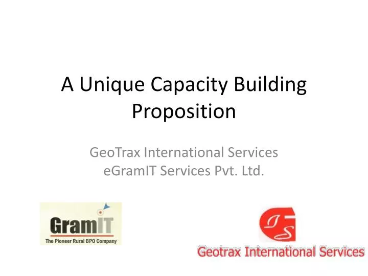
A Unique Capacity Building Proposition. GeoTrax International Services eGramIT Services Pvt. Ltd. Survey organizations & BPO services – A synergistic alliance. Huge requirement for skilled field staff and project managers Fast evolving technologies and trends

E N D
A Unique Capacity Building Proposition GeoTrax International Services eGramIT Services Pvt. Ltd.
Survey organizations & BPO services – A synergistic alliance • Huge requirement for skilled field staff and project managers • Fast evolving technologies and trends • An imminent need to create platform-BPO services • Differentiation through innovation – the need of the hour • Capacity building high on priority. A definite need for • Hard infrastructure • Soft infrastructure • Policy support • Scientific breakthrough • Financials • Societal acceptance and audit mechanisms • The need for high end analytics support for good governance
GeoTrax - eGramIT • GeoTrax • Expertise and experience in land surveys • Bringing in the latest equipment and technologies to ensure accurate recording • eGramIT • Valuable human resource • Project management best practices • Information technology • Scientific training practices
About the company • Founded by Mr. V.V.S. Bandhakavi who has 40+ years of Surveying experience • One of the two companies approved by Government of India’s premier Remote Sensing agency (NRSA) for DGPS Survey and Monumentation • Specializes in Ground Control Surveys and Targeting for Aerial Flying projects
We specialize in… • Boundary and Cadastral surveys using DGPS and ETS; Topographic Surveys. • Route and Alignment Surveys combining conventional and Photogrammetric methods. • Construction and Cross-section surveys (from road design to precision layout and quality control). • GIS-GPS data collection; Collection of high resolution photographs and linking to the GIS-GPS feature data; Creating a standard GIS map database (e.g. ESRI geodatabase)
Past and present DGPS control surveys • 32,000 DGPS points planning, observations (60 Primary; 900 Secondary; 15,000 Tertiary; 16,000 Auxiliary Points) – Ongoing Project, Govt. of Gujarat. Location: Jamnagar, India. • 550 DGPS observations – InfoTech, India. Location: Oman • 700 RTK DGPS locations – Ongoing Project, The Agakhan Academy, Hyderabad, India. Location: Hyderabad.
Past and present DGPS control surveys • 800 DGPS observations – 2009, InfoTech, India. Location: Oman • Over 1,000 DGPS points planning, observations in 80+ cities in India, 2007-2009 – Tele Atlas Pune, India • 200 DGPS observations, level transfer with RTK DGPS – 2008, SCTP, Sultanate Of Oman • Over 60,000 km of DGPS survey all over India for OFC – Reliance Communications, India, 2006-2009
Experiences in Jamnagar, Gujarat • Creating Ground Control network, including Primary, Secondary, and Tertiary Control points for the district of Jamnagar
Establishing the Jamnagar Control Framework The spatial framework will be UTM or any other Cartesian / spherical system desired by SCDLR on WGS -84 for X,Y and Z. The specifications along with number of monuments and observation times are provided here.
Equipment strength • 33 Single and Dual frequency GPS receivers (include makes from China Huace, Trimble, Sokkia, Leica and Topcon) • 15 Electronic Total Stations (includes 5sec, 3sec,2sec and 1sec, from Sokkia, Leica, Topcon and Trimble) • 12 Auto Leveling instruments (includes digital levels and Auto levels) • A number of hand held GIS/GPS receivers
eGramIT – The Pioneer Rural BPO To move rural India from the edge to the center of the services economy Vision
TheValueProposition Delivering world class quality services at significantly lower costs than urban BPO centers eGramIT can be a useful partner in tapping the vast rural potential with alignment to NLRMP objectives • Reduced rework • Reduced cost of hiring • Reduced cost of operation • Improved stakeholder delight • Increased focus on core work for client • Improved productivity • Reduced turnaround times • Improved compliance
Service offering Value-added services • Data management services • Document management services • Scanning of documents • Indexing of documents • Conversion of physical text data to digital form • Archiving • Data translation from local language to English • Creation of summaries with highlights • Design of websites and managing the content • Data cleansing Backend Services First Rural BPO to deliver a wide range of low-end to high-end services
Highlights • More than 4 years of operation • 4 Centers and 300 + people in 30 months • 10 clients • More than 3 crore documents scanning and digitization • 150,000 person-hours of Quality training sessions • 24,00,000 person-hours of World-class Service Delivery • 100% of the eGramITians are trained in Six sigma paradigm • Highly effective onsite-offshore-near shore model Committed to world-class service delivery
eGramIT Impact • Spin-offs in quality of rural basic services • Role models for benefits from education • Wage generation of one eGramIT center equivalent to revenues from 400 acres of wetland • Reverse migration from urban centers • Increased women employment Bringing rural youth into the mainstream economy while delivering business value
GeoTrax - eGramIT strengths in capacity building • State-of-the-art hard infrastructure • Customized HR management • Tie ups with social organizations and educational institutions • Appreciation of language requirements • Rural areas as potential employment markets • Effective in-house training methodology that prepares the employees for the job within a very short span of time • 100% documented approach • Tie ups with various agencies and academic institutions for specific trainings • Innovative e-learning methodologies • Project management and ICT • Platform-BPO capability • End-to-end solution providing
Capacity building model Training on equipment Qualification of people recruited Graduation / post graduation GIS setup District Graduation Static GPS Cluster of 4 mandals Graduation Electronic total stations Mandal Cluster of 4 villages +2 / Graduation Handheld survey devices Village -- --