Download
1 / 4
40 likes | 145 Views
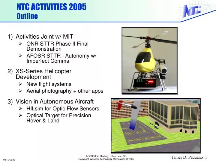
NTC ACTIVITIES 2005 Outline. Activities Joint w/ MIT ONR STTR Phase II Final Demonstration AFOSR STTR - Autonomy w/ Imperfect Comms XS-Series Helicopter Development New flight systems Aerial photography + other apps Vision in Autonomous Aircraft HILsim for Optic Flow Sensors

E N D
NTC ACTIVITIES 2005Outline • Activities Joint w/ MIT • ONR STTR Phase II Final Demonstration • AFOSR STTR - Autonomy w/ Imperfect Comms • XS-Series Helicopter Development • New flight systems • Aerial photography + other apps • Vision in Autonomous Aircraft • HILsim for Optic Flow Sensors • Optical Target for Precision Hover & Land
1) JOINT MIT / NTC ACTIVITIES Aeronautics & Astronautics • ONR STTR: Multi-vehicle cooperation in urban environment • Final Demonstration: 2-vehicle beyond line-of-sight recon • 2 fully autonomous rotorcraft • Real-time coordination by MILP • ‘Away’ UAV goes beyond line-of-sight • ‘Relay’ UAV maintains LOS w/ ‘Away’ UAV and ground station Flight Data in ‘Suburban’ Terrain: Red=Away, Green=Relay • AFOSR STTR: CSAT with Intermittent Communication • Capabilities being developed • Robust Distributed Task Assignment • Comm. emulation for multi-vehicle HILsim and flight testing • Communication Health Management • Low-cost on-board planning module • Phase II Testbed: MIT Fixed-Wing Fleet RDTA Concept (How, MIT)
2) XS-Series Helicopter Development • New airframe, alternator, & 60W UPS • Gas power, comms ~5 mile range • Lighter weight avionics & suspension • Mount points for cameras & sensors • New ground operator console/moving map • Automatic take-off, landing, waypoint navigation, and real-time path uplink (for centralized coordination) • Fail-safe and reversion modes NEAR-TERM APPLICATIONS • Aerial photography/videography: • Stable, hovering platform • Higher altitudes than feasible manually • More accurate altitude, heading • Testbed: Open architecture for integration of additional sensors • “VTUAV surrogate” • < 25 lbs: Lower cost, risk • 2 x 0.7 GHz Pentium processors on board for testing autonomy, vision, etc.
3) Vision in Autonomous Aircraft Aeronautics & Astronautics • Optic Flow Sensor Testing (DARPA) • Sensor from Centeye Inc. • HILsim environment with urban terrain • Feasibility of See-and-Avoid Using Optic Flow • 2nd ‘Threat’ Vehicle Simulated in HILsim environment • Detection, avoidance tests conducted • Algorithms for Dodging / Urban Nav • Optical Target for Precision Landing • Patented design using Moire patterns • Prelim. development underway at MIT • Next phase beginning at NTC • Features • Position/orientation relative to target derived using passive imagery • Position sensitivity ~1 cm • Low resolution imagery sufficient to deduce relative position