Download
1 / 23
230 likes | 327 Views
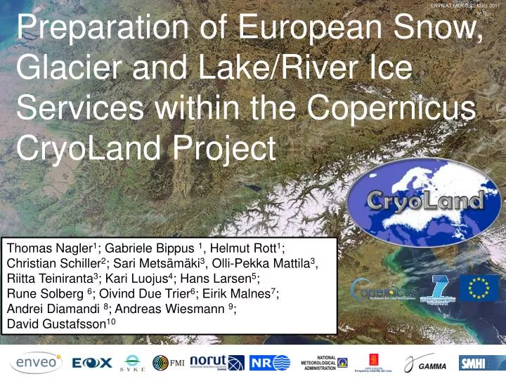
ENVISAT MERIS 22 März 2011. Preparation of European Snow, Glacier and Lake/River Ice Services within the Copernicus CryoLand Project.

E N D
ENVISAT MERIS 22 März 2011 Preparation of European Snow, Glacier and Lake/River Ice Services within the Copernicus CryoLandProject Thomas Nagler1; Gabriele Bippus1, Helmut Rott1; Christian Schiller2; Sari Metsämäki3, Olli-Pekka Mattila3, Riitta Teiniranta3; Kari Luojus4; Hans Larsen5; Rune Solberg 6; Oivind Due Trier6; Eirik Malnes7; Andrei Diamandi8; Andreas Wiesmann 9; David Gustafsson10
CryoLand –GMES Services Snow and Land Ice(FP7 Project 2011-2015) PRIMARY OBJECTIVE Develop, implement and validate an operational, sustainable service for monitoring snow and land ice as a Downstream Service within Copernicus Initiative of EC and ESA. The project prepares the basis for a future cryospheric component of the Copernicus Land Monitoring Service. Contents: • Products Specifications • Example Products for Snow, Glaciers, Lake / River Ice • Product Validation • Preparation for Sentinels • Access to Products • Summary • Announcement on „Satellite Snow Products Intercomparison & Evaluation Exercise - SnowPEX“
CryoLand User Group • CRYOLAND USER GROUP: • 60 Organisationsfrom 15 European countries + 3 EU organisations: • Product & Service RequirementsandSpecs • Product & Service Testingand Evaluation • Hydropower companies • Energy traders • Hydrological services • Meteorological services • Climate monitoring institutions • Avalanche warning centres • Road, Railway and River Authorities • Geotechnical & Construction companies • Ecologists • Reindeer herders • Environmental agencies
Approach for product and service improvement towards user needs User Requirements for Products and Services • User requirements / dialogue for improved product requirements and specification • Algorithm development / adjustment to match user needs • Generation of test products and validation for different regions and periods • User consultation and feedback on product and services • Final algorithms,fully validated products and services Algorithm development / adjustment User consultation / feedback Test products Development cycle Validation Approved Algorithms, Validated Products and Services
Pan-European Fractional Snow CoverProduct • Product Specifications: • Domain: 72°N 11°W – 35°N 50°E • Projection: LatLon/WGS84 • Pixel size: 0.005° (ca 500 m) • Latency: < 1 day • Status: • Algorithm: SCAMOD (SYKE) (550 nm Band) • Sensor: MODIS (Backup VIIRS, ) • Regional service integration, processing chain and portal implemented • Attacheduncertaintymap • Operational NRT Service for 2013/14 • Time seriessince 2000 in generation 4/3/2013 Grey: Clouds
Pan-European SWE Product • Product Specifications: • Domain: 72°N 11°W – 35°N 50°E • Projection: LatLon / WGS84 • Pixel size: 0.1deg; ca 10 km • Temporal resolution: Daily • Latency: < 2 day • Status: • Algorithm based on H-SAF and GlobSnow • Assimilates passive microwave observations and ECMWF weather station data 4/3/2013 Grey: Mountains
Melting Snow Area – Alps, Scandinavia • Binary map of wet snow from Multi-temporal SAR data • 100 m pixel size • Projection: Geographic, UTM, Lambert EA Austria • Demonstration Products: Time series of Products uses archived ENVISAT ASAR data • NRT service with Radarsat for Scandinavia spring 2013/14 Innsbruck 9 June 2006, ENVISAT ASAR WSM. Red – wet snow extent, Yellow – layover / foreshortening
Snow ExtentProduct Quality Assessment • Quality Assessment of Snow Extent Products is performed in different environments: • Fractional SE products from high resolution optical images: • Very High resolution images ( IKONOS, SPOT5, Quickbird) • Landsat TM/ETM+ • In-situ snow transects measured operationally by SYKE in Finland Accuracy assessment of SE products and services is still ongoing according to the planning of the project. VHR Optical Images -Landsat TM/ETM+- In-situ snowtransects
Accuracy Assessment of SE Products MODIS SCAMOD – Pan-European FSC versus In-situ Snow transects High and Very High resolution Images provide detailed snow information in mountains and forests (sparse->dense) and enable the quality assessment of CryoLand SE products in these areas. Landsat TM 25.10.2003 Syke
Conceptfor SENTINEL-3 Snow Mapping using SLSTR (AATSR) and OLCI (MERIS) Sentinel-3: SLSTR (AATSR): 0.5 – 1.6, -3.7 mm+TIR; 1 km OLCI (MERIS): 0.4.-1.2 mm; 300 m
Preparation for Snow Mapping usingSENTINEL-3 SLSTR & OLCI AATSR 1 km MERIS/AATSR 300 m Fractional Snow ExtentMap • Input Data for FSC: • SLSTR (AATSR): 0.5 - 3.7 mm+TIR; 1 km • OLCI (MERIS): 0.4.-1.2 mm; 300 m • Algorithm: • MS Unmixing • Local Adaptive Endmembers
Preparationfor Snow Mapping using Sentinel-1 IWS Dual Pol Data • ENVISAT ASAR Alternating Pol. • IS 6 Polarisation VV and VH : • 7 Feb 2008 13 May 2008 Sentinel-1 IWS TOPS Mode Swath ~250 km Dual Pol: Co, Cross (VV,VH) Resolution: 5 m Slant Range 20 m Azimuth Dynamic Range ofBackscatter Ratio
Example of Wet Snow MapfromASAR AP VV & VH 13 May 2008 Dual Pol: VV & VH Thomas Nagler
Processing Line of Glacier Area Product • Product information: • A standardized, semi-automated processing line using MS (V)HR satellite data and DEM ad input: ice snow detection automatic, manual post-processing required over debris covered areas. • Product generation within CryoLand is done on User Request: selected glaciers in Austria, Greenland, Kyrgyzstan, Bhutan, and Norway • Products generated according to GLIMS and INSPIRE standards
Glacier Area Maps for Hohe Tauern Alps 1.9.2009, SPOT–5 (2.5 m, PAN + MS) Glacier Area Change 1998 2009 Ratio of Snow and Total Glacier Area 0.46 0.14 Pasterze 0.29
Extent of Glacier Lakes • Glacier Lake Extent derived from optical satellite data and SAR data • Method applies classification and manual post-processing and uses existing lake boundaries • Glacier Lake Extent of multiple years for Lake Tininnilik, Greenland, Kyrgyzstan and Bhutan • Validation is carried out with in-situ observations in collaboration with users ENVEO, NORUT Lake outburst observed between 2010/06/28 (red) and 2010/07/05 (blue) using SAR. Comparison with GLL (white) from Landsat 7 ETM+ of 2010/08/17. SAR Analyses: NORUT LS7 Analysis: ENVEO
Lake Ice Extent - Product • Lake Ice Product: • Daily, generated NRT • 250 m pixel • Covering Baltic drainage basin • Sensor: MODIS full snow cover partial snow/ white ice cover Reflectance (550 nm) In-situSnowdepth clear ice/ columnar ice Lake Ladoga SYKE Lake Ice Extent open water Time Lake Ice product 17 April 2013 The threshold reflectances were determined from time series of MODIS reflectance observations from the surroundings of in-situ measurements for snow cover thickness on ice.
Productand Information Exchange ……Portal User Infrastructure CryoLand GeoPortal GEOSS Common Infrastructure INSPIRE Portal Tools https://cryoland.eu Protocols: CSW, WMS, WFS, WPS, PDP • Products accessible by • Geoportals, • GIS Systems, • Automatic Script Downloading Provided data GMES Space Space (general) In-situ Data Auxiliary Data GMES Core Services
Summary • Product and Service Specifications for potential Copernicus Snow and Land Ice Services were compiled together with a wide user group. • Near Real Time Services for Pan-European FSC and SWE and lake / river ice products winter 2013/2014: Products are made available to the public through CryoLand System (https://www.cryoland.eu). • Generation of glacier products in Alps, Scandinavia, Greenland and Himalayan Mountains as requested by CryoLand users. • Validation of products and quality assessment using high resolution optical data and in-situ data is ongoing and specification of. • Algorithms and processing lines are adapted to make use of advanced imaging capabilities of Sentinel satellites, testing with more data sets was limited due to the lack of suitable data sets.
SNOWPEXSatellite Snow Products Intercomparison & Evaluation Excercise An ESA initiative contributing to WMO Global Cryosphere Watch and WCRP CLiC carried out under the lead of ENVEO in cooperation with FMI, SYKE, EC and CCRS. and associated international contributors US National Ice Center / NOAA/ NESDIS, Cryospheric Processes and RS Laboratory, City University of NY Global Snow Lab, Rudgers University Cryospheric Sciences Laboratory, NASA
SnowPEXObjectives SnowPEX aims to bring together scientists and institutions of seasonal snow pack monitoring for assessing the quality of current satellite-based snow products derived from EO data, and working out guidelines for improvement. • The primary objectives are • Intercompare and evaluate global / hemispheric (pre) operational snow products derived from different EO sensors and generated by means of different algorithms, assessing the product quality by objective means. • Evaluate and intercompare temporal trends of seasonal snow parameters from various EO based products in order to achieve well-founded uncertainty estimates for climate change monitoring. • Elaborate recommendations and needs for further improvements in monitoring seasonal snow parameters from EO data. SNOWPEX organizes 2 International Workshops on Snow Product Intercomparison (IWSPI) . The 1st IWSPI is planned to be held in July 2014 in Washington DC (TBC). Point ofContact: thomas.nagler@enveo.at