Download
1 / 23
240 likes | 466 Views
Understanding Weather. Weather results from differences in pressure, heat, air movement, and humidity. WATER IN THE AIR. The Water Cycle The continuous movement of water from sources on the Earth’s surface into the air, onto and over land into the ground, and back to the surface.

E N D
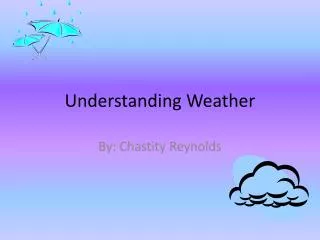
Understanding Weather Weather results from differences in pressure, heat, air movement, and humidity
WATER IN THE AIR • The Water Cycle • The continuous movement of water from sources on the Earth’s surface into the air, onto and over land into the ground, and back to the surface. • Condensation: water vapors cool, change from gas to liquid Clouds form this way. • Evaporation: liquid water changes into water vapor, a gas • Precipitation: rain, snow, slet or hail falls from the clouds • Runoff: water that flows across land and collects in rivers, streams and oceans.
WATER IN THE AIR • Humidity • The amount of water vapor (moisture) in the air. • As water evaporates it becomes water vapor, which is invisible, and humidity increases. • Temperature changes cause the air to hold more or less water vapors. • Temperature increases….. Air holds more water vapors • Relative humidity • Amount of water vapor in the air compared to that amount that the air can hold at a certain temperature. • Given as a percentage • Fully saturated air is 100% relative humidity. • Actual water vapor content divided by saturation % times 100 = relative humidity.
18 g/m3 24 g/m3 X 100 = 75% Actual amount NOW Saturation Amount Calculating Relative Humidity • If 1m3 of air at a certain temperature hold 24 g of water vapor, but you know that right now there is 18 g of water vapor in the air, you can calculate the relative humidity.
Factors Affecting Relative Humidity • Water vapor and Temperature are the main two factors that impact relative humidity • The more water vapor that is in the air, the higher the relative humidity. • IF…. Water vapor amount stays the same but temperature changes…. relative humidity changes. • Temperature increase…… relative humidity decreases • Temperature decreases…. relative humidity increases • REMEMBER….The higher the temperature gets, the more water the air can hold.
Factors Affecting Relative Humidity • Measure Relative Humidity • Psychrometer measures relative humidity with 2 thermometers. • Wet bulb (covered with a damp cloth) • Dry bulb • The difference between the readings is the amount of water vapor in the air. • HOW????? • The wet cloth cools as the dry air passes over it and causes the water to evaporate. • Low humidity --- water evaporates more quickly --- temperature drops • High humidity --- water evaporates slowly, cools slower, small drop in temperature.
CONDENSATION • A change of state from a gas to a liquid • This happens when the air is saturated, in other-words, the air has a relative humidity of 100% • Dew Point • The temperature at which a gas becomes a liquid • Air is saturated at this temperature
Clouds • Cumulus Clouds – (KYOO myoo luhs) • Look like piles of cotton balls • Puffy white clouds with flat bottoms • Form when warm air rises, • They are usually nearer the earth than cirrus clouds. • Generally indicate fair weather
Clouds • Cumulus Clouds – puffy(KYOO myoo luhs) • Cumulonimbus(KYOO myoo loh NIM buhs) • Cumulus clouds that get larger or stack up, turn dark gray and grow taller early in the day can turn into thunderstorms later. • The word NIMBUS or NIMBO added to a cloud’s name means it is likely to produce precipitation.
Clouds • Stratus Clouds(STRAYT uhs) • Not at tall as cumulus clouds, but cover more area • Form in layers • Cover large layers and often block the sun • Nimbostratus (nim boh STRAYT uhs) clouds are dark stratus cloud producing light to heavy, continuous rain • Fog --- a stratus cloud near the ground.
Stratus cloud can range from dark grey to white. It is not so high in the sky, but does not usually bring rain. However it makes the day seem dark and gloomy. • The word ‘stratus’ comes from Latin, and simply means ‘layer’ or ‘blanket’. Sometimes stratus cloud can perform an amazing effect as in the photo above.
Clouds • Cirrus Clouds(SIR uhs) • Made of ice crystals • Thin • Feathery • High in the altitude • Form when the wind is strong • When these clouds become thicker, it indicates that a change in the weather is soon to be expected.
Clouds and Altitude • High Clouds – 6,000 8,000 meters • Because of the low / cold temps, these clouds are made of ice crystals. • The prefix cirro- means high clouds • Cirrocumulus Cirrostratus Cirrus • Medium Clouds – 4,000 6,000 meters • Made of both water drops and ice crystals • Prefix alto- means middle • Altocumulus Altostratus Cumulus Cumulonimbus • Low Clouds – 2,000 4,000 meters • Made of water droplets (no prefix descriptor) • Nimbostratus Stratocumulus Stratus
VIRGA Clouds • Virga is streaks of water drops or ice particles falling out of a cloud and evaporating before reaching the ground. • Low humidity and high temperatures can cause rain to evaporate completely shortly after it’s released from a cloud.
Precipitation • Water in solid or liquid form that falls from the air to Earth • Rain • Most common form of precipitation • Water droplets become a certain size • Starts out smaller than this “ . ” but must become 100x bigger before it falls as rain • Sleet • Rain falling through freezing air, producing falling ice as the rain freezes
Precipitation • Snow • Water vapors change directly into a solid. • This can be a single crystal or several that join to form a snowflake • snowflakes are 6 sided ice crystals. • Hail • Lumps of ice that fall from the clouds • Forms in cumulonimbus clouds • Strong updrafts carry raindrops high into the clouds until the updrafts can no longer carry the hail and it falls to the Earth.
When a hail stone is slicedin half it is common to notice hail rings. • These rings are alternate shades of white. • The whiter rings (soft ice) are produced by supercooled water and ice crystals coming in contact with the hailstone that is below freezing on the surface. • The clearer rings (hard ice) are produced from water that is above freezing that freezes on the surface. • This is an image of the largest hail stone to fall. This is the Coffeyville, Kansas hailstone that fell in 1970. The hail stone was 1.67 pounds and over 5.5 inches in diameter.