Download
1 / 15
150 likes | 165 Views
Next Steps for the Caribbean Marine Atlas Project. Ramon Roach Coordinator Caribbean Marine Atlas Project. Outline. Background of the CMA Current status of the project Challenges in implementation Stakeholder and developer needs Potential areas of collaboration with ICAN community

E N D
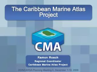
Next Steps for the Caribbean Marine Atlas Project Ramon Roach Coordinator Caribbean Marine Atlas Project
Outline • Background of the CMA • Current status of the project • Challenges in implementation • Stakeholder and developer needs • Potential areas of collaboration with ICAN community • Future areas of development of the CMA
Background of the CMA • Call to Create a Geographic Data Sharing Platform for the Caribbean Region • Modeled on the African Marine Atlas • 1st Stakeholder Meeting for the Development of the CMA Project (October, 2007) • Regional information gathering workshop • Participants from 6 Caribbean countries • Core initiative with scope for expansion • Workshop Goals • To inform the participating countries of the potential benefits of a Caribbean Marine Atlas • To identify current national coastal zone management arrangements • To identify national and regional coastal and marine issues that could be the focus of the Caribbean Marine Atlas
Identified Issues and Data Management Challenges • Regional Priority Issues • Coral Reefs, Seagrass, Mangroves • Overexploitation • Natural Hazards • Beaches • LBS Pollution • Regional Data Access Issues • Most or all essential national indicator data collected • Data access from data holders tends to be problematic • Regional Data Management Issues • Little or no data quality control (geographic, range analysis) • No established metadata schemes • Lack of institutional resources • Personnel and training • Equipment
Capacity Building Exercises for Atlas Development • Data Management Courses (2008-2011) • Ocean Data Management • Oceanographic measurements, programmatic and technical aspects of data collection, data formats used for ocean data • Data Mining • Data processing, metadata requirements, FTP folder schema and use • Database Management • Postgres SQL, PostGIS database creation and management for spatial datasets • Atlas Specific Courses (2009-2012) • Mapserver • Introduction to the mapserver open-source platform • OpenLayers • Mapping application development for national atlases • Geoserver • GeoNetwork
Stakeholder Engagement • National Atlas Project Stakeholder Meetings • Saint Lucia (August 5th 2010) • Barbados (March 2nd 2011) • Jamaica (May 25th2011) Institutional Client Surveys
Current Status of the CMA • Main CMA website • http://www.caribbeanmarineatlas.net • Web map server (Geoserver) • http://geoserver.caribbeanmarineatlas.org • Metadata catalog for CMA data (GeoNetwork) • http://geonetwork.caribbeanmarineatlas.org • Mapping application for the regional atlas • http://atlas.caribbeanmarineatlas.org • Prototype national atlases • Barbados – http://barbados.caribbeanmarineatlas.org • Cuba – http://cuba.caribbeanmarineatlas.org • Dominica – http://dominica.caribbeanmarineatlas.org • Jamaica – http://jamaica.caribbeanmarineatlas.org • Trinidad and Tobago – http://tnt.caribbeanmarineatlas.org
Current Status of the CMA • Regional Marine Data Manager Network and Recognized Project • Eleven regional data managers received data management and web-based atlas development training • Regional network has improved communication among Caribbean marine/coastal management agencies • Regional coastal zone and marine management institutions sensitized to marine atlas concept • CMA requested to participate in Caribbean Large Marine Ecosystem project activities and to give technical support to the Caribbean Sea Commission
Implementation Challenges • Capacity Challenges • Limited specialization at national level for coastal/marine data management • Considerable training effort devoted to basic data management/ GIS skill development • Limited resources (primarily time and manpower) to implement national actions • Limited resources to devote to atlas data preparation tasks • Loss of participants due to staffing changes • Limited ability to share in development burden • Technology Challenges • Changes in atlas backend technologies (Mapserver to Geoserver) • Steep learning curve for development languages (Javascript, PHP, etc) and open-source software (Geoserver, Geonetwork, SLD creation, etc)
Stakeholder Needs • Priority Stakeholder Needs • Additional data collection capacity • Additional data management capacity • Easy data and information search, visualization and download • Transparent, well-defined data sharing policy • Policy-relevant applications for spatial data/information • Economic valuation of the benefits of participating in a coastal/marine atlas programme
Developer Needs • Priority Developer Needs • Capacity development in web coding standards* • Application development support (functionality) • Data management and preparation support • Ability to automate some data management tasks • Data sharing and distribution policy development
Potential Areas of Collaboration with ICAN • Stakeholder Re-Examination • Is our stakeholder scope too narrow (regionally, nationally)? • What other services can atlases provide and to which audiences? • How do you address the needs of multiple stakeholders (technologically, administratively)? • How do you maintain stakeholder interest in atlas projects?
Potential Areas of Collaboration with ICAN • Best Practice Guidance • Design considerations in atlas applications to enable advanced functionality (dataset search, etc), code samples • Automation of data integration for continuously updated datasets (e.g. NOAA earthquake database, SST data) • Data use and dissemination agreement development for use with data providers/stakeholders • Spatial data QA/QC best practices
Plans for the Future of the CMA • Official Project End-Date, December 2013 • Commitment from CZMU Barbados and IODE to maintain project components • Greater Collaboration with Regional/International Projects • CMA/OBIS meeting in August, 2013 on Caribbean biological data management • Continued interaction with the Caribbean Large Marine Ecosystem project • Atlas Application Development • Technical consultations with Flanders Marine Institute • Behind the scenes data management tasks
Thank You Ramon Roach Coastal Information Systems Manager Coastal Risk Assessment and Management Project Coastal Zone Management Unit Bay Street, St. Michael Tel: 228-5950/1/2 Fax: 228-5956 Email: rroach@coastal.gov.bb