Download
1 / 6
60 likes | 166 Views
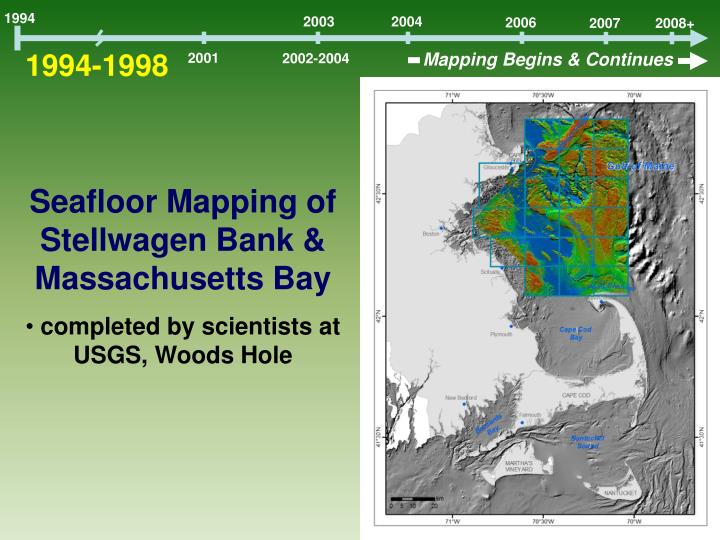
1994. 2003. 2004. 2006. 2008+. 2007. 1994-1998. Mapping Begins & Continues. 2001. 2002-2004. Seafloor Mapping of Stellwagen Bank & Massachusetts Bay completed by scientists at USGS, Woods Hole. 1994. 2003. 2004. 2006. 2008+. 2007. 1994-1998. 2001. Mapping Begins & Continues.

E N D
1994 2003 2004 2006 2008+ 2007 1994-1998 Mapping Begins & Continues 2001 2002-2004 • Seafloor Mapping of Stellwagen Bank & Massachusetts Bay • completed by scientists at USGS, Woods Hole
1994 2003 2004 2006 2008+ 2007 1994-1998 2001 Mapping Begins & Continues 2002-2004 ‘Marine Habitat Characterization and Mapping Workshop’ in Sebasco, ME Gulf of Maine Mapping Initiative (GOMMI)
1994 2003 2004 2006 2008+ 2007 1994-1998 Mapping Begins & Continues 2001 2002-2004 NOAA’s CSC Fellowship Drafted ‘Strategic Plan for Mapping Massachusetts’ Benthic Marine Habitats’ and Published guide on types and functions of marine habitats in Massachusetts
2006 1994 2003 2004 1994-1998 Mapping Begins & Continues 2001 2002-2004 Seafloor mapping data published for North Shore and Boston Harbor CZM initiates study of habitat classification frameworks for the coastal and ocean environments
Boston Harbor • Area mapped 173 km2 • Water depths 0-32 m • NOAA data re-processed -multibeam/single-beam bathymetry -backscatter • New data collection -bottom samples / photography http://woodshole.er.usgs.gov/pubs/of2006-1008/