Download
1 / 22
220 likes | 331 Views
Using GPS to monitor tectonic plate motions across the San Andreas fault in southern California. Sally McGill California State University, San Bernardino.

E N D
Using GPS to monitor tectonic plate motions across the San Andreas fault in southern California Sally McGill California State University, San Bernardino This material is based upon work supported by the National Science Foundation under Grant Number 0844400. Any opinions, findings, and conclusions or recommendations expressed in this material are those of the author(s) and do not necessarily reflect the views of the National Science Foundation.
Note to teachers: • I generally introduce this lesson with a review of plate tectonics including: • The three types of plate boundaries and the types of motion associate with each • A world map of the ocean floors or a world map of tectonic plates, on which I point out that the Pacific Plate • is created at a mid-ocean ridge in the southeastern Pacific ocean • It travels northwestward until it is consumed at subduction zones off the coasts of Alaska, Japan, etc. • And along the way it slides horizontally past California, which is why we have a transform plate boundary in California.
Pacific-North American Plate Boundary What type of motion occurs along the San Andreas fault?
Pacific-North American Plate Boundary What direction is the Pacific Plate moving relative to North America?
Pacific-North American Plate Boundary What direction is the Pacific Plate moving relative to North America? Toward the northwest How do we know?
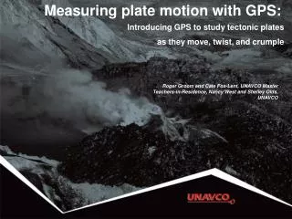
Portable GPS antenna mounted on a tripod and centered exactly over a benchmark Global Positioning System (GPS).
POINT65 Oak Hills H.S. MT. LUNA San Bernardino Mountains ARROWHEAD 6106 NORCO
Sites on the North American Plate: Sites on the Pacific Plate: POINT65 Oak Hills H.S. MT. LUNA San Bernardino Mountains ARROWHEAD 6106 NORCO
Which site do you expect to be moving the fastest (relative to the North American Plate)? The slowest? NORTH AMERICAN PLATE POINT65 Oak Hills H.S. MT. LUNA San Bernardino Mountains ARROWHEAD 6106 NORCO PACIFICPLATE
Demonstrate how to plot the north and east positions as a function of time.
Which site is actually moving the fastest (relative to the North American Plate)? The slowest? NORTH AMERICAN PLATE 1.6 cm/yr POINT65 Oak Hills H.S. 1.7 cm/yr MT. LUNA 2.4 cm/yr ARROWHEAD 3.0 cm/yr 3.3 cm/yr 6106 NORCO PACIFICPLATE
Elastic Rebound 1. A road is constructed across the fault shortly after stress on the fault has been released by the previous earthquake.
Elastic Rebound • 2a. During the following decades or centuries, the tectonic plates on which the road is built continue to move even though the fault itself is locked by friction and is not slipping at the surface or in the upper part of the Earth's crust. This causes the plates to bend elastically within 10-20 km on either side of the fault. The more the plates bend, the more the shear stress builds up on the fault.
Elastic Rebound • 2b. We can use GPS to measure how fast the plates are bending. The blue arrows illustrate the speed and direction of motion of survey benchmarks located in a line across the fault. Note that during this interseismic period (in between earthquakes) the velocities of the stations change gradually, rather than abruptly, across the fault.
Elastic Rebound • 3. Eventually the shear stress on the fault becomes stronger than the friction that is keeping the fault stuck, and the two sides of the fault suddenly slide past each other, resulting an earthquake. After the earthquake we can see an abrupt shift in the road across the fault, and the road is no longer bent.
Which site is actually moving the fastest (relative to the North American Plate)? The slowest? NORTH AMERICAN PLATE 1.6 cm/yr POINT65 Oak Hills H.S. 1.7 cm/yr MT. LUNA 2.4 cm/yr ARROWHEAD 3.0 cm/yr 3.3 cm/yr 6106 NORCO PACIFICPLATE