Download
1 / 42
420 likes | 422 Views
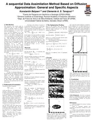
Jordan Case Study: Zerqa River Basin Kick-off Meeting Malta Oct. 28-29,2004 By Prof. Dr. Muhammad Shatanawi UNIVERSITY of JORDAN. 1. INTRODUCTION. Jordan is an arid to semi arid country Jordan covers a land area of about 90 thousand km 2 .

E N D
Jordan Case Study:Zerqa River BasinKick-off MeetingMalta Oct. 28-29,2004By Prof. Dr. Muhammad ShatanawiUNIVERSITY of JORDAN
1. INTRODUCTION • Jordan is an arid to semi arid country • Jordan covers a land area of about 90 thousand km2. • The population of 5.480.000 (year 2003) is growing rapidly with annual growth rate of about 2.8 % . • About 73% of population lives in urban areas concentrated in the northern and middle parts of Jordan .
1. INTRODUCTION • Jordan's topographic features are variable: • A mountainous range from the north to the south of the country. • To the east ,ground slopes gently to form the eastern deserts. • To the west , ground slopes steeply towards the Jordan Rift valley.
Jordan Image Iraq Syria West Bank N Saudi Arabia
1. INTRODUCTION Due to the variable topographic features of Jordan. The distribution of rainfall varies considerably with location 1.1 %of the country receives over 500 mm of rain per year. 1.8 %of the country receives between 300 to 500 mm of rain per year. 5.7%receives 200 to 300 mm/year 91.4 %receives less than 200 mm /year
2. Water Resources 2.1. Surface Water : • Surface water resources average about 693 MCM distributed unevenly in 15 basins. Zerqa River Basin is the second important basin after Yarmouk . • The collective long term average base flow for all basins is about 359 MCM/Year . • Flood flow is estimated at 334MCM/Year .
Surface Water Basins Zerqa River Basin
2. Water Resources 2.2. Ground Water : • Twelve ground water basins have been identified in Jordan . • The long term safe yield of renewable ground water resources has been estimated at 275 MCM/Year . • The main nonrenewable ground water exists in the Disi aquifer with safe yield of 125 MCM/Year . Other nonrenewable ground water estimated at an annual safe yield of 18 MCM.
2. Water Resources 2.3. Wastewater: • Treated Wastewater is an important component of Jordan’s water resources . About 73 MCM of treated wastewater is discharged to various water courses and flows downstream to Jordan Valley where it is used for irrigation. • By the year 2020, it is expected that the volume of treated wastewater will amount to 220 MCM/year, and will constitute a significant portion of the total irrigation demand and hence supplement the demand on renewable ground water resources .
3.Zerqa River Basin 3.1. General Overview : • The Zerqa River Basin extends from the Syrian border in northern Jordan to south of Amman and westward to the eastern slopes of Jordan Rift Valley. • Zerqa River is the second largest in Jordan in the area of its drainage and its annual discharge. • The river consists of two main branches; Wadi Dhuleil, and Seil-Zerqa, both meet at Sukhna to form the Zerqa River. Naturally the former branch drains only flood flows as a result of precipitation, whereas the later drains flood and base flows.
Jordan Streams Zerqa River N
Location of the Zerqa River Basin Zerqa River Basin
The Main Branches of Zerqa River Wadi el.Ajib Jordan River Wadi Dhuleil ZerqaRiver Seil zerqa N
Delineated Zerqa River Basin N Jordan River
3.1. General Overview • The Zerqa River Basinrepresents a transitional area between the semi arid high lands in the west to the dry desert in the east. Its annual rainfall depths ranging from more than 500 mm to less than 100 mm. The great variability in rainfall patterns governs the agricultural potential of the catchment. • Favorable climatic conditions for agricultural production are restricted to the northwest and southwest of the basin.
The Zerqa River Basin belongs to the semi-arid Mediterranean type. The climate is governed by a cool rain season from November to March and long, hot, summer. • The mean yearly air temperatures vary from 14.5 Cْ in the west to almost 18 Cْ in the southeast. The maximum mean daily temperatures occur in July or August ranging from 27 to 23 Cْ. The minimum mean temperatures in January ranging from 2 to 3 Cْ.
3.1. General Overview : • Surface water in the basin primarily used for irrigation purposes. • The As-Samra wastewater treatment plant contributes substantial year-round flow to Wadi Dhuleil, which joins the Zerqa River and finally into King Talal Reservoir. Water stored in resrvoir is channeled to irrigation projects in the Jordan River Valley.
Table: - Surface Water Basins in Jordan and their Available Water Resources * Source: Shatanawi, (2002).
3.2. Water Sector Demand in Zerqa River Basin • Agricultural • Municipal • Industrial
1. Agricultural Sector: • The important role of agricultural sector is reflected in its contribution to Gross Domestic Product (GDP), and the employment of labor forces. • The average contribution of agricultural sector to GDP is 10% • More than 30%of irrigated agriculture exist within Zerqa River Basin. • Mainly existing cropping pattern are Field crops, Vegetables, Fruit Trees, and Green Houses.
2. Municipal Sector: • The Zerqa River basin is a highly populated area. It is located in five governorates, namely Amman, Balqa, Jerash, Mafraq, and Zerqa, where more than 50% of the country population are living there. • The major consumption of municipal water is located in Greater Amman and Zerqa. • The rapid increase of population growth, lead to over utilization of groundwater resources. • The current abstraction has been exceeded twice the groundwater recharged.
Zerqa River Basin is located in Five Governorates N Al Mafraq Jordan River Jerash Zerqa Balqa Amman
3. Industrial Sector: • The industrial activities within the Basin is forming about 23% of total consumption of water. • 80% of the industries, and the solid waste disposal sites are located within the area, where their effluent and leachates reach surface and ground water resources causing a local pollution and threatening to contaminate the aquifers.
Industrial activities at the Zerqa River Bain: • The industrial sector within the Basin is not classified a rural industries. • The use of groundwater for industry is a common practice, as 61 industrial wells are in the area, with total consumption of about 5.743 MCM .
Industrial activities at the Zerqa R. Basin Summary of Industries in Zerqa River Basin: • Petroleum Refinery • Phosphate production • Drugs and Chemical Industries • Distillery and Food Industries • Mining • Textile, Clothing • Tanning Industries • Engineering Industries • Paper and Carton products • Thermal Station
3.3. Zerqa River Basin Problems: The water resources , their limited availability, and the competition on the water between the municipal, agricultural, and industrial sectors are the major concern in the Zerqa River Basin. • High Domestic Demand • High Agriculture Demand • Lack of the Resources
END of SLIDE SHOW THANK YOU