Download
1 / 17
170 likes | 303 Views
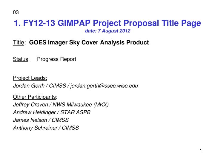
1. FY12-13 GIMPAP Project Proposal Title Page date: 7 August 2012. 03. Title : GOES Imager Sky Cover Analysis Product Status : Progress Report Project Leads: Jordan Gerth / CIMSS / jordan.gerth@ssec.wisc.edu Other Participants : Jeffrey Craven / NWS Milwaukee (MKX)

E N D
1. FY12-13 GIMPAP Project Proposal Title Pagedate: 7 August 2012 03 Title: GOES Imager Sky Cover Analysis Product Status: Progress Report Project Leads: Jordan Gerth/ CIMSS / jordan.gerth@ssec.wisc.edu Other Participants: Jeffrey Craven / NWS Milwaukee (MKX) Andrew Heidinger / STAR ASPB James Nelson / CIMSS Anthony Schreiner / CIMSS
2. Project Summary The goal of this project is to increase the frequency of Cloud Mask, Effective Cloud Amount, and Cloud Top Pressure products from the current GOES, and eventually GOES-R, Imager to produce an average sky cover grid, nationwide, once per hour using multiple scans. Other methods and inputs will eventually be required to complete the grid where ECA and CTP are not valid indicators of sky cover as defined by the National Weather Service’s operational requirements. Numerous NWS forecasters have directly requested such a product to verify an operationally required forecast sky grid because (1) purely numerical weather prediction methods do not account for radiative transparency of clouds and (2) current satellite-based techniques and algorithms, used alone or in existing analysis tools, do not match the forecasters’ interpretation of the NWS-established definition.
3. Motivation / Justification • Sky cover composites from the National Digital Forecast Database (NDFD) lack sufficient integrity due to weak office-to-office consistency, and are relatively smooth in definition within individual forecast areas. • Since sky conditions alone are never hazardous to the general public, and NDFD text output translates a percent into categorical terms, forecasters generally place more attention on the other forecast elements (weather, precipitation, temperature, etc.). • Existing operational numerical weather prediction models do not provide a sufficient first-guess for sky cover, relying heavily on relative humidity in the lower and middle levels of the atmosphere. In addition, convective parameterizations can produce extremes in the forecast cloud field which do not accurately represent a fair weather cumulus scene.
3. Motivation / Justification Example NDFD operational output
4. Methodology Cirrostratus (Cs) covering the whole sky http://www.srh.weather.gov/srh/jetstream/synoptic/h7.htm
4. Methodology • (Underway) For each scan, compute the ECA and CTP from the GOES Imager. Currently, this is only produced once per hour. Depending on CTP and ABI Cloud Mask, apply the ECA directly, or a correction (very high clouds, boundary layer clouds). • Build the celestial dome at each pixel, for each scan. • Average over the one-hour interval to produce the final product. • (Underway) Verify against the 1-hour forecast of sky cover from the NDFD to compute cloud fraction coefficients for each cloud coverage bracket (mostly clear, clear, partly cloudy, mostly cloudy, cloudy). • (FY13) Use simple spatial techniques for bands to discern spatial cloud distribution for sub-pixel cloudiness, as necessary. A numerical weather prediction data assimilation scheme and ad hoc methods may be required to fill gaps where sufficient cirrus clouds prevent observation of the entire cloud scene from satellite.
4. Methodology For each scan within the hour, compute Compute Based on adjacent pixels Effective Cloud Amount for each pixel Satellite scans by pixel; observer considers entire sky (can see high clouds at greater distance) Celestial Dome GOES-R Algorithm Working Group (AWG) ECA is also produced at CIMSS with current GOES and could be used for this exercise as well. Final product Average all scans then check Cloud Top Pressure and ABI Cloud Mask Alternative techniques are required to compute cloud fraction for cloud heights lower than 700 hPa (scattered cumulus or stratus, water cloud).
4. Methodology • The current goal is to reconcile the dichotomy between ECA and cloud fraction. There are also different definitions for cloud fraction. • Wood and Field (2000) discuss a differential equation to explain the relationship between cloud fraction and cloud condensate. • However, there is no equation to definitively describe the relationship between Effective Cloud Amount and cloud fraction due to the spatial resolution of the GOES Imager. For example, some shallow convective clouds are absent on the ECA product but contain significant cloud condensate. • The intent is to use linear optimization as a way to determine for which cloud heights ECA and cloud fraction are similar (proportional by a coefficient and/or additive scalar).
5. Expected Outcomes • This project will, for the first time, create a scientific formulation for the sky cover grid based on the existing definitions and forecaster interpretations. • The initial product, the hour-averaged ECA, is the first step toward a better definition for the sky grid, which adds significant value to the existing GOES cloud products. • There are some situations where ECA is not a valid indicator of sky cover (e.g., a broken cumulus field; thick cirrus). • The final product will require additional input, perhaps from other observations and systems. Depending on feedback from the initial product, subsequent work will pursue identifying techniques which match the NWS requirement for the operational sky cover grid. • The way to achieve the best result will likely be through the use of linear optimization.
6. First Year - Preliminary Results • The process employed in this project for staging and using background data is as follows: • Initialize the dynamical model at time t = -12 (hours). • Obtain the 12-hour forecast from the model initialized at t = -12. • Obtain the analysis from t = 0. • Run linear program to minimize the objective function comparing the 12-hour forecast and analysis both valid at t = 0. • Initialize the dynamical model at time t = 0. • Apply fixed variable values from the linear program (a coefficient and scalar) to dynamical model output at t = 12, t = 24, and t = 36. Calculate skill.
6. First Year - Preliminary Results RMSE resulting from forecasts directly from NWP model post-processor
6. First Year - Preliminary Results RMSE resulting from corrected forecasts based on linear optimization
6. First Year - Preliminary Results Objectives are as follows: • Generate ECA and CTP for every scan from GOES-13 Imager. • Complete first-attempt final product based on aforementioned methodology. • Make available in real-time for dissemination to participating NWS offices (Milwaukee/Sullivan WFO and others as able). • Involve NWS forecasters in providing (1) subjective feedback and (2) quantitative “verification” against the NDFD.
7. Possible Path to Operations • CIMSS has partnerships with dozens of NWS offices around the country, with a five-year history of making experimental satellite imagery and products available to the field in Advanced Weather Interactive Processing System (AWIPS) and Graphical Forecast Editor (GFE) readable formats to assist in operational decisions. This expertise is easily applied to this project. • Pre-operational, interim solutions for extensive field evaluation are employed by CIMSS as part of the GOES-R Proving Ground. Field input is a required component of developing a widely-accepted sky cover analysis grid, and we plan to leverage our NWS connections to assure the end product is consistent with field expectations. • The PSDI path to operations will be investigated for this project. Applying GOES-R AWG algorithms ensures a greater likelihood of a legacy for the resulting product.
8. FY13 Milestones • Generate ECA and CTP for every scan from new GOES-W Imager (GOES-15) and make similar product. • Improve product based on feedback with other observational and numerical inputs. • Applying linear optimization techniques • Publish results. • Work under PSDI to transfer real-time product to operations.
10. Spending Plan FY13 • FY13 $70,000 Total Project Budget • Grant to CI (CIMSS) - $64,000 • % FTE - $60,000, 50% FTE • Travel - $2,000 • Equipment - • Publication charge - $2,000 • Federal Travel – $3,000 • Federal Publication Charges – • Federal Equipment – • Transfers to other agencies – $3,000 to NWS MKX • Other -