Download
1 / 33
330 likes | 507 Views
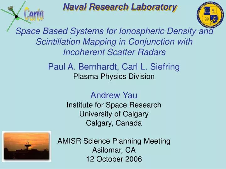
Naval Research Laboratory. Certo. Space Based Systems for Ionospheric Density and Scintillation Mapping in Conjunction with Incoherent Scatter Radars. Paul A. Bernhardt, Carl L. Siefring Plasma Physics Division Andrew Yau Institute for Space Research University of Calgary Calgary, Canada

E N D
Naval Research Laboratory Certo Space Based Systems for Ionospheric Density and Scintillation Mapping in Conjunction with Incoherent Scatter Radars Paul A. Bernhardt, Carl L. Siefring Plasma Physics Division Andrew Yau Institute for Space Research University of Calgary Calgary, Canada AMISR Science Planning Meeting Asilomar, CA 12 October 2006
Space Based Beacons, Receivers and Radars • CERTO Beacon System Objectives • CERTO Space-Based Transmitter • CITRIS Space-Based Receiver • Science Operations with AMISR • Enhanced Tomography • Scintillation and Irregularity Detection • Satellites, Inclinations and Launch Dates • Ground Receivers • Conclusions
NRL Radio Beacon Sensors DMSP/F15 1998 SEEK2 Rockets August 2002 CERTO on ARGOS CERTO on PICOSat (2001-2005) (1999-2001) Past CERTO/TBB on COSMIC (2006) CERTO on C/NOFS (2008) EQUARS (2008) CITRIS on STPSAT1 (2006) CERTO/LP on NPSAT1 (2006) CASSIOPE (2007) Future
NRL CERTO Radio Beacons and CITRIS Receiver for Ionospheric Tomography INCLINATION Check Out Operation Extended Operation SATELLITE 98.6 DMSP/F15 862 80 CASSIOPE/EPOP 325 x 1500 70 COSMIC 6 800 70 COSMIC 5 800 70 COSMIC 4 800 70 COSMIC 3 800 70 COSMIC 2 800 70 COSMIC 1 800 35 NPSAT1 560 CITRIS Receiver 35 STPSAT1 560 20 EQUARS 750 15 C/NOFS 375 x 700 2006 2007 2008 2009
CERTO Beacon Orbits • Global Coverage • Ten New Beacon Satellites • CASSIOPE Orbit Along Magnetic Meridian
Ground Receiver Geometryfor Scintillation and TEC Measurementsfrom LEO Satellites with CERTO Beacons
Down and Side Looking Measurement Geometry for CERTO Receiver Chains
Level 0 Data Storage Level 1 Data Validation CERTO Data Collection and Dissemination Field Receivers Mission Data Centers CERTO Receiver #1 NOAA NESDIS CERTO Receiver #2 COSMIC CDAC NRL CERTO Data Archive CERTO Receiver #3 C/NOFS CERTO Receiver #4 CASS- IOPE . . . . . .
Tomographic Imaging At High Latitudes • F- and E-Region Structures • High Latitude Data Example • Applied to Bubbles at Low Latitudes (Images Courtesy of Dr. L. Kersley, University of Wales, Aberystwyth and and Dr. C. Mitchell, University of Bath)
TOMOGRAPHIC IMAGE OF A MODEL EQUATORIAL BUBBLE Model Density Ground TEC Data Reconstruction Electron Content (1016 m-2) Altitude (km) Relative Time (s) Zonal Distance (km) Zonal Distance (km) Projections of Electron Density to Nine Receivers Image Formation Using Computerized Ionospheric Tomography Ref.: Bernhardt, P.A, et al., Space Weather, Geophys. Monograph, AGU, 2001
Tomographic Algorithm Development and Testing Ionospheric Reconstruction • Synthetic Electron Density Data from SAMI3 Model • Derived TEC for Ground Receivers • Reconstructed Electron Densities Ionosphere Model Densities Output Reconstruction Input TEC Data TEC (1016 cm-2) Latitude
Incoherent Scatter Observations of F-Region Heating Provides Starting Conditions for Tomographic Imaging Scatter From Ion Acoustic Waves
Reconstructed Electron Density from Radar and TEC Observations • Ionospheric Hole Produced by HF Facility • 3-D Image Shows Displacement From HF Beam • ISR Data Establishes Layer Height 67.0 W Longitude 67.3 W Longitude 66.7 W Longitude
Scintillation Prediction for CERTO Beacon Frequencies Near the Equator
Radar and Radio-Telescope Sites with Future CERTO Receivers for Ionospheric Measurements . VLA MU RADAR STPSAT1 Orbit Boundary COSMIC Orbit Boundary
Launch of COSMIC Satellites • 14 April 2006 0140 GMT • Six Satellites • 72 Degree Inclination • 500 km Initial Altitude • 750 km Final Altitude • Three Instruments • JPL/Broadreach GPS Receiver • NRL Tiny Ionospheric Photometer (TIP) • NRL Tri-Band Beacon (TBB or CERTO)
JOINT CERTO, GPS-GOX, TIP OPERATIONS ON COSMIC SUPPORTED BY AMISR RADAR From GPS Satellite TIP EUV Field of View AMISR Scans Ground Receivers
CERTO RADIO BEACON GEOMETRY FOR TEC AND SCINTILLATION MEASUREMENTS GPS RECEIVER and CERTO BEACON TRANSMITTER N Ground Receivers S To GPS Satellite Beacon Low Earth Orbit
0 Electron Density (106 cm-3) 1.0 500 400 300 200 100 0 500 400 300 200 100 0 Horizontal Occultation Paths Tangent Altitude (km) Tangent Altitude (km) 500 400 300 200 100 0 500 400 300 200 100 0 0 100 200 -400 -200 0 200 Zonal Distance at Equator (km) Horizontal TEC (1012 cm-3) Simulation of COSMIC GPS Occultation Studies
TIP Provides EUV Proxy for Scintillation • Images of Equatorial Bubbles Using the GUVI Instrument on TIMED • Radiative Recombination: O+ + e- O + hn (130.4 nm) • TIP Scintillation Proxy: Location Based on EUV Scans Validated with TBB Measurements to Ground Receivers
Phase III: Electron Density and Scintillation Region Tomography Orbit CERTO Beacon Transmissions Irregularity Receiver
Future CERTO Stations in South Asia Region • Three Frequency CERTO Receivers Available from SCION and NWRA • Deployment by Expected by August 2006 CERTO/TBB Receiver SitesTaiwan NSPOFranceAustraliaTBD
SCION 3 Frequency Receiver Example of a Commercially Available CERTO Radio Beacon Receiver SCION Patch Antenna on Stand
Near Term NRL CERTO Receiver Additions to Support the COSMIC Satellites • Current Receivers on Order • 2 SCION-3 • 2 NWRA ITS30-3 • Pan American Tomography Array (PATA-1) • 5 Receivers between Jicamarca and Arecibo • PATA1 Aligned with COSMIC Ascending Orbit • Pan American Tomography Array (PATA-2) • 5 Receivers between Manaus and Ottawa • PATA2 Aligned with COSMIC Descending Orbit • PATAs Finished in 2007 • High Resolution Tomography Array (HRTA) Delayed Until C/NOFS Launch • CERTO Receivers Available • Power and Internet Needed • Sharing of Beacon Data COSMIC Satellite Orbits Chesapeake, Virginia PATA2 Arecibo, Puerto Rico PATA1 HRTA Ancon, Peru C/NOFS Orbit
ARL/UT Austin CIDR TEC from Ancon, Peru • Sample TEC Data • Smooth Ionosphere • Structured Ionosphere
Pan American Arrays • Team • Naval Research Laboratory (Bernhardt, Huba) • Arecibo Observatory (Vo, Sulzer, Tepley) • Jicamarca Observatory (Chau) • University of Illinois (Kamalabadi) • University of Texas, Austin (Bust, Gardner) • Boston College (Valladarez) • University of Bogota (Villalobos) • University Des Andes Merida (Bendito) • Array Locations • COSMIC PAA1: Ancon Peru to Arecibo Puerto Rico • COSMIC PAA2: Manaus Brazil to Ottawa Canada • C/NOFS HRTA: Ancon Peru to Huancayo Peru • New CASSIOPE MCTA: Arecibo Puerto Rico to Argentina
CASSIOPE Micro-Satellite: Instrument Payload • Imaging particle instruments • IRM: Imaging rapid ion mass spectrometer • SEI: Suprathermal electron imager • NMS: Neutral mass and velocity spectrometer • Imager and wave receivers-transmitter • FAI: Fast auroral imager • CERTO: Radio tomography • RRI: E-Field receiver • MGF: Magnetometer • GAP: Differential GPS
Radio Beacon Receiver Chainsto Observe CERTO Beacons ARCTIC Alaska Finland UK Spain Americas Taiwan Kwajalein Ascension India Indonesia South America South Africa
Scheduling of CERTO Operations with Ground Receivers • CERTO Radio Beacons are NOT Operating Continuously • Overflight of Ground Receivers • Two or Three Frequencies Chosen from VHF/UHF/L-Band • GPS Occultation Data if GPS Satellite in Proper Location • Simultaneous Beacon and In Situ Probes with C/NOFS and NPSAT1 • Supporting Ground Systems • 50 MHz Radar: Jicamarca, Peru • 430 MHz Radar: Arecibo, Puerto Rico • All Sky Optical Imagers • Digital Ionosondes • Send Receiver Locations and Turn-On Requests to Paul Bernhardt (bern@ppd.nrl.navy.mil) • CERTO Beacon Satellite Updates Distributed Through IITC from NWRA
Summary • Ten New Satellite Beacons for Ionospheric Studies in Conjunction with AMISR • DMSP/F15 (In Orbit) • COSMIC (In Orbit) • NPSAT1 (Nov 2006 Launch) • CASSIOPE (Nov 2007 Launch) • C/NOFS (2008 Launch ?) • Alaska, Peru and Arecibo are Primary CERTO Receiver Sites • Jicamarca, Peru and Chesapeake, Virginia Lie on COSMIC Orbit Tracks • AMISR Facilities at Poker Flat and HAARP Lie on DMSP/F15 Path • Late 2007 Scheduled for Deployment of 20 to 40 Tomography Receivers • New In Situ and Remote Sensing Diagnostics on Ten New LEO Satellites