Download
1 / 10
110 likes | 287 Views
Using Natural Disasters to Teach Science. Hurricane Mitch – October 1998. Using Natural Disasters to Teach Science. Destruction Caused by Hurricane Mitch in Honduras. Hurricane stalled over the mainland October 29 - 31 1998. . 7,000 fatalities 33,000 homes destroyed

E N D
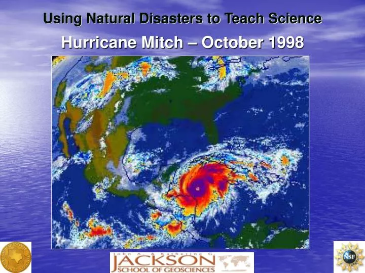
Using Natural Disasters to Teach Science Hurricane Mitch – October 1998
Using Natural Disasters to Teach Science Destruction Caused by Hurricane Mitch in Honduras • Hurricane stalled over the mainland October 29 - 31 1998. • 7,000 fatalities • 33,000 homes destroyed • 95 bridges destroyed • 70% of road network damaged
Flooding Caused by Hurricane Mitch Destroyed housing Flood-inundated area Destroyed agriculture Tributary Rio Choluteca
Using Natural Disasters to Teach Science Landslides Caused by Hurricane Mitch
Using Natural Disasters to Teach Science El Berrinche Landslide Scar (looking south)
Using Natural Disasters to Teach Science Cross Section and Lidar Map of El Berrinche Landslide in Honduras (map view to west)
Using Natural Disasters to Teach Science • Lidar : Light Detection and Ranging
Using Natural Disasters to Teach Science Review of Lidar Principles • Scanning mirror sweeps laser beam across the ground • Range to target is determined by measuring time interval between outgoing and return of reflected laser pulse • Aircraft position is determined using GPS phase differencing techniques • Pointing direction of laser determined with Inertial Measuring Unit (IMU) and recording of mirror position • Data streams recorded and synchronized to process
Using Natural Disasters to Teach Science Lidar Flight Lines over Tegucigalpa, Honduras Survey area Flight lines
Using Natural Disasters to Teach Science Result of Lidar Mapping • Two-dimensional map of Tegucigalpa, Honduras • El Berrinche landslide scar shown by black dotted line • Colors show elevation of land surface in meters • Map is about 3000 m (3 km) wide by 3200 m (3.2 km) tall.