Download
1 / 24
240 likes | 346 Views
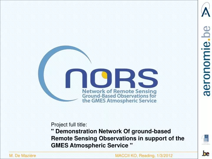
Project full title: " Demonstration Network Of ground-based Remote Sensing Observations in support of the GMES Atmospheric Service ". Introduction. EU 7th Framework Programme R&D Project in R&D to enhance future GMES applications in the Atmosphere area

E N D
Project full title: " Demonstration Network Of ground-based Remote Sensing Observations in support of the GMES Atmospheric Service "
Introduction • EU 7th Framework Programme R&D Project in R&D to enhance future GMES applications in the Atmosphere area • Nov. 1, 2011 – July 31, 2014 (33 months) • 9 NDACC partners, 1 GAW actor and 1 Dutch SME Network forDetection of AtmosphericComposition Change: A research network of more than 70 monitoring stations worldwide, providing high-qualityground-based remote sensing data for • detecting changes in the atmosphericcomposition (stratosphereandtroposphere) • Supporting the validation of satellite experiments andnumerical model developments • Supportingprocess studies • Establishing links betweenatmosphericcompositionandclimate change
NDACC observational capabilities Lidar, Microwave radiometer, FTIR, (MAX)DOAS, Dobson/Brewer, UV spectrometer http://www.ndacc.org
General Objectives • Perform the required research and developments to optimize the NDACC data delivery and data products for the purpose of supporting the quality assessments of the future GAS (MACC-II as the prototype). Ground-based remote-sensing column and profile data are a good complement to surface and satellite data • target NORS data products • tropospheric and stratospheric ozone columns and vertical profiles up to 70 km altitude; • tropospheric and stratospheric NO2 columns and profiles; • lower tropospheric profiles of NO2, HCHO, aerosol extinction; • tropospheric and stratospheric columns of CO • tropospheric and stratospheric columns of CH4 • 4 NDACC techniques + in-situ surface monitoring: Lidar, MW, FTIR, UV-VIS DOAS + in-situ surface monitoring • 4 NDACC pilot stations
General Objectives • Apart from some MAXDOAS data, none of the NORS data are already included in MACC-II VAL. • So NORS is complementary to validation included in MACC-II • NORS will aim at consistency with validation protocols and procedures defined in MACC-II (at management level and in VAL subproject)
Steering Bodies The Steering Committee: • the Project Management Team (coordinator and WP leaders); • R. Engelen for MACC-II • a representative of ESA for the satellite data and the GECA environment (T. Fehr); • Henrik Steen Andersen for EEA: coordination of the in-situ component in the GMES Atmosphere area; • G. Braathen (WMO), as co-chairman for NDACC; • O. Tarasova, responsible at WMO for matters related to Greenhouse gases, Reactive gases, GAW stations and QA/QC; • J.C. Lambert (BIRA), as representative of CEOS WGCV
Objectives (1/2) • to implement procedures for data delivery of NDACC data to GAS actors with a delay of maximum 1 month (WP 3); • to provide an extensive characterisation (metadata) of targeted NDACC data and user documentation. The NDACC data will also be evaluated in comparison with satellite data that are assimilated in the GAS products, and against other network data like Global Atmosphere Watch (GAW) surface data and the Total Carbon Column Observing Network (TCCON) data, in a comprehensive and coordinated way (WP 4); • to investigate the integration of ground-based data products from various sources (ground-based in-situ surface and remote-sensing data, and satellite data), and to provide the integrated data products to GAS. Hereto, new scientific methodologies will be developed. (WP 5 & 6). For example: • integrated O3 profiles from sondes, lidar, microwave and FTIR data • NO2 profiles from surface data and remote-sensing data
Objectives (2/2) • to provide ground-based measurement time series back to 2003 in support of the re-analysis products of GAS. NORS will provide and archive quality-controlled long-term reference data sets for open access by GAS and GMES users, a need expressed in the GAS Implementation Group Final Report. (WP 7) • to develop and implement a new GAS-compliant web-based application for operational validation of GAS products using the NORS data products. In this validation service, better methodologies (“best practices”) for validation will be included, based on the improved characterisation of the ground-based data. This service (based on GECA) will be user-oriented. (WP 8 & 9) • Capacity building (WP 10): • To ‘export’ project achievements to whole NDACC community • to support the extension of NDACC to stations outside Western Europe, namely in the tropics, in China, Latin America, Africa and Eastern Europe.
Connections to MACC-II • Established links with MACC-II Val subproject • CoordinatewithOBS/in-situ and EEA GISC project • In progress : • Development of NORS Validation Server User Requirements • willbeiteratedwith MACC-II representatives (By end of April 2012) • Development of NORS Validation Server Design Documents • Establishment of direct links between MACC-II products and NORS products (NDACC database) • Connection between NORS Validation Server and MACC-II website (By end of June 2012)
Connections to NDACC • Export NORS achievementstoadditional NDACC sites, and new, potential NDACC stations • ExpandtoadditionalNDACC products • taskfor WG co-chairmen • NORS data willbeavailablefrom NDACC database (@ NOAA) • NORS data willbe compliant with GEOMS HDF format (tools willbeavailableto transpose to GEOMS compliant netCDF) Connections toCEOS
Extension beyond W-Europe Seoul Korea ozone radiometer IAP/UBern Sookmyung University
Capacity Building - WP10 • Export NORS achievements to additional NDACC sites and candidate NDACC stations • task for WG co-chairmen • Task for JCL in CEOS WGCV • Task for individual partners according to Table Deliverables = status reports (M33) Already achieved (NDACC SC meeting): NORS data server = NDACC DHF Req’ment: distinctive metadata. Option: DATA_QUALITY ? • Ensure integration of NORS in in-situ component for GMES coordinated by EEA • data policies ? • Metadata standards ? Deliverable = report (M33)
Aim of KO meeting Most important goals to be achieved: • Clarify interaction with MACC-II: • what are its needs, • avoid overlap with activities already undertaken in MACC-II; complementarities ? Contact persons ? • Clarify role of EEA and interaction between NORS and EEA • Start individual activities • Clarify collaborations within WPs/ Tasks • Who takes the lead ? • Identify contributions from partners and timing • Be aware of administrative and financial rules
Reviewers ? • H. Kelder • P. Levelt / P. Veefkind • Erik Liljas • G. Brasseur • Y. Goovaerts
Extension beyond W-Europe Seoul, Korea, ozone radiometer, IAP/UBern, Sookmyung University
Context • European Initiative Global Monitoring for Environment and Security (GMES) 6 thematic areas - land - ocean - security - emergencies - climate - atmosphere • EU FP7 call in Nov. 2010 asking for • Continuation of prototype Service MACC-II • R&D projects for improving GAS in the future NORS MACC, Monitoring Atmospheric Composition and Climate, is the current pre-operational atmospheric service of the European GMES programme. MACC provides data records on atmospheric composition for recent years, data for monitoring present conditions and forecasts of the distribution of key constituents for a few days ahead. MACC combines state-of-the-art atmospheric modelling with Earth observation data to provide information services covering European Air Quality, Global Atmospheric Composition, Climate, and UV and Solar Energy.
Remaining questions • Access to satellite data ? • Access to GECA • Access to MACC-II analyses ?
NORS pilot stations 3 out of 4 are also TCCON sites