Download
1 / 8
80 likes | 87 Views
This article explores Von Thünen's Rural Land Use Model and the relationship between rural and urban land uses. It discusses the Urban Shadow Land Use Model and its application in different regions, including London, Ontario and Greenville-Appleton, Wisconsin. The article also covers the changes in land use patterns between 1971 and 1990.

E N D
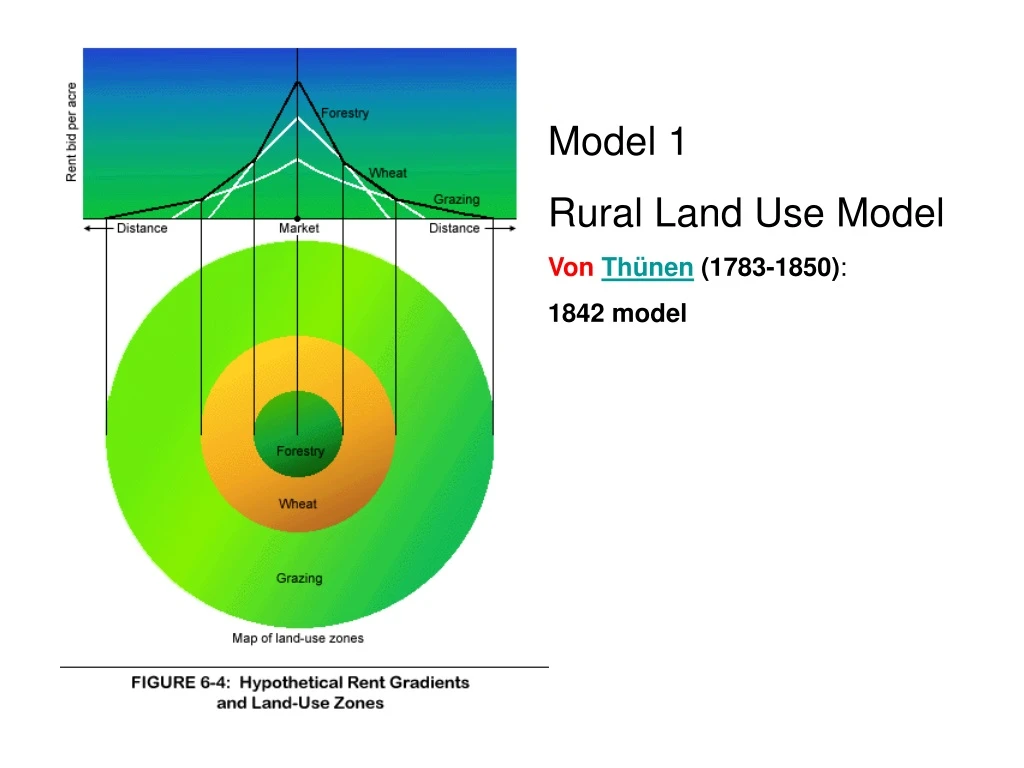
Model 1 Rural Land Use Model Von Thünen (1783-1850): 1842 model
Model 2Urban Shadow Land Use Model Source: M. J. Troughton, Landholding in a Rural-Urban Fringe Environment: The Case of London, Ontario.
full-time Urban Shadow Land Use Model part-time hobby non-resident Source: M. J. Troughton, Landholding in a Rural-Urban Fringe Environment: The case of London, Ontario.
Urban Shadow Land Use Model urban shadow
Urban Shadow in Wisconsin 1956 Greenville-Appleton, Wisconsin Urban Interior Urban Edge Rural Edge Rural Interior Source: Gerald Ottone, “Farming in the Face of Exurbanization,” Wisconsin Geographer, 21(2006), 51-74 1971 1990