Download
1 / 32
320 likes | 826 Views
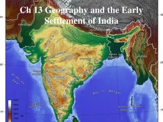
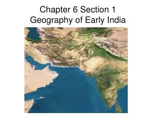
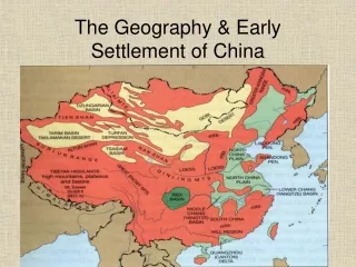
Chapter 13 Geography and the Early Settlement of India. 13.1 Introduction. India is a subcontinent of Asia. It is attached to Asia yet is surrounded on three sides by water. Early walled civilizations appeared around 2500BC. 13.2 Brahmaputra River.

E N D
13.1 Introduction • India is a subcontinent of Asia. • It is attached to Asia yet is surrounded on three sides by water. • Early walled civilizations appeared around 2500BC.
13.2 Brahmaputra River • The Brahmaputra River starts high up in the Himalayas. • The water is clear and cold as it rushes over the sharp rocks. • It becomes slower and deeper as it moves into the valley. • Seasonal monsoon rains add to the river flow and therefore cause the river to overflow its banks. • Monsoon – a large wind that brings lots of rain. • The flooding waters recede and leave behind the silt that it carried down the river from the mountains. • The river joins the Ganges River and where they meet the land is very fertile (good for farming)
13.3 Deccan Plateau • The Deccan Plateau is a triangle-shaped area between two mountain ranges in southern India. • A plateau is an elevated, or raised, area of land that is flatter than a mountain. • The plateau is fairly dry. • There are few rivers. • The soil is black, red or yellow. • The black soil is rich in iron and good for growing cotton. • The redand yellowsoil are missing important minerals. • Farmers have a hard time growing crops in these two soils.
13.4 Eastern and Western Ghats • The Eastern and Western Ghats are long mountain chains near the coast of India. • They form a large V shape when seen from above. • They have steep slopes, narrow valleys, thick hardwood forests and heavy rains. • Travel is not safe on the Ghats.
13.5 Ganges River • The Ganges River flows across most of northern India. • It starts in the Himalaya Mountains. • The river deposits rich sediment after the floods recede. • The northern plains contain some of the most fertile farmland in the world. • The river provides fresh water for the fertile farms. • However, during the rainy season, the river can flood and destroy crops planted along its banks.
13.6 Himalaya Mountains • The Himalayas are located along India’s northern border. • They form a natural barrier between India and the rest of Asia. • They are the highest mountain range in the world. • Mount Everest, the world’s tallest mountain, is part of the Himalayas. • It reaches 5 ½ miles into the sky! • They may receive 120 inches of snow in a single snow storm! • The mountain range is growing every year. • Earthquakes and landslides are very common.
13.7 Hindu Kush Mountains • This mountain range is not as tall as the Himalayas, but it is still one of the highest in the world! • Snow and ice permanently cover the steep slopes and peaks. • Khyber Pass is a 28 mile-long gap between the mountains. • It connects central Asia to the Indian subcontinent.
13.8 Indus River • The Indus River begins in the Himalaya Mountains. • It gets water from the melting snow from the Hindu Kush mountains. • A wide variety of fish and shrimp are caught. • The Indus River valley contains some of the best farmland in the world. • The Indus River has often been compared to Egypt’s Nile River. • It is an important source of fresh water for the farmland that lies along its banks.
13.9 Thar Desert • The massive Thar Desert in northern India is mostly sand and stone. • There is very little plant life. • The heat is unbearable. • There are no rivers. • Rain is rare. Monsoons occasionally bring rain. • A variety of animals make their home in the desert region. • For example, reptiles and birds can be found in the desert region.
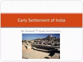
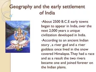
13.10 Early Settlements of India • The ancient people of India first settled around rivers. • The rivers provided food, water, transportation and trade. • The first settlements appeared around the Indus and the Sarasvati Rivers. • The Sarasvati river dried up around 1900 BCE.