Download
1 / 15
170 likes | 354 Views
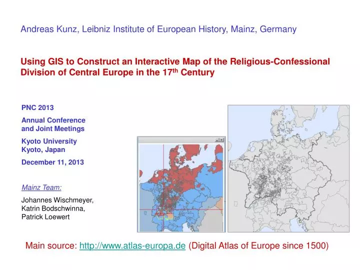
Andreas Kunz, Leibniz Institute of European History, Mainz, Germany Using GIS to Construct an Interactive Map of the Religious-Confessional Division of Central Europe in the 17 th Century. PNC 2013 Annual Conference and Joint Meetings Kyoto University Kyoto, Japan December 11, 2013

E N D
Andreas Kunz, Leibniz Institute of European History, Mainz, Germany Using GIS to Construct an Interactive Map of the Religious-Confessional Division of Central Europe in the 17th Century PNC 2013 Annual Conference and Joint Meetings Kyoto University Kyoto, Japan December 11, 2013 Mainz Team: Johannes Wischmeyer, Katrin Bodschwinna, Patrick Loewert Main source: http://www.atlas-europa.de (Digital Atlas of Europe since 1500)
Religions in Europe in 1555 Impact of the Reformation
1517-1648 Christianity Divided: Confessional Boundaries
Source: GHI-Washington / IEG-Mainz (2007)
1648 Our territorial GIS (c. 1500 units)
1648 GIS-Data Subset linked to 360 souverain states and Imperial territories Confession of the ruling monarch attached to territorial units cuius regio / eius religio principle of 1555
1648 GIS-based confessional map Confession of the ruling monarch attached to territorial units [cuius regio / eius religio principle of 1555]
1648 Excerpt Map
1648 Swiss Confederation Inter/Intra-Confessional Splits Letter code: ka: Catholic re: Reformed pa: Parity rule mk: multi-confessional ge: confession at local basis
1648 GIS-Data Subset linked to 360 souverain states and Imperial territories Confession of the ruling monarch attached to territorial units cuius regio / eius religio principle of 1555
1648 Excerpt Map Decoded Number-Code 1: Imperial Abbeys 2: Ecclesiastical States (princely) 3: Ecclesiastical Orders (imperial) 4: Imperial Cities 5: Imperial Knights
1648 Confessional Divisions The Interactive Map www.atlas-europa.de