Download
1 / 13
140 likes | 377 Views
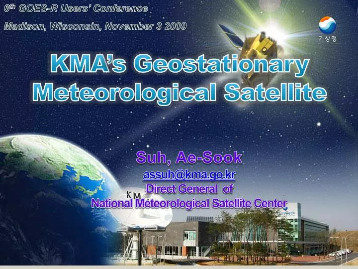
6 th GOES-R Users’ Conference Madison, Wisconsin, November 3 2009. KMA’s Geostationary Meteorological Satellite. Suh , Ae - Sook assuh@kma.go.kr Direct General of National Meteorological Satellite Center. Introduction of NMSC. Organization. Quota (43) Current (40).

E N D
6th GOES-R Users’ Conference Madison, Wisconsin, November 3 2009 KMA’s Geostationary Meteorological Satellite Suh, Ae-Sook assuh@kma.go.kr Direct General of National Meteorological Satellite Center
Introduction of NMSC World Best 365
Organization Quota(43) Current (40) World Best 365
NMSC building construction World Best 365
COMS Ground System for : Antenna/RF Data Pre-processing Data Processing Data Analysis Data Dissemination Application Development Integrated Monitor & Control Job Management Data Communication Satellite Monitoring Data Management World Best 365
Current Status of COMS World Best 365
COMS Development Ka-band Antenna Solar Array MI GOCI Bus • Period: 2003~ 2009(7 years) • Expenses: 74.9 billion won / total354.9 billion won • Governmental Collaborator: MEST, MLTM, KCC • Orbit: 128. 2E, geostationary orbit • Mass/Lifetime: 2,500kg, 7-year MODCS S/L band antenna World Best 365
Milestone Modules Assembly Launch & IOT Satellite Design & Review Satellite System Assembly Analysis on system requirements Operation MI delivery Launch & IOT System design MI Test Preliminary design Critical design System Assembly Integration Test Platform Assembly Integration Test 2003 2004 2006 2007 2008 2005 Now Choose overseas partners Kick-off Manufacture Readiness Review System Design Review Preliminary Design Review Critical Design Review Pre-Shipment Review Launch Prepare the Launch 2010 2009 World Best 365
CMDPSdevelopment (16products) Baseline Products and ServicePlan Animated Picture Service Atmospheric motion vector Cloud Detection Land Surface Temperature Sea Surface Temperature Snow/Sea Ice Detection Tropospheric Precipitable Water Fog COMS Cloud Top Temperature Upper Tropospheric Humidity Clear Sky Radiation Cloud Analysis Aerosol Optical Depth Insolation Aerosol Index Rainfall Intensity Outgoing Longwave Radiation Validation World Best 365
Future Plan World Best 365
Development of COMS follow-on • Development of high performance meteorological instrument • Feasibility study in the first half of 2009 World Best 365
Satellite data utilizationroadmap 2nd phase(2years) Objective 1stphase(3 years) Main areas Very short range forecasting Severe weather forecast using satellite Typhoon &rainfallmonitoring system development Severe weatherdetectionforecastsystembuilding&improvement/ severe weathercase study(rainy spell, typhoon) Regional linear coefficient development & improvement using regional monitoring Atmospheric stability index development using satellite data Regional model &satellite data assimilation Satellite data assimilation NWP results accuracy Improvement using satellite Land variables utilization using satellite data T.q, cloud,rainfall retrieval algorithm development Data assimilation technique selection Aerosol data assimilation technique development Data assimilation model validation Aerosol /Asian dust retrieval algorithm development Aerosol & Asian dust model coupling Data assimilation technique development & operation Next generation satellite data application technique development Next generationsatellite data selection Next generationsatellite data collection/analysis Climate changeprediction&monitoringimprovement Investigation of Long term trend of climate factor variation &climate feedback Satellite data collection &DB implementation Climate monitoring & process analysis Space-basedintercalibration technique development using Climate data Unexpected weather analysis due to warming Effect of Global warmingon water-cyclevariationanalysis Global warming effect on climate system Analysis of Correlation betweendesertification monitoring & climate factor in E.Asia Desertification effect on global climate change Asian dust Aerosolproducts accuracyimprovement Aerosol retrieval algorithm development Validation of Asian dust results Aerosol optical depth retrieval Stratospheric aerosol retrieval Analysis of solar occultation characteristic and aerosol effect Stratospheric aerosol radiative forcing retrieval Aerosoltyperetrieval Aerosol radiative forcing retrieval Aerosol global 3-dim distribution retrieval Production of High qualitySatellite data Satellite data quality control Calibration technique improvement, long-term data analysis &analysis using aircraft measurements Infrared/Visible sensorcalibration techniqueoperation Operating the validation technique of Satellite main products Data Collection for validation and Validation of satellite products