Download
1 / 36
390 likes | 443 Views
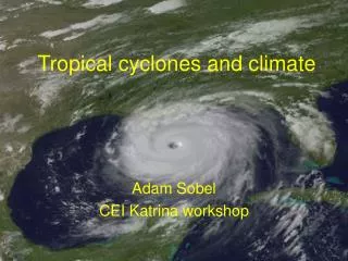
NATIONAL CENTERS FOR ENVIRONMENTAL PREDICTION. Basic Satellite and Radar Interpretation for Tropical Cyclones. JACK BEVEN. NATIONAL HURRICANE CENTER. WHERE AMERICA’S CLIMATE AND WEATHER SERVICES BEGIN. Geostationary Satellites. GOES 8-12. METEOSAT-7. Polar Orbiting Satellites. NOAA.

E N D
NATIONAL CENTERS FOR ENVIRONMENTAL PREDICTION Basic Satellite and Radar Interpretation for Tropical Cyclones JACK BEVEN NATIONAL HURRICANE CENTER WHERE AMERICA’S CLIMATE AND WEATHER SERVICES BEGIN
Geostationary Satellites GOES 8-12 METEOSAT-7
Polar Orbiting Satellites NOAA QuikSCAT DMSP
TRMM Satellite
Image Enhancements • False coloring added to a satellite image to make image easier to interpret or to highlight important features • Useful enhancements include ZA (general use), MB (high clouds and convection), BD (tropical cyclones), and JF (low clouds)
Image Enhancements ZA None
Image Enhancements BD MB
Water Vapor Imagery • 6.7 m channel is sensitive to water vapor in the mid to upper troposphere (generally 200-500 mb) • Water vapor imagery can reveal features that don’t generate visible clouds • Water vapor imagery animation can reveal steering flows or shearing winds for tropical cyclones
Satellite Winds • Satellite winds are computedfrom the displacement of targets on two successive images • Targets can include any type of clouds or features in water vapor imagery • Temperature of cloud or water vapor feature is used for height assignment
Tropical Cyclones in Satellite Imagery IR - BD enhancement Visible
Subtropical Cyclones Hebert-Poteat Technique Pre-Michael Pre-Karen
WSR-88D Doppler Wind Data Lili from the Lake Charles WSR-88D
WSR-88D Rainfall Estimate for Tropical Storm Allison June 2001
Radar, Aircraft, and Satellite Fixes from Lili Aircraft Fixes Radar Fixes Satellite Fixes Best Track
Useful Web Sites - Satellite • TPC Satellite Web Page: www.nhc.noaa.gov/graphics.html • NOAA GOES Web Site : www.goes.noaa.gov/ • RAMDIS Online: www.cira.colostate.edu/ramm/rmsdsol/TROPICAL.html • Satellite ServicesDivision: www.ssd.noaa.gov • CIMSS Tropical Cyclones: www.ssec.wisc.edu/tropic/ • CIMSS AMSU Page: amsu.ssec.wisc.edu/ • CIRA AMSU Page: www.cira.colostate.edu/ramm/tropic/amsustrm.asp • QuikSCAT Winds: manati.wwb.noaa.gov/quikscat/ • NRL Tropical Cyclones: www.nrlmry.navy.mil/sat-bin/tc_home
Useful Web Sites - Radar • NWS Master Radar Page: www.nws.noaa.gov/radar_tab.html