Download
1 / 31
310 likes | 439 Views
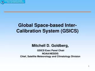
Global Space-based Inter-Calibration System. Mitch Goldberg GSICS, Executive Chair NOAA/NESDIS Chief, Satellite Meteorology and Climatology Division Mitch.Goldberg@noaa.gov. What is GSICS?. Global Space-based Inter-Calibration System (GSICS)

E N D
Global Space-based Inter-Calibration System Mitch Goldberg GSICS, Executive Chair NOAA/NESDIS Chief, Satellite Meteorology and Climatology Division Mitch.Goldberg@noaa.gov The 23rdCEOS Plenary I Phuket, Thailand I 3-5 November 2009
What is GSICS? Global Space-based Inter-Calibration System (GSICS) Goal - Enhance calibration and validation of satellite observations and to intercalibrate critical components global observing system Part of WMO Space Programme GSICS Implementation Plan and Program formally endorsed at CGMS 34 (11/06)
GSICS Mission To provide sustained calibration and validation of satellite observations To intercalibrate critical components of the global observing system to climate quality benchmark observations and/or reference sites To provide corrected observations and/or correction algorithms to the user community for current and historical data 3
Or in technical terms: Quantify the differences – magnitude and uncertainty Correct the differences – physical basis and empirical removal Diagnose the differences – root cause analysis
Motivation Demanding applications require well calibrated and intercalibrated measurements Climate Data Records Radiance Assimilation in Numerical Weather Prediction Data Fusion Growing Global Observing System (GOS) Intercalibration of instruments achieves comparability of measurements from different instruments 5
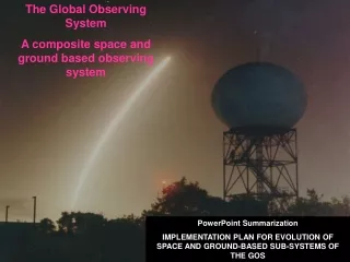
Space-Based component of the Global Observing System (GOS) 6 Intercalibration of instruments achieves comparability of measurements from different instruments
Calibration is Critical for Climate Change Detection Before intercalibraion After intercalibration Trend of global oceanic total precipitable water decreases from 0.54 mm/decade to 0.34 mm/decade after intercalibrations! Calibration uncertainties translate to uncertainties in climate change detection 7 7
Do we Care about Satellite Biases in NWP?After McNally, Bell, et al. ECMWF, 2005 & 2009 Yes! Because: 1) We wish to understand the origin of the bias and ideally correct instrument / RT / NWP model atsource 2) In principle we do not wish to apply a correction to unbiased satellite data if it is the NWP model which is biased. Doing so is likely to: Re-enforce the model bias and degrade the analysis fit to other observations Produce a biased analysis (bad for re-analysis / climate applications) SSMIS calibration biases cause regional weather patterns More accurate satellite observations will facilitate discovery of model errors and their correction. Additional gains in forecast accuracy can be expected. 8
Historical Background The GCOS Climate Monitoring Principles (GCMPs) were extended to address the problems associated with developing long-term climate data records from satellite observations Stable orbits Continuity and adequate overlap of satellite observations Improved calibration and validation
In response to the request by WMO and CEOS on the calibration item of the GCMPs, the CGMS (Sochi, May 2004), the EUMETSAT SAF on Climate Monitoring (Hamburg, July 2004) and WMO’s CBS (St. Petersburg, Feb. 2005) had detailed discussions and tasked the WMO Space Programme to help building an international consensus and consortium for a global space-based inter-calibration system for the World Weather Watch (WWW)/Global Observing System (GOS). Background
GSICS Formulation The Space Programme of WMO initiated a discussion and held two meetings (June and July 2005) to develop the concept of a Global Space-based Inter-Calibration System (GSICS). GSICS Implementation Plan and Program formally endorsed at CGMS 34 (11/06) Formulation team: Mitch Goldberg – NOAA/NESDIS (Chair) Gerald Fraser /Raju Datla– NIST Donald Hinsman – WMO Jerome Lafeullie, WMO Xu Jianmin (CMA) Toshiyuki Kurino (JMA) John LeMarshall - JC Sat. Data Assimilation Paul Menzel –NOAA/NESDIS Tillmann Mohr – WMO Hank Revercomb – Univ. of Wisconsin Johannes Schmetz – Eumetsat Jörg Schulz – DWD, CM SAF William Smith – Hampton University Steve Ungar – CEOS, Chairman WG Cal/Val
Building Blocks for Satellite Intercalibration Collocation Determination and distribution of locations for simultaneous observations by different sensors (space-based and in-situ) Collocation with benchmark measurements Data collection Archive, metadata - easily accessible Coordinated operational data analyses Processing centers for assembling collocated data Expert teams Assessments communication including recommendations Vicarious coefficient updates for “drifting” sensors 12
Other key building blocks for accurate measurements and intercalibration Extensive pre-launch characterization of all instruments traceable to SI standards Benchmark instruments in space with appropriate accuracy, spectral coverage and resolution to act as a standard for inter-calibration Independent observations (calibration/validation sites – ground based, aircraft) 13
GSICS Organization GSICSExecutive Panel GRWG GDWG Calibration Support Segments (reference sites, benchmark measurements, aircraft, model simulations) CSS GPRC GCC CSS GPRC CSS GPRC Regional Processing Research Centers at Satellite Agencies CoordinationCenter Research working group - Consensus algorithms Data working group - Formats, Servers 14
Organizations contributing to GSICS NOAA NIST NASA EUMETSAT CNES CMA JMA KMA WMO Official observers: JAXA ESA GSICS current focus is on the intercalibration of operational satellites, and makes use of key research instruments such as AIRS and MODIS to intercalibration the operational instruments 15
Current focus of GSICS Interagency collaboration on algorithms (GRWG) and data (GDWG) Product acceptance and documentation requirements, metadata standards, data formats, website standards Routine intercalibration (monitor and correct) of all operational GEO Infrared imagers using IASI and AIRS MODIS and Deep Convective Clouds for visible channels Intercalibration of LEO instruments HIRS, SSMI, AMSU, MHS, AVHRR, AIRS, IASI, FY3, GOME-2, OMI, SBUV Traceability Campaigns Key collocation datasets Requirements for pre-launch calibration Root causes and corrections 16 16
Best Practice Guidelines for Pre-Launch Characterization and Calibration of Instruments for Optical Remote Sensing GSICS first guideline document
Simultaneous Nadir Overpass (SNO) Method-a core component of GSICS POES intercalibration • Useful for remote sensing scientists, climatologists, as well as calibration and instrument scientists • Support new initiatives (GEOSS and GSICS) • Significant progress are expected in GOES/POES intercal in the near future • Has been applied to microwave, vis/nir, and infrared radiometers for on-orbit performance trending and climate calibration support • Capabilities of 0.1 K for sounders and 1% for vis/nir have been demonstrated in pilot studies • Method has been adopted by other agencies 18 GOES vs. POES
Integrated Cal/Val System Architecture Calibration Opportunity Prediction Data Acquisition Scheduler Calibration Opportunity Register (COR) Raw Data Acquisition for Calibration Analyses Store Raw Data for Calibration Analysis SNO/ SCO Rad. Bias and Spectral Analysis Calibration Parameter Noise/ Stability Monitoring RTM Model Rad. at Calibration Reference Sites Inter-sensor Bias and Spectral Analysis Earth & Lunar Calibration Geolocation Assessment (Coastlines, etc.) Assessment Reports and GSICS Corrections 19
IASI AIRS Ch2 Ch4 Ch3 Ch6 First agency-wide coordinated GSICS project is the intercalibration of geostationary infrared channels with IASI and AIRS Web Accessible 20 20
Monitoring Example from JMA website MTSAT-1R – AIRS/IASI Time Series of Bias at 220, 250, 290K and lots more… Web-based Monitoring MTSAT-AIRS/IASI 21
Monitoring Meteosat9-IASI IR3.9-IR12.0: Small, stable Biases <0.2K ± 0.05K IR13.4: Larger Bias ~-1K-0.05K/mnth+Jump Time series of brightness temperature differences between MSG2-IASI for typical clear-sky radiances. Error bars represent statistical uncertainty on each mean bias (may be very small). 23
GSICS Correction Algorithm for Geostationary Infrared Imagers The first major deliverable to the user community is the GSICS correction algorithm for geostationary satellites. The user applies the correction to the original data using GSICS provided software and coefficients. The correction adjusts the GOES data to be consistent with IASI and AIRS. The figures to the left show the difference between observed and calculated brightness temperatures (from NCEP analysis) correction, respectively. The bias is reduced from 3 K to nearly zero. Before 3K Bias After: ~ 0K Bias 24
GSICS Correction available for MSG EUMETSAT routinely run prototype inter-calibration of MSG-IASI Results published on webpage for Inter-calibration Services : http://www.eumetsat.int/Home/Main/Access_to_Data/IntercalibrationServices This webpage also allows access to coefficients required to apply GSICS Correction Users can implement this as change in calibration coefficients 25
Promoting access to instrument performance monitoring is also part of GSICS • GSICS beginning to develop observing system monitoring tools for all GSICS partners. Above is example of NOAA tool for NOAA-19 OV and long-term monitoring • The system has detected instrument anomalies, provided an important tool for diagnoses, data quality assurance, and for short and long term applications Courtesy of F.Weng
19 sites selected over North Africa and Arabia CNES SADE Data Base is critical for assessing stability of visible/near infrared reference instruments for intercalibration Time series of the ratio of the ESA MERIS to NASA MODIS 0.665 micron visible channel reflectance from observations at 19 desert sites in North Africa and Saudi Arabia. The results show very good agreement and stability between the two sensors GSICS – Feb 2008 – Claire Tinel / CNES 27
Now with a foundation, we are engaging the User Community 28 • Satellite Community – generation of CDRs • New WMO Space Programme SCOPE-CM • GRP (ISCCP) • National programs - SDS, SAFs, • Satellite Community - NWP direct radiance assimilation • Reanalysis Community • Next reanalysis – 2012 - 2015 • GSICS major deliverable - intercalibrated geostationary data using IASI/AIRS from 2003 – 2010+ • Satellite Acquisition Programs • Prelaunch instrument characterization guidelines • Cal/Val Plans
First GSICS User Workshop Sept. 22, 2009 at EUMETSAT Satellite Conference in Bath, UK Users included ECMWF, UKMO, JCSDA, CM-SAF, DWD, RMIB, KNMI, Hadley Centre, ISCCP Over 60 participants Very positive feedback, established beta users with ISCCP, CM-SAF, and NWP/Reanalysis groups (Met Office, ECMWF, JCSDA)
ConsistentCalibrateddata sets Essential Climate products Satellite data Satellites & sensors Users GSICS GOS SCOPE-CM SCOPE-CM to maximize data usage Sustained and Coordinated Processing of Environmental Satellite Data • Regional/Specialized Satellite Centres • Address the requirements of GCOS in a cost-effective, coordinated manner, capitalising upon the existing expertise and infrastructures. • Continuous and sustained provision of high-quality ECVs • GSICS enables the generation of Fundamental Climate Data records and provides the basis for sustained climate monitoring and the generation of ECV satellite products. 30
Summary Coordinated international calibration program for sustained intercalibration by instrument operators Best practices/requirements for monitoring observing system performance (with CEOS WGCV) Best practices/requirements for prelaunch characterisation (with CEOS WGCV) Establish requirements for cal/val (with CEOS WGCV) Advocate for benchmark systems Quarterly reports of observing system performance and recommended solutions Improved sensor characterisation High quality traceable intercaibrated radiances for NWP, Climate and all satellite applications 31