Download
1 / 36
360 likes | 539 Views
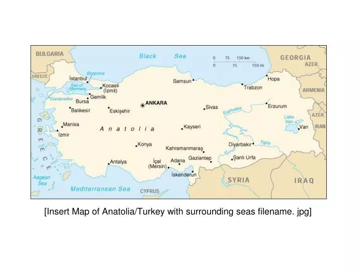
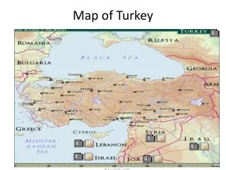
[Insert Map of Anatolia/Turkey with surrounding seas filename. jpg]. [ Insert Map of Fertile Crescent filename. jpg]. The Birthplace of Agriculture. Figure 1.26. Desertification in Fertile Crescent. Ataturk Dam Euphrates River. Harran Plains.

E N D
[Insert Map of Anatolia/Turkey with surrounding seas filename. jpg]
The Birthplaceof Agriculture Figure 1.26
Desertification in Fertile Crescent
Ataturk Dam Euphrates River
[Turkey or Anatolia in 3D / Topography map/ map location – 3D visualization rotating location, zoom in pre set video, noninteractive] NASA/GSFC: OrbView-2SeaWiFS 1 km DEM
Erosion is a process that removes soil layers and carries them away from farmer's fields to bodies of water or other land. There are three primary kinds of erosion: wind, water, and tillage. In areas where the land is especially flat or dry, wind erosion is a problem. As wind blows it spreads soil particles across the land. Water erosion may occur gradually during rainfall or when winter snow melts in fields. It can also happen suddenly during floods. Tillage erosion is mostly caused by the way a farmer tills the land. The kind of equipment a farmer uses, how often the farmer tills the fields, and how the farmer manages the fields during the winter months affect how much soil may be lost. Heavy machinery, frequent tilling, and lack of soil cover during winter months contributes to soil erosion.
Meric River Flood European Turkey
Satellites http://www.caradvice.com.au/9234/satellite-speed-limiter-system-starts-trials/
Black Sea Marmara Aegean Mediterranean http://www.die.gov.tr/ENGLISH/remote.html
BLACK SEA REGION ABANT&YEDIGOLLER
EASTERN BLACK SEA REGION The 6th largest producer of the World
OLUDENIZ Southern Mediterranean- Death Sea


![Consultation with [insert name]](https://cdn1.slideserve.com/3409084/consultation-with-insert-name-dt.jpg)