Download
1 / 5
50 likes | 57 Views
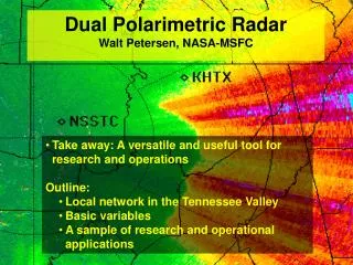
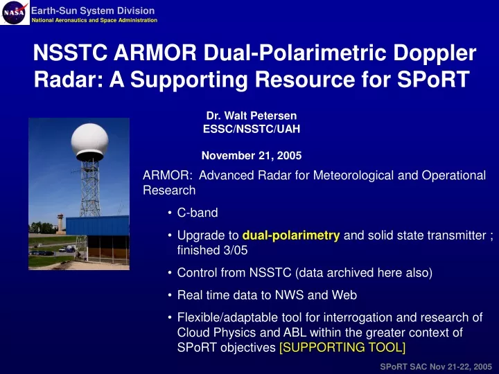
NSSTC ARMOR Dual-Polarimetric Doppler Radar: A Supporting Resource for SPoRT Dr. Walt Petersen ESSC/NSSTC/UAH November 21, 2005. ARMOR: Advanced Radar for Meteorological and Operational Research C-band Upgrade to dual-polarimetry and solid state transmitter ; finished 3/05

E N D
NSSTC ARMOR Dual-Polarimetric Doppler Radar: A Supporting Resource for SPoRT Dr. Walt Petersen ESSC/NSSTC/UAH November 21, 2005 • ARMOR: Advanced Radar for Meteorological and Operational Research • C-band • Upgrade to dual-polarimetry and solid state transmitter ; finished 3/05 • Control from NSSTC (data archived here also) • Real time data to NWS and Web • Flexible/adaptable tool for interrogation and research of Cloud Physics and ABL within the greater context of SPoRT objectives [SUPPORTING TOOL]
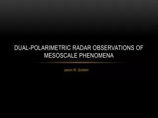
CBL CP CI ARMOR “Boiling Pot”: Convective Initiation • Tools • ARMOR (Flexible high resolution scanning) • LMA/NLDN • SATELLITE • Applications • Improved threat detection • CI detection, short-term forecast • WRF Validation/DA
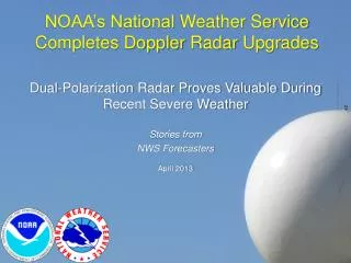
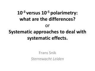
ARMOR HID X-Z Cross Section Y=-18 km 2.0 km CAPPI dBZ Height (km) ARMOR HID 6.0 km CAPPI dBZ X (km) Sources “cap” the most intense core at top of updraft column and in graupel/small hail (not large hail). Warning Decision Model Validation, DA ARMOR, NEXRAD, LMA Tools: Satellite Validation Lightning 3-D Dynamics/Microphysics Processes: Severe Storms: ARMOR February 21 2005 -40 -10 What does lightning data characterize?
Extension to Space and Model DA What is there? What can be assimilated? GLM The future + GPM VIRS IR TMI 85 GHz TRMM-PR E.g., 21 Feb. 2005 Convection from NASA TRMM Satellite e.g. Lightning flash rate DA Present/Future satellite precipitation retrievals PMW (also model-based) PMW + IR + Lightning? Virtual Radar?
STORM SCALE ARMOR-LMA Cloud Model GLOBAL TRMM Incorporation of Lightning into Models: ICE! Physical basis for improved forecasts IC flash rate controlled by graupel (ice mass) production (and vertical velocity) Flash Rate • Observational Validation: • IWP Flash Density • Global to Cloud Scale • Use in WRF? (ice is a prognostic) Ice mass REGIONAL SCALE HOUSTON


![L 23 – Vibrations and Waves [3]](https://cdn1.slideserve.com/1713456/l-23-vibrations-and-waves-3-dt.jpg)