Download
1 / 36
360 likes | 397 Views
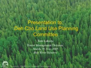
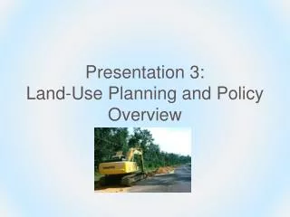
Presentation 3.2: Land-Use Planning. Outline. Introduction Land-use planning defined Elements of the planning process The role of natural resource professionals Smart Growth Land conservation tools Growth boundaries Technology Introduction to conservation development Summary.

E N D
Outline • Introduction • Land-use planning defined • Elements of the planning process • The role of natural resource professionals • Smart Growth • Land conservation tools • Growth boundaries • Technology • Introduction to conservation development • Summary
Introduction Land-use planning (also known as growth management, comprehensive planning): to guide community development; helps people create a vision of how to provide resources for the future.
Elements of the planning process • Data gathering • Goal formation • Land-use decision • Public input • Action plan • Evaluation
Urban sprawl • Characterized by unmanaged widespread • Growth • Considered unattractive • Is environmentally and economically • unsustainable
Ecological effects of sprawl • Destruction of wildlife habitat • Introduction of non-native species • Increased risks of water pollution • Increase potential for flooding • Increased risk of wildfire
Socio-economic effects • Increased community costs for roads, schools, and emergency services • Increase need for automobiles, increased noise, traffic, and pollution • Isolation of the young, poor, and elderly • Increased costs and difficulty of providing public transit
Socio-economic effects (cont.) • Loss of agricultural and forestry jobs and traditional land practices • Increased ordinances regulating logging, noise, odors • Loss of rural character or community sense of place • Reduced walkability or bikability
Smart Growth • Has different definitions in each community • Promotes economic development, social equity, and environmental stewardship to improve overall quality of life
Basic principles • All levels of government play a role in creating and implementing policies that support Smart Growth. • Development should conserve and enhance environmental and cultural resources. • Development should promote vitality for urban centers. 4) Programs and policies need to encourage vital small towns and rural areas. 5) Land and infrastructure (streets, schools, etc.) should be used efficiently.
Basic principles (cont.) 6) A variety of housing choices and mixed-use (commercial + residential) centers should be accessible by multiple transportation options. 7) Development should be considered on a regional scale. 8) A “sense of place” should be fostered. This may include unique cultural, natural, or geographical features. 9) Land-use planning should strive to promote equity and involve its stakeholders in the planning process. 10) One size doesn’t fit all. There are a variety of approaches to accomplish Smart Growth.
Land conservation tools • Greenspace/open space: • Enhances forest and habitat connectivity • Provides recreational opportunities • Preserve wetlands and floodplain areas
Greenspace Greenspace strips that create linear parks for recreation are called greenways. Greenway systems can: • Connect people, communities, countryside • Provide recreational opportunities • Increase public access to cultural and historic sites
Greenway systems can… • Increase property values • Provide refuge and migration routes for wildlife • Provide alternative transportation routes for cyclists and pedestrians • Enhance economic development and tourism • Provide close-to-home access to greenspace • Improve overall quality of life
Other land conservation tools • Conservation easements or land preservation agreements • Land acquisition programs by public agencies or private non-profit organizations
Case Study 20: Where Rural Reigns: Purchase of Development Rights Program in Kentucky
Growth boundaries Urban growth boundaries are lines designated on planning and zoning maps that predict the limit of city services. They define land that can be urbanized outside of the current city limits and identify rural land where development will be discouraged.
Growth boundary example Example – In 1973 Oregon began requiring all cities to develop urban growth boundaries. Affordable housing was required to be developed within the boundary and protective zones were created outside. Urban services were not provided to houses built outside of the boundary.
Growth boundary example (cont.) • Portland’s population increased by 50 percent over about 30 years, while its land area only increased by 2 percent.
Exercise 3.4 - Land Conservation Tools and Policies • Urban growth boundary • Eminent domain • Land acquisition program for public lands • Conservation easement (land preservation agreement) • Agriculture reserve program • Zoning • Conservation subdivision • Floodplain restrictions • Wetlands protection policy • Slope ordinance/mountain ridge protection ordinances • Viewshed preservation
Technology Technology provides many tools to reduce some of the negative effects of development. For example: • CuSoil • Permeable pavement • Geographic Information Systems (GIS) • Others?
Typical subdivision development • Residential subdivisions typically consist of low-density, single-family homes, lacking connectivity within and between neighborhoods. • New subdivisions are often developed on undeveloped land (greenfield sites).
Drawbacks • Typical suburb development involves little diversity of income and thus leads to class segregation. • The lack of mixed land uses means people have to drive long distances to work or shop.
Conservation development Conservation subdivisions • Employ Smart Growth principles • Create dense clusters of homes • Leave undeveloped greenspace for conservation and recreation
Characteristics • Homes are built on smaller lots and are situated to maximize views of the natural area • Developments are walkable and bikable and may be placed close to shopping and jobs
Exercise 3.5 Zoning Ordinances • Traditional minimum lot size of one house/five acres. Design for 10 houses. • Slightly reduced lot sizes allowing one house per two acres. Design for 25 houses. • Conservation development design with 25 houses, designed to maximize walkability, resource conservation, sense of community, and quality of life.
Exercise 3.5 Discussion Questions • Are there any potential differences between the types of people who would be likely to live in each community? • What are the advantages and disadvantages of each design? • Which combination of ordinances might make the most desirable community and why?
Summary • Land-use planning is a visioning tool that helps communities guide development. • The planning process involves 6 steps, 5 of which resource professionals can participate in. • There are many ecological, social, and economic symptoms of urban sprawl. • Smart Growth embodies a set of principles that promote quality of life, natural resource conservation, economic development, and social equity. One size does not fit all; approaches to achieve Smart Growth are different in every community.
Summary (cont.) • There are a variety of land conservation tools including designating publicly owned greenspace, creating greenway systems, conservation easements, and land acquisition programs. • Growth boundaries restrict urban services in an effort to limit sprawl. • Technology can offer solutions to negative impacts from development. • Conservation development represents a set of development practices that work to conserve natural areas, cluster development, and promote Smart Growth principles.
Credits Photos • Slides 5, 6, and 30: Brett Billings, U.S. FWS, NCTC • Slide 7, 8, 15: Larry Korhnak • Slide 9: Reed Saxon, Associated Press • Slide 29 courtesy of NCSU College of Design Literature • Slides 4 and 5: Kelly and Becker 2000 • Slides 6-9: Luther 2005 • Slides 10-12: Boles 2005 • Slide 16: VA Department of Conservation and Recreation 2005 • Slide 21 and 22: Alavalapati 2005