Download
1 / 35
350 likes | 364 Views
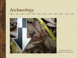
Archaeology 4:. Where Do You Find It? Surveys and Excavations in Practice. Question with video: Describe the 4 different stages of the eruption of Vesuvius in 79 CE and its consequences for the town of Pompeii. http://www.dailymotion.com/video/x421mv2. Formulation of strategy.

E N D
Archaeology 4: Where Do You Find It? Surveys and Excavations in Practice
Question with video: Describe the 4 different stages of the eruption of Vesuvius in 79 CE and its consequences for the town of Pompeii. http://www.dailymotion.com/video/x421mv2
Formulation of strategy Collecting and Recording of Evidence PROJECT DESIGN Processing and Analysis Publication
How Does An Archaeologist Discover a Site? Ground Reconaissance: Historical sources: place names: e.g. English ‘chester’ is from Roman castra; Biblical Archaeology; Schliemann and Homer Salvage/rescue archaeology: time aspect very important; case of Aswan (Egypt) Reconnaissance Survey: looking for sites in the landscape; case of Halos (Greece) 2. Aerial Reconnaissance: Aerial Photography: oblique (better for overview and perspective) and vertical photos (better for making maps and plans, although these usually need to be corrected) High Altitude Remote Sensing = the imaging of phenomena from a large distance, usually from space (satellite pictures)
Modern Archaeological Survey • Not only recording of prominent features in landscape but also less prominent signs (or even when there are hardly any remains left: off-site/non-site) • Not only human remains but also natural remains (minerals etc.) • Not only looking for sites but within their environment/landscape • Looking for settlement patterns in the landscape: distribution of sites across the landscape within a region (‘landscape archaeology’) • Surveys not pre-stage of excavation any more but have developed into separate archaeological projects: combination with excavations or separate projects (for example, to study population growth in region etc.)
Advantages of surveys over excavations: • Cheap • Quick • relatively non-destructive • less tools/physical labour required • Gives a broad overview over a long period of time in large areas (regions) Excavations tell us a lot about a little of a site, and can only be done once, whereas survey tells us a little about a lot of sites, and can be repeated. Ideally: combination of survey and excavation!
Different Types of Survey • Unsystematic/systematic survey • Intensive/extensive survey: in the latter case, data from different areas/regions are combined to study large-scale developments
If We Have Discovered A Site, What Do We Do? a. Recording/mapping; three options: 1. Record it 2. Map it: topographic (contour lines)/planimetric maps (features) 3. Use a Geographical Information System (GIS): a map-based interface to a database, that is, for the collection, storage, retrieval, analysis and display of spatial data b. Assess the Lay-out of Sites and Features: Site surface survey probing Ground-based remote sensing: geophysical sensing techniques
Now the Digging Can Start! Case studies: • Groningen University surveys at Halos, Greece • Wroxeter Hinterland Project: different reconnaisance techniques • First look on site: excavations at White Horse Hill/Uffington Castle, England
TheWROXETER HINTERLANDProject http://www.arch-ant.bham.ac.uk/bufau/research/wh/Base.html ‘Under the aegis of the Wroxeter Project, an international team of archaeologists is carrying out the total exploration of the city by non-destructive remote sensing methods, including magnetometry, resistivity, electrical imaging, seismic scanning, ground probing radar, airborne hyper- and multi-spectral scanning, and satellite imaging.’
Use of GIS at WHP: • For viewing data fromdifferent sources (satellite images etc.) as one set of maps (layers) • To analyse and interpret data on the basis of non-destructive techniques • To makemodels for the landscape • For spatial analysis
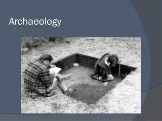
Excavations Digging can be done horizontally (contemporaneous human activities) and vertically (sequence of time) Stratigraphy, from strata: the study of the layers of human or natural debris in the soil Based on the Law of Superposition: When one layer overlies another, the lower one was deposited first Together the layers the soil consists of is called its stratification Stratigraphy, therefore, is the study and validation of stratification or the analysis in the vertical, time dimension of a series of layers in the horizontal, space dimension.
Excavation Techniques: Horizontal and vertical: Wheeler box-grid: horizontal grids (squares) but related with other grids through baulks (vertical) Open-area excavation: opening up of whole area; vertical dimension only with complicated stratigraphy and by keeping measurements Step trenching: large differences in height
Harris Matrix: Continuous Unique Numbering System