Download
1 / 44
440 likes | 540 Views
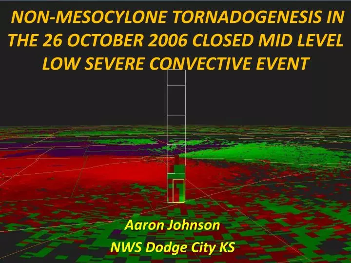
NON-MESOCYLONE TORNADOGENESIS IN THE 26 OCTOBER 2006 CLOSED MID LEVEL LOW SEVERE CONVECTIVE EVENT. Aaron Johnson NWS Dodge City KS. What do we know about mid level closed low tornado events through historical literature review? What does it reveal in terms of…

E N D
NON-MESOCYLONE TORNADOGENESIS IN THE 26 OCTOBER 2006 CLOSED MID LEVEL LOW SEVERE CONVECTIVE EVENT Aaron Johnson NWS Dodge City KS
What do we know about mid level closed low tornado events through historical literature review? What does it reveal in terms of… • Differences/similarities of mid level closed low events compared to a more traditional supercell tornado environment? • Synoptic to meso-beta scale pattern similarities from one event to the next?
Do mini supercells explain tornadogenesis in closed mid level low events? • Davies (1990;1993a) • Theory/conceptual model emanates from extensive Tropical Cyclone research and what appeared to be a plausible connection with a strong “cold core” cyclone. • Steep low level lapse rates but potential instability very low. • Assumption is made that despite low potential instability…moderate to strong wind shear results in enough horizontal vorticity that is subsequently tilted into the vertical, that this can lead to shallow mesocylone/mini supercell • development. Tornado potential in • mid level closed low events is completely • explained in many readers minds. • Brief mention of non-supercell potential due to • stretching of pre-existing vertical vorticity but this • is largely ignored by subsequent research • emanating from these articles.
Literature Review • Miller (1972) – Type D Synoptic pattern
Literature Review • Goetsch (1988) • Found similar synoptic patterns with a closed mid level low and a nearly vertically stacked system resulting in destabilization through mid level cold pool and any diurnal heating. • Low level moisture axis is usually found protruding toward the surface low center from the southeast. • Defined “threat area” in a zone of strong low level convergence along a trough of secondary cold front.
Literature Review • Johns and Doswell (1992) • Briefly mention Miller (1972) Type D patterns for tornadoes. • However…they do state that these events come from relatively low-topped convection that is usually non-supercellular in nature. • Mcdonald (2000) • Similar synoptic pattern as previous literature. • Suggests NMT processes similar to a Landspout but • provides no empirical evidence.
Literature Review • Davies/guyer (2004) and Davies (2006) Composite diagrams showing common features associated with tornado producing CC500L systems.
Closed Low Tornado event Literature • Research/Literature lacking in comparison to other severe convective areas of interest. • Historically…research done by one or two individuals/research groups, with a decade or more between meaningful research at times. • Composite model on the synoptic scale very similar among research and utilized heavily in forecasting. • Little if any empirical evidence to support “cookie cutter “ tornadogenesis model via mini supercell events stemming from tight spin/vorticity from the nearby mid-level low or surface low. • Some theorize NMT processes but little, if any empirical evidence has been provided in literature up to this point.
detailed analysis of level ii data FOR THE OCTOBER 26, 2006 mid level closed low event across SOUTHWEST KANSAS appears to provide some empirical evidence of NMT processes by revealing… • multiple misoscalevorticies near/along boundaries that propagate into regions that spawned tornadoes. • Vorticies moved independent of convective cells and could be traced backwards 30-50 minutes. NOTE: THE APPLICATION OF SUBSQUENT MATERIAL IS MOSTLY LIMITED TO RADAR INTEROGATION DUE TO FEW OTHER REAL-TIME ANALYSIS TOOLS THAT ARE CAPABLE OF RESOLVING FEATURES ON THIS SCALE .
review of october 26 2006 “AMOUNT AND DEGREE OF SEVERE THREAT IS IN SOME DOUBT. HOWEVER MODEL SOUNDINGS CERTAINLY SUPPORT SUPERCELLS BY THIS EVENING AS LOW LEVEL WINDS RESPOND TO THE DEVELOPMENT OF THE SURFACE LOW OVER ERN OK.”
Matches conceptual model Davies/Guyer 2004
Parameter values ON october 26, 2007 (MODIFIED 00z DDC SOUNDING) ALSO SIMILAR BUT different than previous literature : Davies/guyer 2004 • sb/ML cape = ~500-700 j/kg • 0-3km ml cape = ~170 j/kg • 0-1KM SRH = 86 M2/S2 • 0-6km Bulk shear = 72 kts • Lcl/lfc = ~450-500 (m) • El height = ~7.2 km
2022 GMT A B C D
2022 GMT B C B C
2028 GMT A B C D E
2028 GMT A A
2034 GMT A A
2049 GMT B C D E
2053 GMT • Tornado reported ~2050-2055 GMT B C D E
2053 GMT • Tornado reported ~2050-2055 GMT B B
2116 GMT B C D E
Key points • synoptic/mesoscale environment very similar to Closed mid level low conceptual models derived from previous literature • Multiple vorticies seen traveling along a boundaries before tornado development • rapid stretching of preexisting vorticies appeared to be key component to tornadogenesis • mini supercell with associated tornado seen near the end of nmt tornado events • Does a possibility exist that most mid level closed low tornado events actually switch TORNADOGENESIS modes or are multi mode rather than simply mini supercell only? The evidence is trending toward “yes.” • Do other events exist with this multi mode characteristic?
2032 GMT • APRIL 4, 2009 - • SOUTH CENTRAL NEBRASKA
2032 GMT • APRIL 4, 2009 - • SOUTH CENTRAL NEBRASKA
2202 GMT • Supercell • Phase after nmt phase?
recommendations • remain situationallyaware of synoptic/mesoscale environment compared to conceptual models • monitor low level lapse rate trends in relation to boundary position for possible enhancement of low level stretching • adjust velocity color curve for enhancement near zero isodop because…