Download
1 / 19
190 likes | 325 Views
Polar Overview. Vice Admiral Conrad C. Lautenbacher, Jr., U.S. Navy (Ret.) Under Secretary of Commerce for Oceans & Atmosphere/NOAA Polar Max 2004 October 21, 2004. Presentation Outline. Integrated Earth Observation System Global Framework U.S. Draft Strategic Plan Benefits Focus

E N D
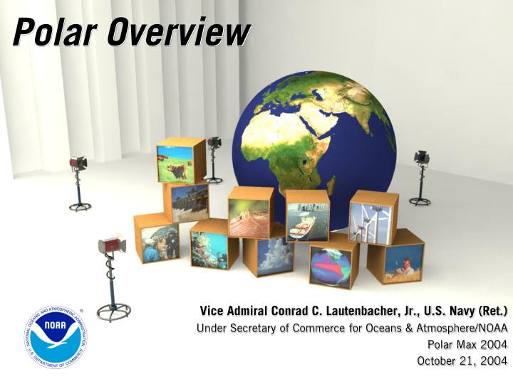
Polar Overview Vice Admiral Conrad C. Lautenbacher, Jr., U.S. Navy (Ret.) Under Secretary of Commerce for Oceans & Atmosphere/NOAA Polar Max 2004 October 21, 2004
Presentation Outline • Integrated Earth Observation System • Global Framework • U.S. Draft Strategic Plan • Benefits Focus • Research to Operations • NOAA – NASA Partnerships • NOAA’s Polar Satellites • Past - TIROS • Present – Today Operations • Future – N’, NPP, NPOES, METOP
The Global Framework • A distributed system of systems • Improves coordination of strategies and observation systems • Links all platforms: in situ, aircraft, and satellite networks • Identifies gaps in our global capacity • Facilitates exchange of data and information • Improves decision-makers’ abilities to address pressing policy issues
U.S. Contribution to GEOSS • VISION: • Enable a healthy public, economy, and planet through an integrated, comprehensive, and sustained Earth observation system. • National Plan • Public comment period until November 8, 2004 • Electronic comments only • Available at http://iwgeo.ssc.nasa.gov/ • Send to iwgeo.comments@noaa.gov • Early 2005 Workshop • Establish Formal USG Mechanism • Capable of committing necessary resources and implementing functions
U.S. Plan Benefits Focus Ecosystems Water Resources Natural & Human Induced Disasters Energy Resources Sustainable Agriculture & Desertification Human Health & Well-Being Oceans Weather Information, Forecasting & Warning Climate Variability & Change
Research to Operations • International Level • Critical to success and longevity of GEOSS • National Level • Focus of National Academy of Sciences study: NASA – NOAA Transition from Research to Operations • NOAA External Research Review Team Recommendations: Report - August 6, 2004 • Develop a Vision for Research in support of Strategic Plan, extending 20 years • Develop a NOAA wide Research Plan, and address transition of research to operations • Establish position of Associate Administrator for Research • Ongoing Focus of NASA & NOAA • More formal mechanism needed • NOAA Uses: MODIS on Terra and Aqua; TRMM; LANDSAT; SeaWinds on QuikSCAT
Research to OperationsOngoing Work • Joint Center for Satellite Data Assimilation • To reduce time for implementation of satellite technology into operations • To increase use of satellite data into numerical weather prediction models • Cooperative Institute for Meteorological Satellite Studies (CIMSS) at University of Wisconsin • To develop and implement techniques and products using GOES. • To transfer new technology into operational practice. • Cooperative Institute for Research in the Atmosphere (CIRA) at Colorado State University • To transition research results into practical applications in the weather and climate areas
NPOESS Program Status • Program is within cost, schedule, and performance specifications • CrIS – Crosstrack Infrared Sounder • Successfully completed first phase of environmental qualification • Sensor meets or exceeds every specification • VIIRS – Visible/Infrared Imagery Radiometer Suite • Technical problems with optical module resolved • VIIRS is the critical path for NPP schedule • OMPS – Ozone Mapping and Profiler Suite • Some detector problems – fixed – and on schedule • Data processing system (IDPS) – about 6 weeks behind schedule • Will meet delivery date for NPP • C3 – on schedule
NPOESS AverageData Latency Latency (minutes)
Example of NPOESS Use NPOESS Multispectral Imagery From VIRRS… …combined with ATMS/CMIS Microwave EDRs… …and Altimeter-Derived Ocean Heat Content… … Supports Improved Tropical Cyclone Forecast Accuracy&Reduced Impact on Maritime Forces
N-Prime Update • Contract modification formalized September 29, 2004 • Rebuild of NOAA N-Prime satellite • Preserves December 2007 launch date • Ensures continued access to NOAA satellite data that feeds our prediction and warning capability for weather, oceans, and climate. • Partnership with NOAA, NASA, DOD remains strong
Continuity of Operational Satellite ProgramsNOAA Satellite Launches* Scheduled to Maintain Continuity 1996 1997 1998 1999 2000 2001 2002 2003 2004 2005 2006 2007 2008 2009 2010 2011 2012 GOES 8 – nine years of service! GOES 9 operated by FCDAS GOES 10 (West) GOES 11 (stored in orbit) GOES 12 (East) GOES N – Series GOES R-Series NOAA 12 (am) NOAA 14 (pm) NOAA 15 (am) NOAA 16 (pm) NOAA 17 (mid am) NOAA N (pm) NOAA N’ (pm) METOP-1, 2, 3 (mid am) ** European Coordination NPP NPOESS Satellite is operational beyond design life * Actual launch dates are determined by the failure of on-orbit assets Satellite is pre-operational (stored in orbit) ** Assumes METOP will provide the morning orbit and NOAA-N’ will provide afternoon orbit instruments Satellite is providing backup support to GMS-5