Download
1 / 32
330 likes | 465 Views
GIS General Consulting Services. April 12, 2011. Introductions and Agenda. Introductions Stephen Ellis – GeoDecisions David Gilbert – GeoDecisions Drew Meren – Infotech Les Byrnside – H&B Surveying and Mapping, LLC. Introductions and Agenda. Agenda Project Overview/Staffing

E N D
GIS General Consulting Services April 12, 2011
Introductions and Agenda • Introductions • Stephen Ellis – GeoDecisions • David Gilbert – GeoDecisions • Drew Meren – Infotech • Les Byrnside – H&B Surveying and Mapping, LLC
Introductions and Agenda • Agenda • Project Overview/Staffing • Corporate Overviews (Geo, Infotech, H&B) • Project Approach/Qualifications • Summary • Q&A
Project Overview • Open End • 4yrs • Task by task basis • Multiple Awardees
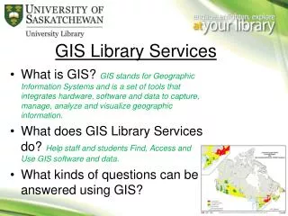
Project Overview • GIS Services • GIS Technology • Web Development & Hosting • Data Conversion, Conflation, Development • Database • Mobile Applications & Technology • Survey, GPS, Field Data Collection • Systems Integration
GeoDecisions – History • Founded in 1986 @ Penn State University • January 1992: became subsidiary of Gannett Fleming • January 1996: became a division of Gannett Fleming • Gannett Fleming: an international planning, design, and construction management firm with more than 2,100 employees in 50 offices, serving clients since 1915.
GeoDecisions - Today • Operates as an Independent Spatial IT Company • Specializes in design and implementation of enterprise, leading-edge systems • ISO 9000:2008-Certified • CMMI Level 2 Operation
About GeoDecisions • Staff of more than 150 • 14 offices nationwide • Recognized leader in spatial IT industry • Dedicated Multimedia, Graphics, and CADD groups • Focus on Four Verticals/Markets • Municipal/W/WW/Engineering Support • Commercial • Government • Military
Strategic Planning Needs Analysis and Requirements Database Design and Development Systems Design and Integration Application Design and Development Wireless Technology Integration Mobile Applications Transportation Logistics Intelligent Transportation Systems (ITS) Linear Referencing System (LRS) Design and Implementation Image Processing/Remote Sensing Web Design and Hosting Certified Training Services
GeoDecisions Leading Edge Technology • 20 Web Servers with over 5.0 Terabyte Capacity • 24/7/365 Service • Multiple T1 line Internet Connection • Wireless Solutions • VPN Solutions - Remote User and Server to Server Connection • Data Secured by Firewall, Anti-Virus and Real-Time Monitoring Software
GeoDecisions Leading Edge Technology • Web Software Solutions: • Integrated Client Information Management Systems • Web Mapping Solutions • Information Portals • Web Hosting Services • Standard and GIS sites • Esri ArcGIS Server ASP license and dedicated servers • Real-Time Weather Applications • Real-Time Tracking Services • Real-Time Traffic Services • Oracle and SQL Server Database Solutions
Awards - ESRI • 2000 ESRI New Partner of the Year • 2005 ESRI Partner of the Year • 2008 ESRI Foundation Partner of the Year • 2009 ESRI Partner of the Year
H&B Surveying and Mapping, LLC • Founded on April 27, 2009 (Alison W. Hanson, L.S.) • SWaM Certified Woman Owned Business • Federal Woman Owned Business – DBE / WBE • Land Surveying and Mapping Firm • Three Licensed Professional • Three Fully Equipped Survey Crews • In – Depth Knowledge of Hanover County Monumentation Program
H&B Surveying and Mapping, LLC • H & B Key Staff – • Leslie R. “Les” Byrnside, L.S. • Vice President & Co-Founder • 25 + years of Surveying Experience • Virginia Licensed Surveyor in 1999 • Managed Lasted Hanover County Monument Network Enhancement • Roger MacDonald • 31 + years of Surveying Experience • Expert in the GPS Community • Has Performed Many County Network Adjustments – Hanover County and HenricoCounty, Virginia
Project Approach • Treat Each Task as a Project • Use ISO/GEM Process • Xxx • Xxx • xxx
GPS, Survey, Field Data Collection • GPS Equipment – • 12 Ashtech Z – 12 Dual Frequency Receivers - Utilizes Ashtech Solutions for Office Computations • 1 – Leica RTK GPS Smart Rover • 1 – Carlson RTK GPS Smart Rover • Connected to SmartNet North America by Leica