Download
1 / 45
450 likes | 461 Views
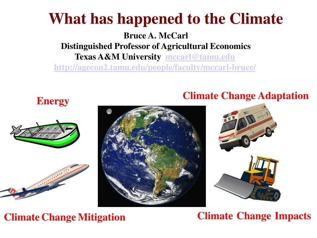
What has happened to the Climate. Bruce A. McCarl Distinguished Professor of Agricultural Economics Texas A&M University mccarl@tamu.edu http://agecon2.tamu.edu/people/faculty/mccarl-bruce/. Climate Change Adaptation. Energy. Climate Change Impacts. Climate Change Mitigation.

E N D
What has happened to the Climate Bruce A. McCarl Distinguished Professor of Agricultural Economics Texas A&M University mccarl@tamu.edu http://agecon2.tamu.edu/people/faculty/mccarl-bruce/ ClimateChangeAdaptation Energy ClimateChangeImpacts ClimateChangeMitigation
Temperature history 0.95 2016 0.91 2015 0.85 2017 0.79 2018 0.75 2014 • 2018 was the fourth warmest year in NOAA's 139-year record. • 2018 is 42nd consecutive year with temperatures above 20th century average. • Since 2100 new record highs in (2005, 2010, 2014, 2015, and 2016), with three back-to-back. • Nine of the 10 warmest years have occurred since 2005, • Last five years (2014–2018) are five warmest years on record. • 1998 is only year in 20th century among ten warmest years, tied with 2009 at ninth. • Temp increase 0.07°C (0.13°F)/decade since 1880; 0.17°C since 1981 > twice as much From NOAA State of the Climate https://www.ncdc.noaa.gov/sotc/
Temperature History - Anomalies The following table lists the global combined land and ocean annually-averaged temperature rank and anomaly above 20th century mean through 2018 for each of the 10 warmest years on record. Including 2018, 17 of the 18 years since 2001 among the 19 warmest since 1880. Only one year during 20thcentury—1998—was in top 19. 2019 may be hot as El Nino is typically last 3 months 2nd warmest ever NOAA National Climatic Data Center, State of the Climate: Global Analysis annual 2013 http://www.ncdc.noaa.gov/sotc/global/2013/13/.
Temperature History Figure TS.20. (Top) Records of Northern Hemisphere temperature variation during the last 1300 years with 12 reconstructions using multiple climate proxy records shown in colour and instrumental records shown in black. (Middle and Bottom) Locations of temperature-sensitive proxy records with data back to AD 1000 and AD 1500 (tree rings: brown triangles; boreholes: black circles; ice core/ice boreholes: blue stars; other records including low-resolution records: purple squares). Data sources are given in Table 6.1, Figure 6.10 and are discussed in Chapter 6. {Figures 6.10 and 6.11} Figure TS.20 Lots of climate records agree Source : Intergovernmental Panel on Climate Change. IPCC Fourth Assessment Report WGI http://ipcc-wg1.ucar.edu/
Temperature evolution over time Since 1888 – 0.07οC/decade Since 1950 – 0.14οC/decade Since 2000 – 0.19οC/decade Pace is increasing From NOAA State of the Climate https://www.ncdc.noaa.gov/sotc/
Temperature since 1901 Hotter almost everywhere IPCC WG1 AR5 Summary for Policy Makers
Ocean Oceans rising 82mm since 1990 Ocean getting hotter Chapter 3 AR5 , IPCC thermal expansion and ice melt
What is happening up to now – Potential Precipitation Rainfall is increasing (ocean evaporation) http://www.ncdc.noaa.gov/sotc/service/global/global-prcp-anom/201401-201412.gif
What is happening up to now -- Precipitation • R95 is rain from top 5% wettest days SDII is average daily precipitation intensity CCD is frequency of max number of consecutive dry days HY-INT reflects change in length of drought or extreme precipevents • Rainfall has become more concentrated and Texas again has such areas AR5 WGI chapter 2 figure 2.33
Impacts In recent decades, changes in climate have caused impacts on natural and human systems on all continents and across the oceans. Evidence of climate-change impacts is strongest and most comprehensive for natural systems.
Climate Change is making things non stationary Water - Can we use 100 year flood? Milly, PCD, J. Betancourt, M. Falkenmark, 2008. Climate Change: Stationarity Is Dead: WhitherWaterManagement?, Science, Vol. 319. No. 5863, pp. 573 – 574. Ag yields - Can we history to assess risk? McCarl, Bruce A., Xavier Villavicencio, and Ximing Wu. "Climate change and future analysis: is stationarity dying?." American Journal of Agricultural Economics 90.5 (2008): 1241-1247.
Climate Change is making things non stationary http://www.edwardsaquifer.net/data.html
Observed Changes in Oceans, Snow and other items
What is happening up to now -- Ocean Source : Intergovernmental Panel on Climate Change. IPCC Fifth Assessment Report WGI - SPM http://ipcc-wg1.ucar.edu/
Ocean in Texas Vicinity Fast shoreline retreat Hotter - Stronger Hurricanes NOAA presentation slide that shows warming temperatures in the Gulf during hurricane season (http://www.climatecentral.org/gallery/graphics/coastal-water-temperature-trends). And bureau of economic geology
Sealevel rise - Coastal retreat Aug 2013 Measurements of Galveston shore level retreat averaging 6 feet per year
Ocean Acidification Ocean absorbing more Co2 lowering PH – mollusks Not climate change but another externality https://ocean.si.edu/conservation/acidification/ocean-acidification-graph
What is happening up to now – Glaciers Glaciers are retreating almost everywhere around the world — including the Alps, Himalayas, Andes, Rockies, Alaska and Africa. http://maps.grida.no/go/graphic/retreat-of-seven-andean-glaciers
What is happening up to now – Glaciers Glaciers are retreating almost everywhere around the world — including the Alps, Himalayas, Andes, Rockies, Alaska and Africa. Aug 2013. Water supply source, Boulder CO, Arapaho Glacier, Colorado. http://nsidc.org/rocs/adopt-a-glacier/arapaho.html
Ice on Land – Antarctica and Greenland Antarctica Data from satellites show that Mass is being lost by the Antarctica and Greenland land ice sheets . Antarctica has been losing about 134 gigatonnes of ice per year since 2002 Greenland has been losing an about 287 gigatonnes per year. Greenland Contributes to sea level rise and altered Thermohaline Circulation (Gulf Stream) http://climate.nasa.gov/vital-signs/land-ice/
Artic Sea Ice • Satellite data have confirmed that the amount of floating Arctic sea ice is much less than it used to be. • September Arctic sea ice is declining 13.4 percent per decade, relative to the 1981- 2010 average. Graphs show average September Arctic sea ice derived from satellite observations. • The 2018 sea ice is lowest in the satellite record. 1979 minimum 2012 minimum 2015 minimum Soon a reliable Northwest Passage from Europe to Asia http://climate.nasa.gov/vital-signs/arctic-sea-ice/
Impacts - Permafrost B. Bolton and V. Romanovsky, Permafrost, Feb 2016, University of Alaska Fairbanks
Impacts - Permafrost B. Bolton and V. Romanovsky, Permafrost, Feb 2016, University of Alaska Fairbanks
We are also seeing major alterations in frequency and severity of Extremes
Index of Extremes From NOAA state of the climate • Maximum temperatures much below normal and much above normal. • Minimum temperatures much below normal and much above normal. • Land in severe drought - lowest 10th % PDSI and severe moist. surplus highest 10th % • Land with greater than normal share of precip from highest 10th % 1-day events. • Land with a much > than normal days with precip and much > of days without. • Landfallingtropical storm and hurricane wind velocities. https://www.ncdc.noaa.gov/extremes/cei/
US Incidence of Extremes We see an increase in events and variability since about 1970 when warming began with more in southwest? US From noaa climate extremes index http://www.ncdc.noaa.gov/extremes/cei/introduction • average of percentage of conterminous U.S. area: • with maximum temperatures much below or above normal • with minimum temperatures much above or below normal. • under severe drought • with severe moisture surplus • with a much greater than normal precipitation from extremes • with a much greater than normal number of days with precipitation • with much greater than normal days without precipitation. Southwest
Climate Change is making things non stationaryUSGS 05054000 RED RIVER OF THE NORTH AT FARGO, ND Where is the dark Blue? Note it is more common recently https://www.ndsu.edu/fargoflood/images/red_river_of_the_north_raster_plot_august_2014.pdf
Precipitation Intensity – The wet side Houston – flooding 4-5 times more likely A Preliminary Examination of Heavy Rainfall Changes in Harris County, John Nielson Gammon TAMU
What is happening up to now – Hurricanes Fig. 4. Atlantic tropical storm and hurricane counts (five-year averaged from 1880 to 2008). Short-duration storms refer to storms lasting two days or less, while moderate duration storms are those storms lasting more than two days at tropical storm intensity. The moderate-duration storm data have been adjusted for ‘missing storms’ using past records of observing ship track density. Adapted from Landsea et al. 2010. scientists are still “uncertain whether past changes in tropical cyclone activity (frequency, intensity, rainfall, and so on) exceed the variability expected through natural causes, after accounting for changes over time in observing capabilities” (Knutson et al., 2010). Source : http://www.hurricanescience.org/science/science/climate/longtermrecordsofhurricaneactivity/
What is happening up to now – Hurricanes Fig. 4. Intensity of hurricanes according to the Saffir-Simpson scale (categories 1 to 5). P. J. Webster et al. Science 2005;309:1844-1846 Published by AAAS
What is happening up to now – Tornadoes Regions of the World with Increased Likelihood of Experiencing Tornadoes From https://www.ncdc.noaa.gov/climate-information/extreme-events/us-tornado-climatology
What is happening up to now -- Drought The graph shows the monthly percentage of global land area, excluding ice sheets and deserts, experiencing moderate (beige), severe (tan), and extreme (brown) drought conditions since 1950. Global-scale drought conditions temporarily improved in early 2017 compared to recent years. Global drought area reached its highest level in several years starting in late 2015 and remained high throughout 2016, but rapidly declined by early 2017. https://www.climate.gov/news-features/featured-images/2017-state-climate-global-drought
What is happening up to now -- Extremes https://www.ncdc.noaa.gov/billions/
What is happening up to now -- Extremes https://www.ncdc.noaa.gov/billions/time-series
What is happening up to now -- Extremes Disasters increasing Disasters expensive From Special Report of the Intergovernmental Panel on Climate Change, Managing the Risks of Extreme Events and Disasters to Advance Climate Change Adaptation
What is happening up to now -- Extremes The IPCC Special Report on Managing the Risks of Extreme Events and Disasters to Advance Climate Change Adaptation (forthcoming soon) http://ipcc-wg2.gov/SREX/ and http://ipcc-wg2.gov/SREX/images/uploads/IPCC_SREX_slide_deck.pdf
Climate Change can be disruptive Lots of Impacts Source :2001 US National Assessment
More Observations • Altered plant growth and nutrition • Greater plant water needs • Greater city water needs • Less/more fresh surface water • Less grass • Altered cattle and animal performance • Poleward migrations in activities • Diminished water quality • Sea level rise and Coastal flooding • CO2 and plant change • Fires and carbon release • Pest and disease spread • Altered albedo • Species migration and extinction • Water dilution lessening with less flows • Change in cooling and heating • Infrastructure at coast and permafrost • Income and food security and poverty Many, many other things going on
Map of Impacts Figure SPM.2 | Widespread impacts in a changing world.
North America Table SPM.A1 | Observed impacts attributed to climate change reported in the scientific literature since the AR4. These impacts have been attributed to climate change with very low, low, medium, or high confidence, with the relative contribution of climate change to the observed change indicated (major or minor), for natural and human systems across eight major world regions over the past several decades. [Tables 18-5, 18-6, 18-7, 18-8, and 18-9] Absence from the table of additional impacts attributed to climate change does not imply that such impacts have not occurred.
Risks to Unique and Threatened Systems: New and stronger evidence of observed impacts on unique and vulnerable systems (such as polar and high mountain communities and ecosystems), with increasing levels of adverse impacts as temperatures increase
Risks Associated with the Distribution of Impacts Vulnerability differences across regions . Those in the weakest economic position are often the most vulnerable to climate change. There is increasing evidence of greater vulnerability of specific groups such as the poor and elderly not only in developing but also in developed countries. … Increased evidence that low-latitude and less developed areas generally face greater risk, for example, in dry areas and megadeltas