Download

1 / 53
560 likes | 1.38k Views
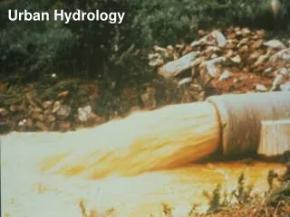
TR-55 Urban Hydrology for Small Watersheds. Simplified methods for estimating runoff for small urban/urbanizing watersheds. Ch 1 Intro Ch 2 Estimating Runoff Ch 3 Time of Concentration Ch 4 Peak Runoff Method Ch 5 Hydrograph Method Ch 6 Storage Volumes for Detention Basins. Appendices.

E N D
Simplified methods for estimating runoff for small urban/urbanizing watersheds • Ch 1 Intro • Ch 2 Estimating Runoff • Ch 3 Time of Concentration • Ch 4 Peak Runoff Method • Ch 5 Hydrograph Method • Ch 6 Storage Volumes for Detention Basins
Appendices • A-Hydrologic Soil Groups • B-Rainfall Data • C-TR-55 Program (old; outdated) • D-Worksheet Blanks • E-References
TR-55 • PDF is available at http://www.hydrocad.net/tr-55.htm • Software (WinTR-55) available at http://www.nrcs.usda.gov/wps/portal/nrcs/detail/national/ndcsmc/?cid=stelprdb1042198
Objectives • Know how to estimate peak flows by hand using the TR-55 manual • Know how to obtain soil information
TR-55 (General) • Whereas the rational method uses average rainfall intensities the TR-55 method starts with mass rainfall (inches-P) and converts to mass runoff (inches-Q) using a runoff curve number (CN) • CN based on: • Soil type • Plant cover • Amount of impervious areas • Interception • Surface Storage • Similar to the rational method--the higher the CN number the more runoff there will be
TR-55 (General) • Mass runoff is transformed into • peak flow (Ch 4) or • hydrograph (Ch 5) using unit hydrograph theory and routing procedures that depend on runoff travel time through segments of the watershed
Rainfall Time Distributions • TR-55 uses a single storm duration of 24 hours to determine runoff and peak volumes • TR-55 includes 4 synthetic regional rainfall time distributions: • Type I-Pacific maritime (wet winters; dry summers) • Type IA-Pacific maritime (wet winters; dry summers-less intense than I) • Type II-Rest of country (most intense) • Type III-Gulf of Mexico/Atlantic Coastal Areas • Rainfall Time Distribution is a mass curve • Most of upstate NY is in Region II
Appendix B • 24-hr rainfall data for 2,5,10,25,50,and 100 year frequencies
Limitations of TR-55 • Methods based on open and unconfined flow over land and in channels • Graphical peak method (Ch 4) is limited to a single, homogenous watershed area • For multiple homogenous subwatersheds use the tabular hydrograph method (Ch 5) • Storage-Routing Curves (Ch 6) should not be used if the adjustment for ponding (Ch 4) is used
Ch 2 Determine Runoff Curve Number Factors: • Hydrologic Soil Group • Cover Type and Treatment • Hydrologic Condition • Antecedent Runoff Condition (ARC) • Impervious areas connected/unconnected to closed drainage system
Hydrologic Soil Group • A-High infiltration rates • B-Moderate infiltration rates • C-Low infiltration rates • D-High runoff potential
Soil Maps GIS accessible maps are at http://websoilsurvey.nrcs.usda.gov/app/ Hints: AOI (polygon; double click to end) Soil Data Explorer Soil Properties and Qualities Soil Qualities and Features Hydrologic Soil Group View Rating Printable Version
Cover Type and Treatment Urban (Table 2-2a) Cultivated Agricultural Lands (Table 2-2b) Other Agricultural Lands (Table 2-2c) Arid/Semiarid Rangelands (Table 2-2d)
Hydrologic Condition Poor Fair Good Description in table 2-2 b/c/d
Antecedent Runoff Condition (ARC) Accounts for variation of CN from storm to storm Tables use average ARC
Impervious/Impervious Areas • Accounts for % of impervious area and how the water flows after it leaves the impervious area • Is it connected to a closed drainage system? • Is it unconnected (flows over another area)? • If unconnected • If impervious <30% then additional infiltration will occur • If impervious >30% then no additional infiltration will occur
Table 2-2a Assumptions • Pervious urban areas are equivalent to pasture in good conditions • Impervious areas have a CN of 98 • Impervious areas are connected • Impervious %’s as stated in Table • If assumptions not true then modify CN using Figure 2-3 or 2-4
Modifying CN using Figure 2-3 • If impervious areas are connected but the impervious area percentage is different than Table 2-2a then use Figure 2-3
Modifying CN using Figure 2-4 • If impervious area < 30% but not connected then use Figure 2-4
Determining Q (runoff in inches) • Find rainfall P (Appendix B) • Find Q from Figure 2-1 • Or Table 2-1
Equation • S is maximum potential retention of water (inches) • S is a function of the CN number • 0.2S is assumed initial abstraction
Limitations • CN numbers describe average conditions • Runoff equations don’t account for rainfall duration or intensity • Initial abstraction=0.2S (agricultural studies) • Highly urbanized areas—initial abstraction may be less • Significant storage depression---initial abstraction could be more • CN procedure less accurate when runoff < 0.5” • Procedure overlooks large sources of groundwater • Procedure inaccurate when weighted CN<40
Examples • Example 2-1 (undeveloped): • Impervious/Pervious doesn’t apply • Example 2-2 (developed): • Table assumptions are met • Example 2-3 (developed): • Table assumptions not met (Figure 2-3) • Example 2-4 (developed): • Table assumptions not met (Figure 2-4)
Examples • Example 2-2: • Land is subdivided into lots • Table assumptions are met
Examples • Example 2-3: • Land is subdivided into lots • Table assumptions are not met • Table assumes 25% impervious; actual is 35% impervious • The runoff should be higher since impervious is increased
Using Figure 2-3 • Pervious CN’s were 61 and 74 • Open space; good condition; same as first example • Start @ 35% • Go up to hit CN 61 & 74 curves • Go left to determine new CN=74 & 82
Examples • Example 2-4: • Land is subdivided into lots • Table assumptions are not met • Actual is 25% impervious but 50% is not directly connected and flows over pervious area • Use Figure 2-4 • The runoff should be lower since not all the impervious surface is connected (water flows over pervious areas and allows more water to infiltrate)
Using Figure 2-4 • Pervious CN is 74 • Open space; good condition; same as first example • 50% unconnected • Start @ the bottom (right graph) @ 25% • Go up to 50% curve • Go left to pervious CN of 74 • Go down to read composite CN of 78
Undeveloped Developed (25% impervious connected Developed (35% impervious connected) Developed (25% impervious but only 50% connected) Roff=2.81” Roff=3.28” Roff=3.48” Roff=3.19” Example Comparison
Time of Concentration & Travel TimeChapter 3 • Sheet flow • Shallow Concentrated Flow • Channel Flow • Use Worksheet 3
Chapter 4: Graphical Peak DischargeWorksheet 4 • Inputs: • Drainage Area • CN (from worksheet 2) • Time of concentration (from worksheet 3) • Appropriate Rainfall Distribution (I/IA/II/III) App B • Rainfall, P (worksheet 2) • Runoff Q (in inches) from worksheet 2 • Pond & Swamp Adjustment Factor (Table 4-2)
Ch 4 Calculations • Find initial abstraction • Function of CN # • Find in Table 4-I • Calculate Ia/P
Ch 4 Calculations • Determine peak discharge (cubic feet per square mile per inch of runoff) from Exhibit 4-I, 4-IA, 4-II or 4-III by using the Ia/P ratio and the time of concentration