Download
1 / 15
150 likes | 237 Views
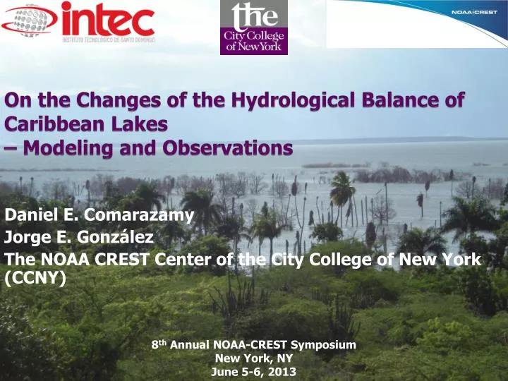
On the Changes of the Hydrological Balance of Caribbean Lakes – Modeling and Observations . Daniel E. Comarazamy Jorge E. González The NOAA CREST Center of the City College of New York (CCNY ). 8 th Annual NOAA-CREST Symposium New York, NY June 5-6, 2013. Acknowledgements.

E N D
On the Changes of the Hydrological Balance of Caribbean Lakes – Modeling and Observations Daniel E. Comarazamy Jorge E. González The NOAA CREST Center of the City College of New York (CCNY) 8th Annual NOAA-CREST Symposium New York, NY June 5-6, 2013
Acknowledgements • Yolanda León, Cándido Quintana (INTEC) • Domingo Brito, Julio Román, Aury Nova (MINMARENA) • Fred Moshary, Michael Piasecki, Equisha Glenn, Adam Atia, KseniaShikhmacheva, HagaiRifkind, Joseph Cleto (CCNY) • This study is supported and monitored by NOAA under CREST Grant # NA11SEC4810004, by NSF, and by the National Fund for Innovation and Scientific and Technological Development of the Dominican Republic (FONDOCYT).
Summary of Lake Surface Area Changes 1984-2012 EnriquilloSaumatre • 2004: 165 km2, smallest rec. • 2006: 276 km 2, same as in 1984 • 2011: 331 km2, 17% larger than in 1984 and 2X larger than in 2003-04. • Water level increase: ~11 m from 2003-04 to 2013 • Salinity - 2013: 14ppm • - 2003: 100 ppm • Shows a general increasing trend from 1984 to 2010 • 1984: 116 km2 • 2011: 134 km2 • 15.8%increased in past 25 years, 17% since 2003 • Salinity – Planned for 2013 • SOCIAL IMPACT • Flooding and damages of 16 communities in numerous provinces in two countries • 10,000 affected farmers • Continuous lake growth enhances natural, social, and economic stresses in the region
Why is the Surface Area of the Lakes Changing Dramatically? • Earthquakes cause aquifers to feed lakes at increased rates • LCLU changes increase surface runoff into lakes • Lake water level rise due to increased lake bed sedimentation • Regional and local hydro-climatic changes Increased precipitation Reduction in evaporation Increase in Lake surface area Increase in orographic water production • Increased moisture in the lake area due to increased SSTs surrounding the lake basin • Increasing runoffs due to increased precipitation and changes in use of surrounding land • Increasing fresh water production in the area due to increased horizontal rain produced mainly by orographic cloud formation in the surrounding cloud montane forests • A combination of these factors could lead to total lake surface area increase
Local Observations: Hydrological and Climate Surface Stations Location
Why is the Surface Area of the Lakes Changing Dramatically? A Hydro-Meteorology Hypothesis Local Climate Data from COOP Station (Barahona); SST of Surrounding Water (PedernalesPeninsula) Cloud Cover Frequency 2000-2010
Instrumentation of the Neyba Sierra by CCNY/INTEC: Averaged Temperature and Humidity Profiles
Instrumentation of the Neyba Sierra by CCNY/INTEC: Total Daily Precipitation (mm) Bromeliad Branch: 330 mm of water measured by Fog Gauge Jul 25, 2012 to Jun 22, 2013
Instrumentation of the Bahoruco Sierra: Total Daily Precipitation (mm)
A Hydro-Meteorology Hypothesis Tested with Integrated Atmospheric/Hydric Modeling • The regional and local observations are complemented by a set of numerical atmospheric and hydric simulations that allows the: • Generation of key variable gridded datasets; • Incorporation of climate change effects; • Incorporation of SST change effects; • Incorporation of LCLU change effects; • Generation of datasets of variables not easily measured (e.g., atmospheric liquid water content, wind patterns); • Projection of future climate conditions and lake growth.
A Hydro-Meteorology Hypothesis Tested with Atmospheric Modeling: Preliminary Results for Differences in Key Variables Total surface precipitation and Total liquid water content between 700-1500 m April 2010 (Growth) and1995 (Shrinking Period) Modeling grids showing horizontal resolution of each. Averaged surface wind (vectors) with vertical motions (contours) and Total liquid water content along cross-section at 18.25 N Lat.
Upcoming exercises to complete the integrated atmospheric and hydric modeling
Future Tasks • Measurements to test the hypothesis and aid modeling efforts: • Contribution of horizontal and potential water production • Bathymetry for both lakes: Enriquillo completed; Azuei Planned 06/2013 • Estimate underground in/out flow • Water salinity and temperature • Study the possible influence of increased extreme events frequency • Further analyze the correlation with increasing SSTs • Study the geological dynamics of the region to better understand and quantify groundwater flow, underground aquifers, seepage from lake beds. Working on new proposal collaborating with geologist from INTEC.