Download
1 / 1
10 likes | 168 Views
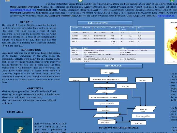
. . Satellite Imagery. Google Earth Image/ Landsat / NigeriaSat-1. Ground Truth . Srtm Data. Geo-referencing. LULC Map. Sub-set. Image processing/Supervised Classification. Supervised Classification. Reclass and Combine. Flood Maps. NASA generated flood extent. Compute areas.

E N D
. Satellite Imagery Google EarthImage/Landsat/ NigeriaSat-1 Ground Truth Srtm Data Geo-referencing LULC Map Sub-set Image processing/Supervised Classification Supervised Classification Reclass and Combine Flood Maps NASA generated flood extent Compute areas Maps, Tables GIS Overlay • The Role of Remotely Sensed Data in Rapid Flood Vulnerability Mapping and Food Security a Case Study of Cross River State, Nigeria in the 2012 Flood • Olojo Olabamiji Oluwaseun, National Space Research and Development Agency, Obasanjo Space Center, Piyakasa Bustop, Airport Road PMB 437Garki Post Office Abuja Nigeria, +2348056356477, olojolabamiji@gmail.com ,Oladeinde Adepero, National Emergency Management Agency, Plot 439, Adetokunbo Ademola Crescent, Maitama, Abuja, P.M.B 357 Garki, Abuja, .+2348174644572 , perooladeinde@gmail.com, Oyewunmi Ademuyiwa Samsudeen, , National Space Research and Development Agency, Obasanjo Space Center, Piyakasa Bustop, Airport Road PMB 437Garki Post Office Abuja Nigeria, +2348034343549, ademuyiwa.oyewumi@nasrda.gov.ng, Okorukwu Williams Okey, Office of the Surveyor General of the Federation, Garki Abuja+2348123685391, willy@nignet.net ABSTRACT The year 2012 flood in Nigeria is said be the worst flood to have ever devastated the country in the last fifty years. The flood was as a result of many underlying factors and the persistent rain fall which some have alluded to as a result of the changing global climate. As a result of the 2012 flood there has been persistent calls of a looming food crisis and imminent flood in the year 2013. DATA AND SOURCES INTRODUCTION Cross river state was one of the states hardest hit because of its coastal communities by the 2012 flood. The communities affected were mainly the ones located on the banks of the cross river which happens to be the main river passing through the state and in some areas the flood extended up to two kilometers from the river banks. The Cross River which takes its source from Mamfe in Cameroon Republic is fed by many other rivers and streams as it courses its way through Cross River Central and Cross River Southern Senatorial Districts down to the Atlantic Ocean. METHODOLOGY RESULTS • The total cultivated areas affected by the 2012 flood was about 140 sqkm and within the affected area tuber crops were mostly such as, cassava ,cocoa -yam, rice, yam . The farmlands affected were due to the fact that they were cited along the cross river, river which has a number of rivers flowing into it from neighbouring states namely Abia ,Akwa-Ibom, Benue and Ebonyi which was due to the rise in water level as a result of the rains . Also cross river being one of the southern states towards the tail end of the country had most of the flood waters from the Northern part of the country flowing downstream into it. OBJECTIVES • To investigate types of land use affected by the Flood • To carry out a rapid assessment mapping of flooded areas • To develop a flood risk assessment map • To determine areas suitable for relocation of affected settlement LIMITATION The Nigeria space assets being optical sensors has not been able to acquire a cloud free cross river state yet thus the inability to carry out a more robust research using High resolution imagery. The coastal areas are being constantly monitored so that any window of opportunity to acquire a cloud free image is utilized STUDY AREA Cross river is on 5°45′N, 8°30′E and has a landmass of 23,074 sqkm, with a population of 2.892 million has at 2006 census..It boasts the worlds second largest preserved rain forests and has a number of tourist attractions. REFERENCES International Institute of Tropical Agriculture,NASRDA,2010 Draft Final Project Technical Report, Development Of A Model For Prediction Of Cassava Yield Using Remote Sensing And Gis. The Nigeria Hydrological Services Agency, Federal Ministry of Water Resources,2013 ,Annual Flood Outlook (AFO) for Nigeria, April 2013. B. Bhatta ,Remote Sensing and GIS,Oxford University Press,2009. DISCUSSIONS AND FURTHER RESEARCH The National Space Research and Development Agency has a cassava crop yield estimation research which is on going using space based technologies and field spectrometer .Expertise is being built in the area of spectral data interpretation and building of a spectral library. It is expected that when the spectral library of various crops in Nigeria is achieved , classification of farmlands would be done using the spectral value of the crops being planted in order to ascertain to a degree of accuracy the specific crops that were affected or affected during flood or other related disasters .