Download
1 / 55
570 likes | 800 Views
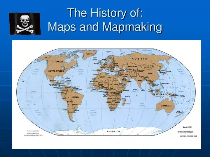
The History of: Maps and Mapmaking. Maps are an important tool for understanding and navigating the world around us. Different kinds of maps. Physical maps- show what the land itself looks like, identifying physical features Distribution maps- show where something can be found

E N D
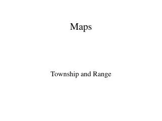
Maps are an important tool for understanding and navigating the world around us
Different kinds of maps • Physical maps- show what the land itself looks like, identifying physical features • Distribution maps- show where something can be found • Political maps-show us how an area is divided into countries, states, provinces or other units • Movement maps-show us how to get around. Such as road maps.
Topographical/Physical Map Of Finland Topographical Contour Map
Distribution Map of Rhino’s in Africa
Map terms to know • Latitude • Longitude • Prime Meridian • International Date Line • Equator • Tropic of Cancer and Tropic of Capricorn • Arctic Circle and Antarctic Circle • Hemisphere • Scale • Compass • Key/Legend
Early Mapmaking The way they used to do it.
The first maps • The first known map was created in 2300 B.C.E. by the Babylonians, living in what is now modern day Iraq, and was scratched on a clay tablet. This map shows a representation of the world. • By the 500s B.C.E., Greece was the center of scientific study and learning in the ancient world. • Most people at that time thought that the Earth was flat. The Greeks, however, described a round Earth.
Aristotle • While the idea of a spherical earth was postulated by previous Greek philosophers, including Pythagoras: • Aristotle(384–322 BCE)– proves that the earth is spherical with the following evidence. • Lunar eclipse makes a circular shadow on the moon • Ships “sink” on the horizon • Some stars can be seen from some locations of the earth but not from others
Eratosthenes 276 BCE-194 BCE * The first contributions to the science of cartography were the Ancient Greeks. * Used logic and trigonometry to solve many early questions such as, the shape of the earth. * Circumference of the earth was calculated by Eratosthenes who measured the difference in angle between the solstice sun being vertical at Syene, and 7.2 degrees off vertical at Alexandria (or 1/50 of 360°). * This distance of approx. 500 miles was extrapolated to create 50 x 500 miles, which is very close to the actual figure.
The Roman Empire and Ptolemy • Ptolemy-was the most important cartographer during the time of the Roman Empire. • Ptolemy c. ACE 130 revolutionized the depiction of the spherical earth on a map, and suggested precise methods for fixing the position of geographic features on its surface using a coordinate system with parallels of latitude and meridians of longitude. • Ptolemy's eight-volume atlas Geographia (Geography) is a prototype of modern mapping. It included • an index of place-names, with the latitude and longitude of each place to guide the search, • scale, • conventional signs with legends, and the practice of orienting maps so that north is at the top and east to the right of the map—a universal custom today. • In this work, he used information first presented by the Greeks, and was the first to come up with what are known as projections. • Although Ptolemy’s maps were incredible for the time, his maps were very inaccurate. ACE 90 – ACE 168
60° N to 30°S Ptolomy’s map
The Middle Ages400-1450 • During the Middle Ages, scientific learning became less important than religion. • The center of Christian faith was Jerusalem, so that city often occupied the center of a world map. • Maps were wonderfully colored and decorated with fanciful animals and people. • Two very useful maps were invented and produced during this time. • Road maps-showing the route to holy places. • Portolan maps-maps for navigators.
During the Medieval period, European maps were dominated by religious views. The T-O map was common. In this map format, Jerusalem was depicted at the center and east was oriented toward the map top. All maps were, of course, drawn and illuminated by hand, which made the distribution of maps extremely limited. Year circa 1450 ACE Year circa 1300 ACE Year circa 1050 ACE
Dark Ages (800-1450) • The Dark Ages in Europe followed the collapse of the Roman empire and the 'decline of western civilization', the rise of Christianity but more directly the decline of the sciences: "The lamp of scientific knowledge was obscured by the light of religious ecstasy". • Knowledge and maps, resided in the hands of religious scribes, who tended to support references in the bible rather than depicting geographic facts, and supporting the idea of a 'flat' earth
Early Navigation • As the Middle ages came to a close, Ptolemy’s maps drew a sense of curiosity to the people of Europe, and prompted new exploration. • As a result, the explorations of two navigators changed the world forever.
Christopher Columbus • Historic voyage in 1492 to chart a western trade route to Asia from Spain. • Columbus used Ptolemy’s inaccurate maps to cross what was then thought to be a small ocean. • As we know he never found Asia. • Instead he ran into what is now known as the America’s • The maps that were created from his voyages, changed the world forever.
The invention of printing made maps much more widely available beginning in the 15th century. Maps were at first printed using carved wooden blocks. Among the most important map makers of this period was Sebastian Münster in Basel (now Switzerland). His Geographia, published in 1540, became the new global standard for maps of the world. Post Columbus world view
Christopher Columbus That’s Florida
Ferdinand Magellan • In 1519, Magellan was sent by Spain to once again find a trade route to Asia. • This time they were searching for a way through the America’s. • As he found out, there is no way through the continents of North and South America. • Magellan sailed to and around the tip of modern day South America to reach Asia. • After finally reaching the modern day Philippines, he was killed by natives. • Magellan’s work will forever be remembered, because he was the first man to circumnavigate the planet.
1500’s Gerardus Mercator of Flanders (now Belgium) was the leading cartographer of the mid-16th century. He developed a cylindrical projection that is still widely used for navigation charts and global maps. He published a map of the world in 1569 based on this projection. Many other map projections were soon developed. Polar View
The Modern Atlas As a result of countless explorations, the modern Atlas was developed. An atlas is a book containing maps of the world, named after the giant in Greek Mythology who held the world on his shoulders. Geography as we know it today, centers around the use of an Atlas. Censored
Astrolabe • The Greeks invented the astrolabe in the second century B.C. • It is a flat metal ring marked off in degrees, with a rotating bar in the center. • It was used to measure the altitude of stars, planets, and the sun. • From these measurements it was possible to establish latitude. • Astrolabes were used until the 1500s, when the cross-staff came into use.
Cross Staff • Like an astrolabe, the cross staff measured altitude, by looking at the sun and establishing latitude. • Navigators preferred using a cross staff because it was much easier to use on a rolling ship. • Although it was easier to use, it became very unpopular after many navigators became blind from staring at the sun too long.
Sextant • In 1757 a new tool called a sextant was introduced. • The sextant derived its name from the fact that it could measure up to sixty degrees. • The sextant became very popular and is still used today.
Compass • A magnetic needle mounted on what is known as a compass rose • Because of the earth’s magnetic fields, the compass always points North • Aiding explorers in navigation • Considered the greatest invention in the world of exploration
The Birth of Modern Mapmaking-Surveying • The refinement of surveying techniques in France in the late 1700s greatly improved the art of mapmaking. • By measuring angles and distances between various points, surveyors can plot a picture of the part of the Earth they are studying. • They can learn its shape, size and position. • Based on the new art of surveying, an accurate map of the planet was finally developed in 1791.
Mapmaking Has Changed the World Surveying has lead to many new types of maps over time: Accurate maps of cities Accurate maps of roads Accurate maps for traveling on the ocean Even in the air…..such as…..
Sonar • A new device known as Sonar was invented during World War II. • Sonar involves the use of sound waves to detect objects. • A sound wave is sent to an object, and the time it takes to return determines distance. • In relation to sonar, we are talking about water depth. • Many consider the ocean to be the last great frontier.
The use of sonar has lead to very accurate maps of our oceans and waterways.
Satellites • The first satellite was launched into space in 1957 by the former Soviet Union. • In the fifty years since the first satellite was launched, we have gathered as much information as possible from many satellites circling the Earth. • Satellites can carry various types of data gathering equipment. • Such as: Sonar, thermometers, radar and cameras.
The Future of Mapmaking Satellite Imagery
Data gathered from satellites provides 4 distinct types of Maps Topographical Map: Shows elevation and contour
Resource Map: Location of natural resources, rivers, lakes, weather, etc
Map Projections • Robinson • Globular • Mercator • Mollweide • Hammer equal-area
Robinson Projection Pro: -size and location of main landmasses -curve of planet -easy to measure distance N/S Con: -Poles are distorted -Longitude lines do not intersect -Antarctic disproportionate (too large)
Globular Projection Pro: -proper display of poles (South) -Longitude lines intersect at Pole -Proper Antarctic size Con: -Only shows half of Globe -”squeezes” land masses and makes them look smaller (S.A.)
Mercator Projection Pro: -Easy to identify location (flat surface) -Easy to move around especially on the water (this map is used for shipping) -commonly seen in most classrooms (familiarity) Con: -Poles are distorted -Longitude lines do not intersect -cuts off landmasses (Greenland)
Mollweide Projection Pro: -most accurate for location -size of oceans are accurate -doesn’t distort size of poles Con: -hard to measure anything -visually “cut-up” -Landmasses split
Hammer Equal-area Projection Pro: -more accurate “look” -curve of planet -doesn’t distort landmasses size or location Con: -Latitude lines aren’t parallel -appearance all land is on one side of globe
Maps are a scientific languageThe language is a system of assumptions:“Also known as the five D’s” • Description • Details • Direction • Distance • Designation