Download
1 / 24
240 likes | 413 Views
Ch.1 Parts of a Map/Types of Maps!. Maps/Globes. Globe: A round model of the Earth that shows its shape, lands, and directions, as they truly relate to one another

E N D
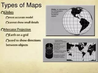
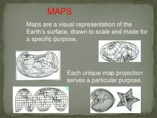
Maps/Globes • Globe: A round model of the Earth that shows its shape, lands, and directions, as they truly relate to one another • Map/Map Projection: A flat drawing of all or part of the Earth’s surface. Cartographers, or mapmakers, use mathematical formulas to transfer information from the round globe to a flat map.
Title The title tells you what information the map is showing
Key (Legend) • The key explains the symbols, colors, and lines on the map.
Scale Bar • A scale bar helps you figure distance on the map. The map scale shows the relationship between map measurements and actual distances on the Earth.
How do I use a Scale Bar? • The scale bar tells you how many kilometers or miles are represented in a given length. You can use a ruler or basic math to calculate distance based on the bar’s length.
Let’s calculate distance like we would in math class! • Problem: • Miss. D REALLY wants to visit the Adventure Science Museum in Nashville. The scale on Miss. D’s map of Nashville says 1inch = 5 miles. She took out her ruler and measured her map and saw that It was about 6inches from her house. Using the scale, how many miles is Adventure Science Museum from Miss. D’s house?
Now you try a few… Directions: Use the map & scale on page RA2 of your text book to Calculate the distance in miles between: - Sao Paulo & San Francisco - Los Angeles & Medellin - Omsk & Beijing
Answers • 8,000 miles+/- • 4,000 miles • 4,000 miles
Compass Rose • The Compass Rose is a symbol that tells you where the cardinal directions- North, South, East, and West, are positioned.
Cities -Cities are symbolized by a solid circle -This symbol is found in the key and on the map.
Capitals • Capitals are symbolized by a star • This symbol is found in the key and on the map.
Boundary Lines • Boundary Lines show the extent of an area’s territory or political influence.
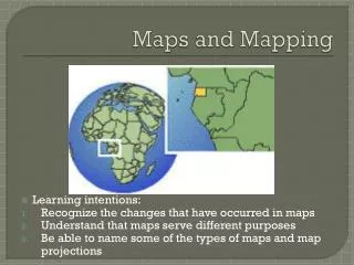
Types of Maps • What are some differences between the World Map on our Wall and the map on page 3 of your text book?
General Purpose Maps • General Purpose Maps are maps that show a wide range of information • Examples: Physical & Political
Special Purpose Maps • Maps that are made to present specific types of information in great detail. Special Purpose Maps are also called thematic maps. • Topics: Climate, Vegetation, Natural Resources, Population density, historical expansion.
Historical Maps • Show events that occurred in a region over time.
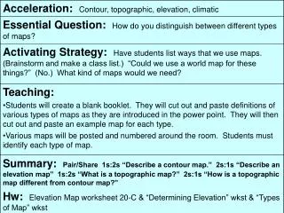
Contour Map • A contour map has contour lines- one line for each major level of elevation. All of the land elevation is connected by a line. These lines usually form circles or ovals-one inside the other. If contour lines are close together, the surface is steep. If the lines are spread apart, the land is flat or rises gradually.
Vegetation Maps • Vegetation Maps are special purpose maps that show the different types of plants that are found in a region