Download
1 / 16
160 likes | 162 Views
This overview explores the use of LIDAR and RADAR data to estimate forest biomass in tropical and boreal forest areas. It discusses the methodologies, data acquisition, and model-assisted estimation of biomass using these evolving technologies.

E N D
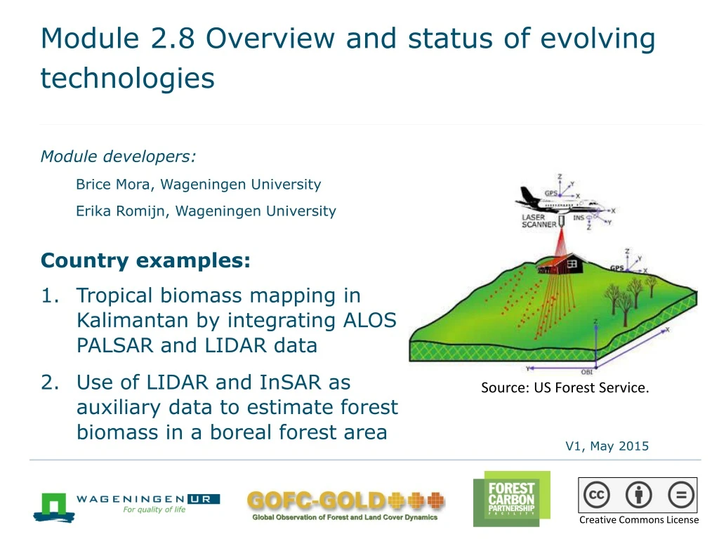
Module 2.8 Overview and status of evolving technologies Module developers: Brice Mora, Wageningen University Erika Romijn, Wageningen University Country examples: • Tropical biomass mapping in Kalimantan by integrating ALOS PALSAR and LIDAR data • Use of LIDAR and InSAR as auxiliary data to estimate forest biomass in a boreal forest area Source: US Forest Service. V1, May 2015 Creative Commons License
1. Tropical biomass mapping in Kalimantan by integrating ALOS PALSAR and LIDAR data • Study from Quinones et al. (2014) on estimating tropical forest biomass in Kalimantan using a combination of RADAR and LIDAR • Advantage of RADAR: works under cloudy conditions • Limitations of RADAR: saturation effects and speckle • Using RADAR in combination with LIDAR can help to overcome the limitations
Classification of forest structural types using RADAR data • Image processing chain: • Data import and metadata extraction, radiometric calibration, coarse geocoding, fine geocoding, and geometric and radiometric terrain correction • Preprocessing: • Strip selection, radiometric correction, ortho-rectification, slope correction, and mask preparation • Classification 17 strata • Unsupervised segmentation, postprocessing, validation, and LCCS labelling
Generation of vegetation height map through fusion of LIDAR and RADAR data LIDAR height histograms for each stratum • Extraction of vegetation height from LIDAR data for 100,000 points: histogram with distribution of heights for each vegetation structure type (stratum) • Matching of LIDAR height histograms with ALOS PALSAR HV histograms for each vegetation structure type height map for whole Kalimantan RADAR HV histograms
Tropical biomass mapping • Use of 3 different equations to calculate biomass based on the height map: - Bio1 = Height^1.68 - Bio2 = 0.06328*(Height^2.4814) - Bio3 = 9.875+0.04552*(Height^2.5734) • Map validation with biomass estimates from field data • Use of 3 different equations to calculate biomass based on field data: - Ketterings et al. (2001) BIO = 0.066*D^2.59 - Kenzo et al. (2009) BIO = 0.0829*D^2.43 - Brown (1997) BIO = 0.118*D^2.53
Tropical biomass mapping • Use of 3 different equations to calculate biomass based on the height map: - Bio1 = Height^1.68 - Bio2 = 0.06328*(Height^2.4814) - Bio3 = 9.875+0.04552*(Height^2.5734) • Map validation with biomass estimates from field data • Use of 3 different equations to calculate biomass based on field data: - Ketterings et al. (2001) BIO = 0.066*D^2.59 - Kenzo et al. (2009) BIO = 0.0829*D^2.43 - Brown (1997) BIO = 0.118*D^2.53
2. Use of LIDAR and InSAR as auxiliary data to estimate forest biomass in a boreal forest area Naesset et al. (2011),“Model-assisted Regional Forest Biomass Estimation Using LIDAR and InSAR as Auxiliary Data: A Case Study From a Boreal Forest Area” • Enhancing biomass estimation with input from forest structure parameters, which were measured with LIDAR and InSAR techniques
Use of LIDAR and InSAR as auxiliary data to estimate forest biomass in a boreal forest area Methodology • Stratification of forest land into four strata, through interpretation of aerial photographs (photogrammetry) • Collecting field data: • For sample survey plots and large field plots • For measurements of tree diameter (dbh) and tree height • Computed from field measurements: Lorey’s mean height hL, basal area (G), number of trees per hectare (N) • Acquiring LIDAR and InSAR data
Acquiring LIDAR and InSAR data • Acquiring LIDAR data for each grid cell of the study area: • Canopy height distributions, including order statistics: height deciles and maximum height value • Canopy density distributions • Acquiring SRTM InSAR (X-band) data to produce a digital surface model (DSM) and digital height error model (HEM) and two datasets of pixel-level canopy heights: • Subtracting the LIDAR terrain model from InSAR DSM • Subtracting the terrain model generated from official topographic map from the InSAR DSM
Estimation of aboveground biomass • Estimation of aboveground biomass (AGB) from field data: • Using dbh and tree height as independent variables to estimate the mean biomass per hectare for each stratum, which is called “observed biomass” • Model-assisted and model-based regression to estimate AGB, using LIDAR and InSAR as auxiliary data: • Using variables from canopy height distributions obtained with LIDAR for 4 forest strata • Using the 2 InSAR height variables for 4 forest strata • Difference between observed biomass and model-assisted estimation of biomass using LIDAR and InSAR data was calculated
Comparison of model-assisted estimation of biomass and observed biomass Observed biomass (Mg/ha) Observed biomass (Mg/ha) Observed biomass (Mg/ha) Predicted biomass (Mg/ha) Predicted biomass (Mg/ha) Predicted biomass (Mg/ha) LIDAR estimates InSARTopo estimates InSARLIDAR estimates Source: Naesset et al. 2011, fig. 2.
Conclusions: Use for tropical biomass estimation • LIDAR: • Promising for tropical biomass estimation • High accuracy and high precision of estimates • However, monitoring costs are high • InSAR: • Moderate accuracy and precision • RADAR: ability to see through clouds • Frequent updates at low costs • Useful when accurate terrain model is used—however, these are not widely available in the tropics
Recommended modules as follow-up • Modules 3.1 to 3.3 to proceed with REDD+ assessment and reporting
References • Brown, S., 1997. Estimating Biomass and Biomass Change of Tropical Forests: a Primer (FAO Forestry Paper-134), FAO, United Nations, Rome. • Di Gregorio, A., and Louisa J.M. Jansen. 2000. Land Cover Classification System (LCCS): Classification Concepts and User Manual. Rome: Food and Agricultural Organization. http://www.fao.org/docrep/003/x0596e/X0596e00.htm#P-1_0. • IPCC (Intergovernmental Panel on Climate Change). 2000. Good Practice Guidance and Uncertainty Management in National Greenhouse Gas Inventories. (Often IPCC GPG.) Geneva, Switzerland: IPCC. http://www.ipcc-nggip.iges.or.jp/public/gp/english/. • Kenzo, T., R. Furutani, D. Hattori, J. J. Kendawang, S. Tanaka, K. Sakurai, and I. Ninomiya. 2009. “Allometric Equations for Accurate Estimation of Aboveground Biomass in Logged-over Tropical Rainforests in Sarawak, Malaysia.” Journal of Forest Research 14 (6): 365–372. doi:10.1007/s10310-009-0149-1 • KetteringsQ. M., R. Coe, M. van Noordwijk. 2001. “Reducing Uncertainty in the Use of Allometric Biomass Equations for Predicting Aboveground Tree Biomass in Mixed Secondary Forests.” Forest Ecology and Management 146: 199–209.
Næsset, E., Gobakken, T., Solberg, S., Gregoire, T.G., Nelson, R., Ståhl, G., Weydahl, D., 2011. “Model-assisted Regional Forest Biomass Estimation Using LiDAR and InSAR as Auxiliary Data: A Case Study from a Boreal Forest Area.” Remote Sensing of Environment 115 (12): 3599-3614. • Quinones, M., C. Van der Laan, D. Hoekman, and V. Schut., 2014. Integration of AlosPalSAR and LIDAR IceSAT data in a multistep approach for wide area biomass mapping. Presentation Living Planet, Edinburg, September 2013.