Download
1 / 8
80 likes | 186 Views
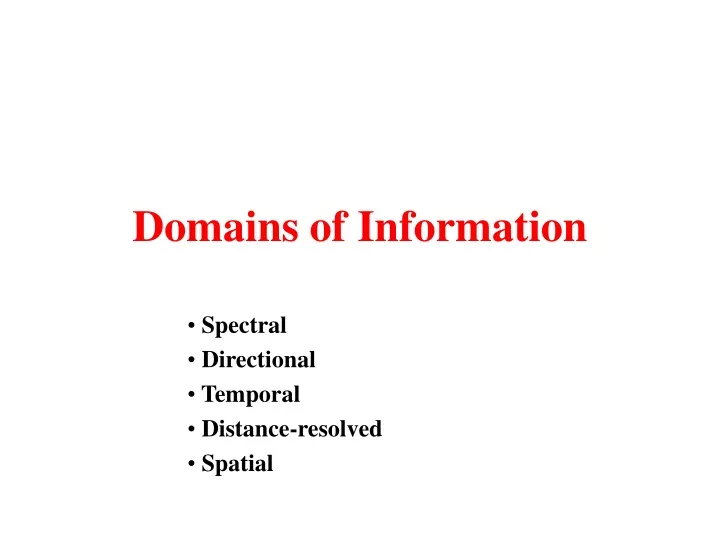
Domains of Information. Spectral Directional Temporal Distance-resolved Spatial. Spectral. cover type variation spectral properties (of leaves, soil etc.) projected towards viewer, illuminated depends on amount of material Vis - e.g. NDVI - quantify amount

E N D
Domains of Information Spectral Directional Temporal Distance-resolved Spatial
Spectral • cover type variation • spectral properties (of leaves, soil etc.) • projected towards viewer, illuminated • depends on amount of material • Vis - e.g. NDVI - quantify amount • relationships depend on cover type
Green red nir swir Directional • Discrimination / classification
Directional • Parameterisation of surface conditions • build model of physics of effect of surface properties on reflectance • invert model against RS BRDF measurements
Temporal • Basis: dynamics/change • Methods: • classification … change • phenology-based description / classifications • NDVI / thermal data - temporal trajectories • Principal Components Analysis
Distance-Resolved • LIDAR • ‘Simple’ form of measurement • easy to use (? Simply) • doesn’t work (well) on high slopes • requires highly-sensitive instrumentation • potentials for new forms of information • waveform LIDAR
Distance-Resolved • Interferometry • Used for number of years • operational (SRTM) • different ‘scales’ for different SAR frequencies • doesn’t work well (for height) if change between images • wind in forests • doesn’t work on high slopes
Spatial • ‘texture’ information • may be directional • row spacing • spatial dependancy - geostatistics • semivariogram • range • size / spacing of objects • sill • variance at range - cover • nugget • sub-pixel variation / noise