Download
1 / 45
450 likes | 459 Views
Rumsey Mill & Fred Burr Creek Site Characterization. Project Members. Granite Headwaters Watershed Group DNRC Grant Trout Unlimited Project Coordination Landowners KC Harvey Environmental Natural Resource and Technical Lead. Rumsey Mill & Fred Burr Creek Site Characterization.

E N D
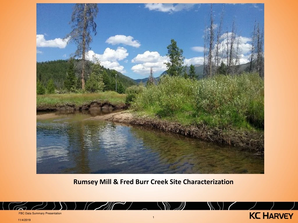
Rumsey Mill & Fred Burr Creek Site Characterization FBC Data Summary Presentation
Project Members • Granite Headwaters Watershed Group • DNRC Grant • Trout Unlimited • Project Coordination • Landowners • KC Harvey Environmental • Natural Resource and Technical Lead FBC Data Summary Presentation
Rumsey Mill & Fred Burr Creek Site Characterization Project Location FBC Data Summary Presentation
Site Background • Mill History • Milling silver circa 1890’s • Mercury and metals in tailings • Substantial Site Disturbance • Off site Re-processing (historic; 1930’s – 1950’s) • Pond and ditch construction (circa 1996/97) • Pond site reclamation (circa 2002/03) • Subdivision and Development (current) • Recent fire • Natural erosion of mill site area and streambanks FBC Data Summary Presentation
Site Background • Key Previous Investigations • Focused on Mill Site area and SW/Sediments • MDEQ • AML program (circa 1995) • SW and Sediments (circa 2015/16) • EPA (1997 – 2001) • In response to 404 violation/pond construction • SW, Sediments, Soils/Tailings • Ecological Risk Assessment • Montana FWP (2014) • BMI’s Private (2002) • Reclamation of pond construction site • University of Montana (2014) • Sediment Sampling FBC Data Summary Presentation
Existing Data Review(Pre-2018 Field Investigation) • Summary • Elevated mercury, arsenic and lead in surface water and sediments in Fred Burr Creek below mill site to Flint Creek • Elevated mercury, arsenic and lead in floodplain soils of Fred Burr Creek around mill site • Elevated mercury in BMI and fish in Flint Creek • Eco Risk Assessment - Benthic and terrestrial invertebrates and reference plants impacted • Mill site area disturbed/reclaimed in some areas of sampling; no post-reclamation confirmation sampling of soils • Unknown level of soil contamination below historic mill/tailings location on Fred Burr Creek floodplain FBC Data Summary Presentation
Rumsey Mill circa 1890’s FBC Data Summary Presentation
Historic Rumsey Mill Site (MBMG) FBC Data Summary Presentation
Parcel Map of Upper Fred Burr Creek FBC Data Summary Presentation
Historic Soil Data in Vicinity of Mill and Reclaimed Areas FBC Data Summary Presentation
Reclaimed Bare/Tailings Areas (left) and Repository (right) (From LMRC and WET, 2003) FBC Data Summary Presentation
b FBC Data Summary Presentation
2017 Data Gaps • Extent (lateral and depth) of contamination • Limited to historic mill site area • Many historic land disturbances • Sediment source to Creek • Groundwater Quality and effects on Fred Burr Creek • Roads/Construction materials • Effect of recent flood flows on stream sediment chemistry FBC Data Summary Presentation
Field Investigation • Objective: Define extent and degree of milling contamination in upper FBC • Sampling and Analysis Plan • Focused soil/tailings sampling from soil pits in the upper (mill area) FBC floodplain (no access) • Soil/Tailings sampling from soil pits along transects between mill site and moraine crest • XRF analysis permits real time decision making and saves $ • Laboratory confirmation samples • Sediment sampling at select locations (similar to previous efforts) • Limited co-located surface water samples to correlate to stream sediment results • Groundwater observations/sampling to: • Note depth to GW in soil pits • Install piezometers for seasonal measurements of GW levels FBC Data Summary Presentation
Sampling Methods • Soil • 11 Hand-dug pits • 39 Mini excavator (larger) • 147 XRF samples from various depths • Sediment • 5 samples from low-energy sections of FBC channel • Surface Water (SW) • 4 samples co-located with sediment samples • Groundwater (GW) • 6 piezometers installed in soil pits FBC Data Summary Presentation
QA/QC • Soil • Daily accuracy and precision using NIST Hg standards • Daily cross-contamination blanks • 11 Field Duplicates • 20 sample splits for lab physical & chemical analyses • Sediment • 1 Field Duplicate • All samples for lab analyses • All samples split for fine fraction (< 63um) analysis of Hg • Surface Water (SW) • 1 Field Duplicate FBC Data Summary Presentation
Fred Burr Creek bench (foreground) and floodplain looking SE FBC Data Summary Presentation
Typical excavator-dug soil pit during the July 23rd to 26th 2018 field investigation at Fred Burr Creek. FBC Data Summary Presentation
Watershed-scale site map and sampling locations for the July 2018 field investigation at Fred Burr Creek. FBC Data Summary Presentation 6/17/2019
Sampling locations and results summary for July 2018 field investigation in upper Fred Burr Creek. FBC Data Summary Presentation 6/17/2019
Representative FBC soil profile and descriptions at sampling pit SP-8 (sharpshooter spade for scale). Inset, lower left: close-up of tailings layer (2-8” BGS) found throughout FBC. 0-2” BGS: silty loam; roots/OM (mg/kg: 90 Hg / 2,593 As / 1,254 Pb) 0” 2” 2-8” BGS: Medium brown very fine (v.f.) sand to silt, no mica (tailings layer—mg/kg: 226 Hg / 8,425 As / 3,084 Pb) 8” 8-16” BGS: Dark brown micaceous v.f. sand to silt (mg/kg: ND<1.8 Hg / 85.0 As / 9.5 Pb) 16” 16-23” BGS: Interbedded fine to medium sand with black v.f. sand lenses (0-1”) (mg/kg: ND<2.7 Hg / 21.5 As / 8.3 Pb) 23” 23-32” BGS: Light gray coarse sand with black organic matter interbeds (<1”) 32” FBC Data Summary Presentation 6/17/2019
Mercury concentrations for laboratory and XRF analyses of soil samples collected in upper FBC watershed FBC Data Summary Presentation 6/17/2019
Arsenic concentrations for laboratory and XRF analyses of soil samples collected in upper FBC watershed FBC Data Summary Presentation 6/17/2019
Lead concentrations for laboratory and XRF analyses of soil samples collected in upper FBC watershed FBC Data Summary Presentation 6/17/2019
Mercury and arsenic concentrations for XRF and laboratory splits of soil samples collected in upper FBC watershed FBC Data Summary Presentation 6/17/2019
Mercury and lead concentrations for XRF and laboratory splits of soil samples collected in upper FBC watershed FBC Data Summary Presentation 6/17/2019
Sample Split Lab vs XRF Total Concentrations FBC Data Summary Presentation • 6/17/2019
Results • Soil • Presence of tailings/impacted soils are primarily limited to the riparian corridor and lower terraces of the floodplain (average width approximately 250 feet) • Impacted material ranged between approximately 0 and 25 inches BGS • Most impacts observed within the upper 12 to 15 inches • Total mercury (Hg), arsenic (As) and lead (Pb) concentrations correlate strongly • Mercury (Hg) and arsenic (As) are elevated, particularly in “tailings” layer • Mercury ranged between below detection to 450 mg/kg • Arsenic and lead ranged between below instrument detection and 17,100 mg/kg and 5,460, respectively • Antimony concentrations (only 20 lab samples) were also elevated • Antimony ranged between below detection to 530 mg/kg • Soils and sands immediately beneath tailings/impacted soils and above groundwater in most locations had relatively low to below detection limits for mercury, arsenic and lead FBC Data Summary Presentation
FBC floodplain cross-section schematic showing tailings, impacted, and non-impacted sediments and soils (not to scale). FBC Data Summary Presentation 6/17/2019
Typical sediment sample location on Fred Burr Creek FBC Data Summary Presentation
Sediment • Mercury, arsenic and lead concentrations were comparable with values observed in the recent MDEQ sediment sampling • Splits of the fine fraction (silt <63um) of samples had mercury, arsenic, lead and antimony concentrations between 2 to 3, 4 to 10, 4 to 6 and 2 to 6 times greater than bulk samples, respectively. • Recent overbank flood deposits similar to sediment Hg and metal concentrations • Implications for long-term impacts Results FBC Data Summary Presentation
Recent (2017) flood overbank deposits on Fred Burr floodplain • Hg, As and Pb concentrations similar in overbank deposits and stream sediment FBC Data Summary Presentation
Surface Water • Generally within the range observed in recent MDEQ sampling at similar locations Results FBC Data Summary Presentation 6/17/2019
Results • Groundwater • Depth to GW ranged from 24-56” BGS in floodplain • Analytical results are not conclusive, as groundwater was highly turbid at the time of sampling from piezometers FBC Data Summary Presentation • 6/17/2019
Select Agency Soil Screening and Risk Levels FBC Data Summary Presentation • 6/17/2019
Screening Levels • Sediment • Mercury • All samples exceeded EPA BTAG freshwater benchmarks (0.18 mg/kg) • Arsenic • All samples exceeded EPA BTAG freshwater benchmarks (1.8 mg/kg) • Lead • All samples exceeded EPA BTAG freshwater benchmarks (35.8 mg/kg) • Antimony • All samples exceeded EPA BTAG freshwater benchmarks (2 mg/kg) FBC Data Summary Presentation • 6/17/2019
Screening/Regulatory Levels • Surface Water • Mercury • All samples exceeded MDEQ human health standard • A single sample exceeded MDEQ chronic aquatic standard • Arsenic • All samples exceeded MDEQ human health standard • Lead • All samples exceeded MDEQ chronic aquatic standard FBC Data Summary Presentation 6/17/2019
Conceptual Site Model schematic for potential tailings impacts and exposure pathways in the FBC floodplain. ? ? FBC Data Summary Presentation 6/17/2019
Contaminant Transport/Exposure Pathways • Streambank erosion and fluvial processes • Likely substantial source of elevated Hg and metals in sediment and SW • Groundwater • Large decrease (2 orders of magnitude) in Hg and metal concentrations in underlying soil/seds Suggests limited movement via infiltration to GW • Floodplain surface runoff is likely minimal • Floodplain has a low slope • Floodplain also well-vegetated, minimizing runoff/erosion • Exposure due to ingestion or airborne soils likely minimal • Well-vegetated floodplain • Roads near mill site unknown • Mill site characteristics are the primary unknowns • How much source material remains and where is it located? • What does runoff regime look like? • What is extent/degree of impacts in FBC floodplain near mill site? • Effect of disturbance on distribution • Road material contamination FBC Data Summary Presentation
Contaminant Transport/Exposure Pathways FBC Data Summary Presentation
Soil (A) slumping into FBC channel as a result of streambank erosion and undercutting near SP-37. Also note red top and willows on top of the river bank—the vegetation assemblage observed with tailings impacts in the FBC floodplain. A FBC Data Summary Presentation 6/17/2019
Next StepsWhat We Are Doing Now • Develop volume estimate of tailings/impacted soils in floodplain using LiDAR, GIS and existing analytical data • Sample domestic wells for Hg and metals • Analyze sediments/soils for methylmercury • Begin Preliminary Risk Assessment • Refine Hg/metal source loading to FBC • Estimate bank migration rates and develop estimate of sediment input and Hg/metal loading to FBC • If warranted, install a few shallow monitoring wells to characterize floodplain GW quality FBC Data Summary Presentation