1 / 0

The Interior Plains

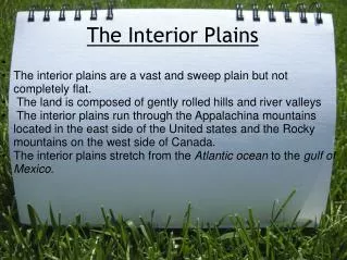
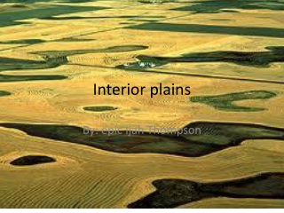
The Interior Plains. Of Canada By: Aytekin, Hazim , Vivian, Nabeel. Land Shape. Once covered by water 500 million years ago Sedimentary rocks through deposition over long period Caused many layers of Sediment to accumulate Created very thick sediment, ideal for farmland. Land Shape.

morag
Download Presentation

The Interior Plains

An Image/Link below is provided (as is) to download presentation Download Policy: Content on the Website is provided to you AS IS for your information and personal use and may not be sold / licensed / shared on other websites without getting consent from its author. Content is provided to you AS IS for your information and personal use only. Download presentation by click this link. While downloading, if for some reason you are not able to download a presentation, the publisher may have deleted the file from their server. During download, if you can't get a presentation, the file might be deleted by the publisher.

E N D

Presentation Transcript


  1. The Interior Plains

    Of Canada By: Aytekin, Hazim, Vivian, Nabeel
  2. Land Shape Once covered by water 500 million years ago Sedimentary rocks through deposition over long period Caused many layers of Sediment to accumulate Created very thick sediment, ideal for farmland
  3. Land Shape Northern areas are very rocky Plateau-like land Deposition of less fertile land occurred Mountainous and rocky terrain towards east
  4. Size Yukon, Northwest Territories, British Columbia, Alberta, Saskatchewan, Manitoba 1.8mill km2, 18% of Canada’s land
  5. Minerals and Rocks Uranium , zinc, copper, silver, gold, potash Sedimentary rock most evident type (1st) Limestone, shale, sandstone Moderate metamorphic (2nd) little igneous (3rd) 3500 different rock types
  6. Major Water Bodies Lake Agassiz Lake Winnipeg Lake Manitoba Lake Winnipegosis Great Bear Lake Great Slave Lake Saskatchewan River Churchill River Lake Agassiz Saskatchewan River
  7. Soil Soil is fertile - good for farming Soil contains minerals/nutrients Nitrogen, Phosphate, sulfur, and hummus
  8. Soil Over 500 mill. ago area covered by seas After thousands of years seas evaporated Thick layers of minerals were left Minerals are what makes the soil fertile 500,000,000 years ago
  9. Soil Extreme north ground freezes (permafrost) Chernozemic Ordered Soil in the south (dark, fertile soil) Luvisolic Ordered Soil in north (clay, permafrost)
  10. Vegetation The vegetation regions in the south are grasslands Tundra/boreal forest in the north Extreme north (Tundra) has shrubs, bushes, lichens Taller grass grows in the south
  11. Vegetation Tress (coniferous/deciduous) grow near rivers/streams in the south The northern part is mostly all boreal forest Fir, Pine, Cedar, Spurs trees in the north
  12. Climate Mainly humid climate Moderated temperatures Receives less than 50 cm of rainfall annually South receives very hot, moist climates North contains very cold climate
  13. Industries Saskatchewan 22 000 in oil industries(2nd largest) 20% crude oil from Saskatchewan Alberta 275 000 jobs in oil sands 2011 170.2 billion barrels of oil – Alberta 98% oil in Canada from Alberta
  14. Industries Mineral sale: Saskatchewan, 2001 - 2.4 billion dollars Uranium, zinc, gold, silver, copper, nickel 8 368 800 tonnes of wheat in 2012- Alberta 255 dollars per tonne – Alberta 4 125 190 of livestock & products in 2012 - Alberta
  15. Tourism Banff and Jasper National Park; Dinosaur Provincial Park, Calgary Stampede West Edmonton Mall covers 490 000 m2 90 000 – 200 000 people Over 20 000 parking spots Over 250 museums in Saskatchewan Batoche Historical site – last battle of North West Rebellion (1855)
  16. Key Cities Edmonton Calgary Saskatoon Winnipeg
  17. THE END

    Thanks For Listening
  18. Bibliography – Industries, Minerals and Rocks, Tourism (Aytekin) Agriculture Statistics Yearbook 2012. (n.d.). Agriculture Statistics Yearbook 2012. Retrieved April 27, 2014, from http://www.agric.gov.ab.ca/flippingbook/agdex/853-10_2012/html/index.html Attractions. (n.d.). - Tourism Saskatchewan. Retrieved April 26, 2014, from http://www.tourismsaskatchewan.com/things-to-do/attractions Common menu bar links. (n.d.). Parks Canada. Retrieved April 26, 2014, from http://www.pc.gc.ca/eng/docs/v-g/nation/sec2/nation33.aspx Dinosaur Provincial ParkLat: 50.760095   Long: -111.519734 | DirectionsInformation: 403-378-4342 ext. 235 . (n.d.). Dinosaur. Retrieved April 26, 2014, from http://www.albertaparks.ca/dinosaur/information-facilities.aspx Facts and Statistics. (n.d.). Alberta Energy:. Retrieved April 26, 2014, from http://www.energy.alberta.ca/OilSands/791.asp Geography of Saskatchewan. (n.d.). The Encyclopedia of Saskatchewan. Retrieved April 26, 2014, from http://esask.uregina.ca/entry/geography_of_saskatchewan.html Government of Alberta. (n.d.). Industry and economy. Retrieved April 26, 2014, from http://alberta.ca/industryandeconomy.cfm Interior Plains. (n.d.). Interior Plains. Retrieved April 27, 2014, from http://projects.cbe.ab.ca/ict/2learn/kdwajda/canada/studentwork/plains.htm The Plains. (2005, March 3). The Plains. Retrieved April 25, 2014, from http://hrsbstaff.ednet.ns.ca/phillie/InternationalExchange/Canada/Physical%20Regions/Physical_Regions/plains.htm West Edmonton Mall - Website. (n.d.). West Edmonton Mall - Website. Retrieved April 27, 2014, from http://www.wem.ca/
  19. Bibliography – Size, Water Bodies, Key Cities(Vivian) 1. Acton, D., Ryder, J., French, H., Brookes, I., & Slaymaker, O. (2014, February 27). Physiographic Regions. The Canadian Encyclopedia. Retrieved April 26, 2014, from http://www.thecanadianencyclopedia.ca/en/article/physiographic-regions/ 2. City of Saskatoon. (n.d.). Population Estimate & Projection. Retrieved April 26, 2014, from http://www.saskatoon.ca/DEPARTMENTS/COMMUNITY%20SERVICES/PLANNINGDEVELOPMENT/FUTUREGROWTH/DEMOGRAPHICANDHOUSINGDATA/Pages/PopulationEstimateProjection.aspx 3. City of Winnipeg. (n.d.). Popultion of Winnipeg. Retrieved April 26, 2014, from http://www.winnipeg.ca/cao/pdfs/population.pdf 4. Clark, B., Wallace, J. K., & Earle, K. (2006). Making connections: Canada's geography. Toronto: Pearson Education. 5. Interior Plains. (n.d.). Interior Plains. Retrieved April 24, 2014, from http://hrsbstaff.ednet.ns.ca/jmmoore/pages/SS%20interior_plains.html 6. Marsh, J. (2006, February 6). Churchill River (Manitoba). The Canadian Encyclopedia. Retrieved April 26, 2014, from http://www.thecanadianencyclopedia.ca/en/article/churchill-river-manitoba/ 7. Marsh, J. (2006, February 7). Great Bear Lake. The Canadian Encyclopedia. Retrieved April 26, 2014, from http://www.thecanadianencyclopedia.ca/en/article/great-bear-lake/ 8. Marsh, J. (2009, August 6). Great Slave Lake. The Canadian Encyclopedia. Retrieved April 26, 2014, from http://www.thecanadianencyclopedia.ca/en/article/great-slave-lake/ 9. Marsh, J. (2009, February 18). Saskatchewan River. The Canadian Encyclopedia. Retrieved April 26, 2014, from http://www.thecanadianencyclopedia.ca/en/article/saskatchewan-river/ 10. McDonald, B. (2011, May 13). Prairie flooding: Lake Agassiz fills yet again - Quirks and Quarks. CBCnews. Retrieved April 26, 2014, from http://www.cbc.ca/newsblogs/technology/quirks-quarks-blog/2011/05/prairie-flooding-lake-agassiz-fills-yet-again.html 11. Rutter, N. (2006, February 6). Lake Agassiz. The Canadian Encyclopedia. Retrieved April 26, 2014, from http://www.thecanadianencyclopedia.ca/en/article/lake-agassiz/ 12. The City of Edmonton. (n.d.). Population History. Retrieved April 26, 2014, from http://www.edmonton.ca/city_government/facts_figures/population-history.aspx 13. 2013 Civic Census Results. (n.d.). The City of Calgary. Retrieved April 26, 2014, from http://www.calgary.ca/CA/city-clerks/Pages/Election-and-information-services/Civic-Census/2013-Results.aspx "About Membership | Visit Calgary." <i>Visit Calgary</i>. N.p., n.d. Web. 27 Apr. 2014. &lt;http://www.visitcalgary.com/industry-members/members/about-membership&gt;.
  20. Bibliography – Vegetation, Soil(Nabeel) 1) Geography of Saskatchewan. (n.d.). The Encyclopedia of Saskatchewan. Retrieved April 25, 2014, from http://esask.uregina.ca/entry/geography_of_saskatchewan.html 2) Interior Plains. (n.d.). Interior Plains. Retrieved April 24, 2014, from http://hrsbstaff.ednet.ns.ca/jmmoore/pages/SS%20interior_plains.html 3) Spectrum Commodities. (n.d.). Wheat. Retrieved April 24, 2014, from http://www.spectrumcommodities.com/education/commodity/statistics/wheat.html 4) Canadian landforms. (n.d.). The Canadian Atlas Online. Retrieved April 26, 2014, from http://www.canadiangeographic.ca/atlas/themes.aspx?id=canadianlandforms&sub=canadianlandforms_land_plains&lang=En 5) Soil Formation in the Canadian Prairie Region. (n.d.). Agricultural Soils of the Prairies. Retrieved April 26, 2014, from http://www.prairiesoilsandcrops.ca/articles/volume-3-8-print.pdf 6) Clark, B., Wallace, J. K., & Earle, K. (2006). Making connections: Canada's geography. Toronto: Pearson Education. 7) What is Prairie?. (n.d.). Alberta Prairie Conservation Forum. Retrieved April 26, 2014, from http://www.albertapcf.org/about-prairies/what-is-prairie 8)Orders: Chernozemic. (n.d.). Soils of Canada. Retrieved April 26, 2014, from http://www.soilsofcanada.ca/orders/chernozemic
  21. Bibliography -Land Shape, ClimateHazim "Web Publishing: Halton District School Board." Web Publishing: Halton District School Board. N.p., n.d. Web. 27 Apr. 2014. <http://www.chatt.hdsb.ca/~1salmoncon/?OpenItemURL=S0F09C44F>. "Interior Plains region: Halton District School Board." Interior Plains region: Halton District School Board. N.p., n.d. Web. 27 Apr. 2014. <http://www.chatt.hdsb.ca/~1khanmah/FOV1-00117665/>.  "Explore by themes." The Canadian Atlas Online. N.p., n.d. Web. 28 Apr. 2014. < http://www.canadiangeographic.ca/atlas/themes.aspx?id=canadianlandforms&sub=canadianlandform "Interior Plains." Interior Plains. N.p., n.d. Web. 27 Apr. 2014. <http://projects.cbe.ab.ca/ict/2learn/kdwa "Encyclopedia of the Nations." Climate. N.p., n.d. Web. 27 Apr. 2014. <http://www.nationsencyclopedia.com/Americas/Canada-CLIMATE.html>. "Explore by themes." The Canadian Atlas Online. N.p., n.d. Web. 28 Apr. 2014. <http://www.canadiangeographic.ca/atlas/themes.aspx?id=canadianlandforms&sub=canadianlandform
More Related