Download
1 / 11
230 likes | 634 Views
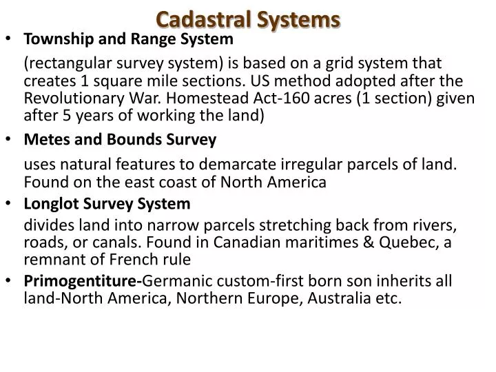
Cadastral Systems. Township and Range System (rectangular survey system) is based on a grid system that creates 1 square mile sections. US method adopted after the Revolutionary War. Homestead Act-160 acres (1 section) given after 5 years of working the land) Metes and Bounds Survey

E N D
Cadastral Systems • Township and Range System (rectangular survey system) is based on a grid system that creates 1 square mile sections. US method adopted after the Revolutionary War. Homestead Act-160 acres (1 section) given after 5 years of working the land) • Metes and Bounds Survey uses natural features to demarcate irregular parcels of land. Found on the east coast of North America • Longlot Survey System divides land into narrow parcels stretching back from rivers, roads, or canals. Found in Canadian maritimes & Quebec, a remnant of French rule • Primogentiture-Germanic custom-first born son inherits all land-North America, Northern Europe, Australia etc.
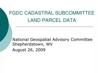
Township and Range – The cultural landscape of Garden City, Iowa reflects the Township and Range system. Townships are 6x6 miles and section lines are every 1 mile.
Longlot Survey System – The cultural landscape of Burgundy, France reflects the Longlot Survey system, as land is divided into long, narrow parcels. People live in nucleated villages and land ownership is highly fragmented.
Agricultural Villages • Nucleated settlement-intense cultivation with homes clustered in a village-most of the world’s farms are nucleated. • Dispersed settlement-individual farm house widely spaced-North America • Linear Village-follows a stream or road • Cluster Village-(nucleated) intersection of roads • Round Village-to corral livestock (rundling-Slavic farmers) • Walled Village-e.g. Medieval Europe • Grid Village-Spanish colonial villages & modern day planned-towns
Nordlingen, Germany built in the Middle Ages circa, 14th Century
Top-a Namibian village or kraal to protect livestock Right-Masaai use the blood of their livestock for food.
Functional Differentiation within Villages • Cultural landscape of a village reflects: • Social stratification (How is material well being reflected in the spaces of a village?) • Differentiation of buildings (What are they used for? How large are they?)
Farm in Minnesota each building serves a different purpose