Download
1 / 14
140 likes | 207 Views
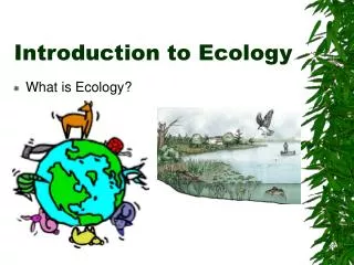
Introduction to Ecology. Chapter 52. Climate. …is the average long-term weather of an area; varies with differing amounts of solar energy received by different places on Earth.

E N D
Introduction to Ecology Chapter 52
Climate • …is the average long-term weather of an area; varies with differing amounts of solar energy received by different places on Earth. • Solar energy input determines temperature, precipitation, and air and ocean circulation patterns which leads to different climates and vegetation patterns.
Uneven Heating • Regions near equator are hot due to more direct sun rays, concentrating energy in a smaller area. • Regions near poles are cold due to the acute angle of rays. • Regions in between have intermediate temps.
Seasonal Changes • The 23.5 degree axis tilt causes regions to receive more direct rays during certain times of the year. • Our winter = northern hemisphere tilted away from sun. • Our summer = northern hemisphere tilted toward sun.
Hadley Cells • …vertical convection cells that distribute heat and moisture over earth’s surface. • Warm moist air rises, dropping precip. • Air moves N or S, then falls as cool dry air.
Global air circulation • Most precip tends to fall at equator (rainforests), tapering off towards 30 degrees latitude. • Dry air descends at 30 degrees (deserts). • Precip falls again at 60 degrees (decid. and conif. forests). • Dry air descends at poles.
Coriolis Effect and Winds • Due to the rotation of the earth, air masses don’t just move N and S. • Air masses (winds) in northern hemisphere are deflected to the right. • Winds in southern hemisphere deflected to the left.
Microclimates • …local climates that differ from the general climate of a region due to local topography. • …formed by: • Rain shadow effect: more arid conditions on leeward sides of mountain ranges. • Cities: buildings block wind, absorb and emit heat. • Land breezes/Sea breezes: day to night differences in coastal areas. • Altitude: climate colder as elevation increases.
Aquatic Biomes • Saltwater (marine): • Oceans • Estuaries – semi-enclosed area; saltwater mixes with freshwater. • Coastal wetlands – land areas covered with water at least part-time. • Freshwater: • Standing (lentic) – lakes, ponds, inland wetlands. • Flowing (lotic) – stream and river systems.
Coral reefs: High diversity and productivity. Grow slowly, disrupted easily, need certain temp and nutrients. Problems: warming trends, destruction. Inland wetlands: Marshes, swamps, prairie potholes, floodplains. Vital breeding grounds. Water purification. Flood control. Areas of Concern
Terrestrial Biomes • Have characteristic climate and plant life. • Here is an incomplete list of biomes: • Temperate Forest Coniferous ForestTaiga TundraTemperate Grassland SavannasChaparral/Mediterranean Scrub DesertTropical Rain Forest