Download
1 / 59
590 likes | 744 Views
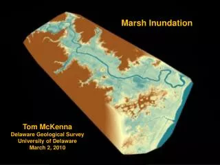
Restoration of flow and inundation regimes. Tom Dunne Spring 2010. Flow and inundation in rivers, floodplains, lakes, estuaries. The most fundamental characteristics of aquatic regime Also affect water-table elevations and degree of saturation in riparian zones

E N D
Restoration of flow and inundation regimes Tom Dunne Spring 2010
Flow and inundation in rivers, floodplains, lakes, estuaries • The most fundamental characteristics of aquatic regime • Also affect water-table elevations and degree of saturation in riparian zones • Affect conditions for regeneration, feeding, growth, and refuge for plants and animals in the water and in the riparian zone • Mold the habitat through erosion and sedimentation, especially in river channels and floodplains
Effects of flow regime in ecology Karr (1991)
Examples of the role of flow magnitude and frequency in defining habitatA: Water tables sustain riparian vegetation and delineate in-channel baseflow habitat A Poff et al. (1997)
Examples of the role of flow magnitude and frequency in defining habitatB: Small, frequent floods transport fine, organic sediments (food) and maintain spawning substrates for fishes B B Poff et al. (1997)
Examples of the role of flow magnitude and frequency in defining habitatC: Intermediate-sized floods transport and clean bed material, scale the size and shape of most channels, and inundate lower parts of floodplains C C Poff et al. (1997)
Examples of the role of flow magnitude and frequency in defining habitatD: Intermediate-sized floods inundate floodplains, depositing fine sediment and seeds for pioneer plants D D Poff et al. (1997)
Examples of the role of flow magnitude and frequency in defining habitatE: Rare, large floods uproot mature trees from banks and topple them into channels as LWD jams, scour new channels across floodplains, break up dense floodplain tree covers and spread seeds creating diverse vegetation communities. E E Poff et al. (1997)
Complex inundation regimes of floodplain habitats(Tuolumne R. Technical Advisory Committee, 2000)
Characteristics of water regime important for ecosystem functions in rivers, lakes, estuaries • Duration and season of inundation (hydroperiod) • Depends on climate and drainage area of basin • Altered by reservoir storage or flow diversion • Reliability of inundation • Some species require secure flow regimes; others opportunistic • Connectivity • Dam construction or dewatering of reaches interrupts passage of organisms, reduces usable area, or confines a species that was formerly an upstream, cold-water species to a lowland species in warmer water (e.g salmon in Sacramento River tributaries) • Channel-floodplain connection increases diversity and range of habitat conditions and food • Flow depth and velocity • Depend on discharge, gradient, and channel resistance [Manning’s equation]
Seasonal and inter-annual discharge regimes Mississippi, rain-fed summer maximum Poff and Ward (1990) Upper Colorado, snowmelt and late summer rains
Making flow regime restoration work(Richter et al., 2006, River Research Applications)“an adaptive, inter-disciplinary, science-based process for developing environmental flow recommendations.” Trial ? ?
Conceptual model of flow-ecology linkages for Savanna R., constructed by an interdisciplinary groupRichter et al. 2006, Riv. Res. Appls.
Flow regime recommendations, Savanna R. GA, constructed at a workshop(Richter et al., Riv. Res. Appls., 2006)
Making flow regime restoration work(Richter et al., 2006, River Research Applications)“an adaptive, inter-disciplinary, science-based process for developing environmental flow recommendations.” Adaptive Management Trial ? ?
Inundation of floodplains and other wetlands: Tigris-Euphrates basin (MODIS)
TURKEY Tigris IRAN Karkhah SYRIA Euphrates Baghdad JORDAN IRAQ KUWAIT Gulf SAUDI ARABIA Turkey’s Gap Project Ongoing Tabaqa Dam TURKEYKebanKarakayaAtaturkSYRIATabaqaIRAQHaditha DamRamadi BarageHabbania Lake(Warrar & Deban) Tharthar OutletFeluja BarageHindya Barag(Partow, 2001) Tharthar Lake Outlet Haditha Dam Ramadi Barrage Feluja Barrage Hindiya Barrage Warrar Regulator, Habbaniya Lake, Diban Lake, Mujjarah Regulator, Abu Dibbis Depression/Razzaza
Ataturk Dam, Turkey Partow, 2001
R. Euphrates hydrograph Partow 2001
Digital Elevation Data (1990s) 1 meter contour elevation map
Eden Again Project Scenarios Conceptual sketch of substantial marsh restoration Conceptual sketch of limited marsh restoration (diffuse scenario)
California example: Tuolumne R. regulated streamflow (Tuolumne R. Technical Advisory Committee, 2000)
Flood-frequency curves before and after impoundment(Tuolumne R. Technical Advisory Committee, 2000)
Strategies for flow restoration • Remove dams or diversions and breach artificial levees • (CA Bay-Delta, Lower Danube, Elwah R., WA. And other dam removal projects) • Release more water, but very expensive • (Calfed ~800,000 acre-feet/yr of ‘environmental water’). Requires extensive negotiation and justification through habitat-flow simulation. • Purchase smaller amounts of water for targeted releases on an opportunistic basis, • e.g. for planned floods (Colorado R.) or for emergency relief of fish or water quality or temperature constraints. • Re-scale river channel to smaller flows: • increase mobility of channel bed and banks, increase frequency of overbank flow.
Purposes for altering flow regimes (1) • Flood control: either to reduce inundation hazard or to keep flow from eroding channel or levees. • Requires flood routing (HEC-RAS) • Flushing fine sediment out of ‘impacted’ gravel spawning areas (‘flushing flows’). Usually empirically established thresholds using after initial Shields-type calculation. • scour chains • MacNeil samplers (15 cm diameter pipes hammered into bed and sediment excavated for sieving) • freeze-coring for fine sediment characterization • Reduce water temperatures (occasionally raise them by avoiding release of cold, deep water from reservoirs). • Requires water temperature modeling or empirically established relations
Purposes for altering flow regimes (2) • Alter extent and/or connectedness of habitat depth and velocity. • Modeling of ‘instream flows’ for characterizing habitat quality • Life-history models for a species • Restoring channel mobility, floodplain disturbance, and connection of channel flow and floodplain water bodies (’geomorphic flows’) • Chronosequences of maps, aerial photos, cross-section surveys • Modeling of probable channel change for an expected flow regime
Basis of flow modeling for flood control and habitat definition Manning’s equation for open-channel flow Q = discharge (m3/s) w = channel width (m) d = average channel depth (m) s = water-surface gradient n = hydraulic resistance of flow system. Depends on bed texture, vegetation, sinuosity, water temperature, etc.
Factors that control the distribution of a given discharge of water in a channel-floodplain system • Discharge • Cross sectional geometry of lowest flow path • Gradient of flow path (channel) • Hydraulic resistance to flow (bed texture, vegetation, woody debris)
Use of Manning’s equation to calculate depth and velocity in width increments for a fixed discharge www.fort.usgs.gov/products/Publications/3910/3910.pdf
Flow-habitat simulation • PHABSIM: one-dimensional flow assumed • RIVER2D: two-dimensional flow allowed • Both require large inputs of topographic survey data and therefore of labor • Both predict distribution of flow depth and velocity and require measurement of substrate texture. • Output compared to tables of habitat preferences for various species to produce maps of the distribution and amount of various forms of habitat (e.g. ‘chinook spawning habitat’; ‘juvenile steelhead rearing habitat’)
Manning’s Equation for steady uniform flow Can apply to whole cross section of channel or to some increment of width Metric In the units formerly known as “British”
Manning’s roughness parameter, n • For sand-bed channels 0.03 • For gravel-bed channels n 0.04 • For bouldery channels n 0.05 • For riparian vegetation dangling in flow add about 5% • For sinuous channel, add about 5% • Increased by large woody debris in channel • For forested floodplain n 0.07-0.1 • Consult illustrated handbooks [Web?] for an ungauged site • Transfer back-calculated values from similar gauged sites using
Variation of Manning’s n with flow depth or discharge [actually with d/coarse particle size on bed] www.fort.usgs.gov/products/Publications/3910/3910.pdf
Steady uniform flow downstream in a channel-floodplain system Floodplain A Floodplain B Channel Q is the sum of three ‘channels’ coupled by a horizontal water surface
Gradually varied flows: step-backwater calculation Q H4 H3 H1 H2 Downstream control • Values of H and velocity at each cross section computed in an upstream-moving sequence beginning at some downstream ‘control’ (e.g. a major river or sea level) where the bed elevation and water surface are known. • Method is known as a step-backwater calculation, HEC-RAS routing software used (from Corps of Engineers) • Requires surveyed cross sections and bed long profile and estimates of Manning’s n for each cross section
The Instream Flow Incremental Methodology (IFIM) • A formal way of combining discussion of habitat needs with evaluations of natural flow regimes, floods and droughts, water operations to manipulate flows, and water rights.
Instream Flow Incremental Methodology (IFIM) • For stream habitat analysis • Developed under leadership of US Dept of Fish & Wildlife, 1980ff • Problem-solving tool for decision support • Combines ecological and physical variables • For solving water allocation problems as they relate to fluvial habitat quality • Allows evaluation of habitat suitability at a range of flows, integrated over life history of a fish species • Allows rapid comparison of scenarios of flow management • Allowed resource/habitat managers a place at the table when water operations being discussed
Schematic diagram of the components of IFIM www.fort.usgs.gov/products/Publications/3910/3910.pdf
Components of the PHABSIM www.fort.usgs.gov/products/Publications/3910/3910.pdf
Habitat simulation within IFIM [PHABSIM] • Habitat structure is quantified at the microhabitat scale (1-10 m2), but aggregated to the mesohabitat (reach) scale (~channel width) within the macrohabitat scale (whole river or long reach) • Use Physical HABitat SImulation Model • PHABSIM combines simulations of width, depth and velocity of river at a chosen discharge with habitat suitability criteria for chosen species • Can simulate duration and timing of inundation across aquatic-terrestrial transition zone to quantify role of off-channel habitat
Potential for examining critical biological conditions and interactions • Unfavorable temperature regimes during egg incubation • High velocities during fry emergence • Overlap in preferred rearing or resting space for various species during critical periods
Components of the PHABSIM • Channel structure: don’t change with flow; e.g channel dimensions, substrate texture, cover • Hydraulic variables: change with flow, e.g. depth, velocity, wetted area • Habitat suitability criteria: range of depth, velocity, cover, and substrate that favor a species at a certain life stage • Calculates area of suitable habitat per unit length of channel • Requires detailed channel surveys (topography and bed texture) and calibration to measured water surface elevations • “The duration of a project may vary from 1 to 10 years depending on scope and complexity” (USGS manual)
Channel Survey for a PHABSIM www.fort.usgs.gov/products/Publications/3910/3910.pdf
Use of Manning’s equation to calculate depth and velocity in width increments for a fixed discharge www.fort.usgs.gov/products/Publications/3910/3910.pdf
Step-backwater calculation for PHABSIM www.fort.usgs.gov/products/Publications/3910/3910.pdf