Download
1 / 22
220 likes | 334 Views
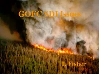
Global Observation of Forest Cover (GOFC): Fire. S. E. Asia Fire Cal/Val Workshop A special session of the APAN Earth Monitoring Working Group Summary of January 22 session. Attendees: Pakorn Apaphant John Owens Chaowalit Silapathong Veerachai Tanpitat

E N D
Global Observation of Forest Cover (GOFC): Fire S. E. Asia Fire Cal/Val Workshop A special session of the APAN Earth Monitoring Working Group Summary of January 22 session
Attendees: Pakorn Apaphant John Owens Chaowalit Silapathong Veerachai Tanpitat Treechada Tawornmas Horacio T. Cadiz Krisanadej Jaroensutasinee Peera Chernchit Agus Hidayat Chanchai Sitabutr Mastura Mahmud Alias Mohm Sood Khen Rong Den Pisuth Paiboonrat Do Xuan Lan Soo Chin Liew Panarat Sareewattana Panjit Musik Renato L. Lapitan Bruno Margerin
Background to GOFC • Developed originally under the Committee on Earth Observation Satellites (CEOS) initially as a pilot to test the concept of an Integrated Global Observing System • IGOS goals • To improve use of Earth Observation data to address major problems of global concern; • To improve coordination of national programs; • To improve co-operation between providers and users of Earth Observation data for regional and global applications. • Has become one of the Panels of the Global Terrestrial Observing System GTOS (FAO GTOS Secretariat)
The Organization of GOFC Implementation Teams, Activities and Projects * Fire Monitoring and Mapping .. * Cover Characteristics and Changes.. * Biophysical Parameters Scientific and Technology Board Regional Activities and Networks Collaborations e.g. WGISS and WGCV
GOFC Fire Implementation Team The GOFC Forest Fire Monitoring and Mapping Implementation Team is responding to a critical need by fire management agencies, international agencies, and policy makers at national, regional and global levels, for accurate and timely information regarding wildfires in forestland and other vegetated areas. The Fire IT consists of a number of contributory activities from different research groups and organizations, which demonstrate the operational utility of satellite observations of fire, making the case for long-term observations of fire and the research and development necessary to improve these capabilities to meet user needs.
Fire in S.E. Asia * Fire affects all of the nations in S.E. Asia. * Nearly all the fires in the region are man made. * During dry years fires can rage uncontrollably. *Fire is widely used to dispose of agricultural residues, short term enhancement of crop growth conditions, and in the conversion of forests to agricultural land. *Fire is one of the major factors in the region associated with global change. * Impacts include transboundary smoke, loss of forests, loss of biodiversity, land degradation. * Fire management is now recognized as an important function of government, requiring local and regional communication and cooperative effort. * Fire management includes prediction of risk, prevention, detection, suppression, post fire assessment and recovery.
Workshop Objectives While a number of resource management and scientific applications for satellite fire observations have been identified, little is known about the accuracy and validity of the various data sources and products or how they might be used together for an improved depiction of fire events. The objective of the workshop is to initiate and plan the intercomparison, calibration, and validation of active fire and burn scar products from primary sensor systems capable of making frequent wide area observations of S.E. Asia. In addition, the topics of building a regional capability to generate satellite fire products and widening the use of these products through open access and interactive overlay of multiple data sources will be explored.
Why Accuracy Assessment? "There are many reasons for performing an accuracy assessment. Perhaps the simplest reason is curiosity - the desire to know how good something is. In addition to the satisfaction gained from knowledge, we also need to increase the quality of the map information by identifying and correcting the sources of errors. Third, analysts often need to compare various techniques, algorithms, analysts, or interpreters to test which is best. Finally, if the information derived from the remotely sensed data is to be used in some decision-making process, then it is critical that some measure of its quality be known." Quotation from " Assessing the Accuracy of Remotely Sensed Data: Principles an Practices", Russell G. Congalton and Kass Green, 1999, Lewis Publishers.
Importance of Accuracy Assessment for Fire and Burn Scar Products * Documenting the detection limits for various sensors. * Understanding the errors for each sensor. * Improving the algorithms. * Developing confidence in the use of the data. * Developing calibrations for more accurate input into models. * Others.....
Initial set of objectives of GOFC cal/val in S.E. Asia. A) What are the practical reference data sources, their collection methods, uses, and limitations. B) How well do active fire detections from course resolution environmental satellites (MODIS, AVHRR, DMSP and others) match the location and extent of fires found in reference data. C) How well do burn scar products from course resolution environmental satellites match the location and extent of burn scar found in reference data. D) How well do fire risk predictions match the fire observations (active fires and burn scars).
Review of satellite data and product sources for fire and burn scar monitoring in S.E. Asia Who has what data? What products are being generated? How are the data distributed or accessed? Develop an inclusive table summarizing as many of the data sources and activities as possible.
Positional Accuracy Reference:U.S. Federal Geographic Data Committee (FGDC) Geospatial Positioning Accuracy Standards Part 3: National Standards for Spatial Data Accuracy (NSSDA) The NSSDA uses root-mean-square error (RMSE) to estimate positional accuracy. RMSE is the square root of the average of the set of squared differences between dataset coordinate values and coordinate values from an independent source of higher accuracy for identical points. http://www.fgdc.gov/standards/status/sub1_3.html
Thematic Accuracy Reference: "Assessing the Accuracy of Remotely Sensed Data: Principles an Practices", Russell G. Congalton and Kass Green, 1999, Lewis Publishers. "The purpose of quantitative accuracy assessment is the identification and measurement of map errors. Quantitative accuracy assessment involves the comparison of a site on a map against reference information for the same site. The reference data is assumed to be correct. Because comparison of every spatial point is impractical, sample comparisons are used to estimate the accuracy of maps."
For the thematic accuracy assessment of active fires what types of reference data could be used? * The best reference data would be simultaneously (or near simultaneously) satellite observations at much finer spatial resolution. Ideally this source exhibit many fires, allowing detection limits in the coarse resolution data source to be analyzed. E.g. MODIS & ASTER (simultaneous), 10 am Landsat and 10 am MODIS, 10 pm Landsat and 9 pm DMSP. * Accuracy assessment of cumulative fire detections performed using the burn scar increment is flawed due to the fact that much of the burning is “unobserved” due the the discrete nature of the active fire observations (once or twice per day). * Field data
For the thematic accuracy assessment of burn scars what types of reference data could be used? * Burn scars derived for the same time period from fine resolution satellite imagery (ETM, SPOT, ASTER, BIRD) • * Field data
Pilot Study - Datasets assembled: • Landsat 7 ETM of Landsat Path/Row 131/47 February 2, 2000 and March 5,2000 • AVHRR fire detections from World Fire Web, Bangkok Node (http://wfw-thailand.acrors.ait.ac.th/wfw/) • ATSR fire detections from World Fire Atlas (http://shark1.esrin.esa.it/ionia/FIRE/AF/ATSR/) • TRMM VIRS fire detections from Louis Giglio (NASA-GSFC) • DMSP-OLS fire detections from NGDC
Pilot Study – Data Analaysis: • Burn scar map produced for each date. • Color image generated to show new burn scar added from February 2 to March 5, burn scar present in both dates, and burn scar found in February 2 image but not in the marhc 5 image. • Fire pixels overlayed on burn scar image. • Preliminary Results and Conclusions: • TRMM VIRS and ATSR had very few fire detects, bu associated with burn scars, but did appear to be associated with burn scar. • AVHRR had a moderate number of fire detections, and were geenerally associated with burn scars. • DMSP had a large number of fire detects, most of which were associated with burn scars. • Fresh burn scars tend to have high DN in TM bands 5 and 7 and low • DN in bans 1,2,3 and 4.
Regional and Technology Presentations CRISP experiences in active fire and burn scar cal/val (Dr. Liew) Research results and activities related to forest fires in Indonesia (Mr. Agus Hidayat, Indonesia) Fire cal/val activities and plans for the Huai-Kha-Keang Wildlife Sanctuary, Thailand (Veerachai Tanpipat and Dr. Kiyoshi Honda, Thailand) Options for on-line access to regional fire data (John Owens, University of Maryland). Satella: A tool for peer-to-peer Landsat data sharing (Mr. Bruno Margerin, USA)
Two Sets of GOFC Cal/Val Activities Planned for 2002: Thailand (January – March) Indonesia – Malaysia (May – September)
Thailand (January – March) 1.Landsat Path/Row 131/47 (Chang Mai) used in CEOS WGISS Demo and Pilot Study. Daytime Landsat acquisitions scheduled on 1/31, 2/16, ¾, and 3/20. Nighttime Landsat acquisitions on 2/8, 2/24, 3/12 and 3/28. 2. Landsat Path/Row 130/49 (Huai-Kha-Keang Wildlife Sanctuary). RFD is collecting extensive field data on active fire and burn scar timing and location. Daytime Landsat acquisitions scheduled on 2/7, 2/23, 3/11, 3/27.. Nighttime Landsat acquisitions on 2/8, 2/24, 3/12 and 3/28. Other requested data ASTER, MODIS fire and burn scar (Umd/NASA), AVHRR fire detects (AIT), DMSP fire detects (NOAA-NGDC), fire risk map (TBD). Analysis plan Active fires from Landsat and ASTER data will be used to perform an accuracy assessment of fires detected in MODIS, AVHRR, and DMSP-OLS. The two best Landsat scenes will be used to perform an accuracy assessment of a MODIS burn scar product for the same time period: Data hosting for ftp access: AIT?
Indonesia - Malaysia (May-September) 1. Riau, Sumatra 2. Selangor, Malaysia Data sets to be requested: Day and night Landsat ETM, SPOT (CRISP), ASTER, MODIS fire and burn scar (CRISP), AVHRR fire detects (multiple sources), DMSP fire detects (NOAA-NGDC), FDRS fire risk maps, LAPAN fire risk maps . Analysis plan: 1) Active fires from Landsat and ASTER data will be used to perform an accuracy assessment of fires detected in MODIS, AVHRR, and DMSP-OLS. 2) Active fires detections will be compared against fire risk maps. 3) The two best Landsat scenes will be used to perform an accuracy assessment of a MODIS burn scar product for the same time period: Data hosting for ftp access: UKM?
Outstanding Issues: 1. How can we determine the accuracy of burn scar maps to be used as reference data sources? Questions were raised in the pilot that dry grass and clearings were mapped as burn scar. 2. How do we know how many active fires are missed in reference data sets, especially daytime Landsat and ASTER? 3. Should we have a follow on workshop. If so, when and where? APAN 2003?