Download
1 / 62
660 likes | 1.44k Views
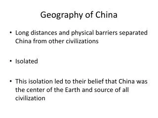
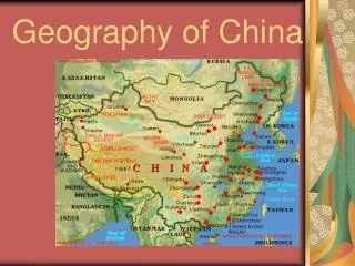
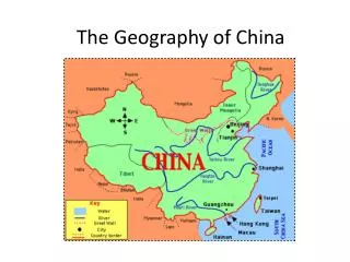
The Geography of China. World Regional Geography Canton High School. Satellite View of China. China’s Provinces. China—Asia’s Superpower. China vs. the U. S. in Size. China. United States.

E N D
The Geography of China World Regional GeographyCanton High School
China vs. the U. S. in Size China United States • SOURCE: Topic 5: “The Awakening Giant” by Dr. Jean-Paul Rodrigue, Dept. of Economics & Geography, Hofstra University.
Countries & Regions Russia Mongolia N. Korea S> Korea Tibet Indian Subcontinent Taiwan Southeast Asia Philippines
Cities Harbin BEIJING Nanjing Shanghai Xi’an Lhasa Taipei Guangzhou HongKong Macao
Completed Political Map Harbin Mongolia BEIJING N. Korea S> Korea Tibet Nanjing Shanghai Xi’an Lhasa Indian Subcontinent Taipei Taiwan Guangzhou HongKong Macao Southeast Asia Philippines
Bodies of Water Amur River Sea of Japan Yellow Sea Huang-He River Yangtze River Xi River Pacific Ocean SouthChinaSea
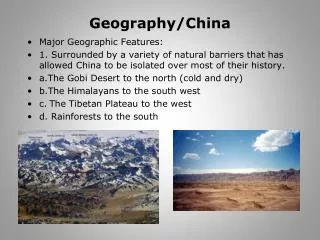
Mountains & Peaks Altai Mts. Greater Khingan Tian Shan Kunlun Shan Himalayan Mts.
Deserts & Plateaus Gobi Desert Taklamakan Desert Tibetan Plateau
Valleys / Plains / Basins Manchurian Plain North China Plain Tarim Basin Sichuan Basin
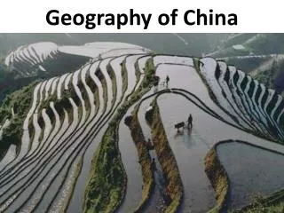
Agricultural Regions in China Great Wall Shabdong Peninsula Grand Canal CHUNG KUO
Completed Topographic Map Amur River Altai Mts. Greater Khingan Manchurian Plain North China Plain Tian Shan Sea of Japan Gobi Desert Tarim Basin Great Wall Taklamakan Desert Kunlun Shan Shabdong Peninsula Huang-He River Yellow Sea Tibetan Plateau Grand Canal CHUNG KUO Himalayan Mts. Sichuan Basin Yangtze River Xi River Pacific Ocean SouthChinaSea
“Brown” China vs. “Green” China Wheat Dominant Pasture and Oasis Rice Dominant Double-crop rice • SOURCE: Topic 5: “The Awakening Giant” by Dr. Jean-Paul Rodrigue, Dept. of Economics & Geography, Hofstra University.
Natural Resources
Top 10 Populated Nations 2001 2050
The Population of China thousands
Population Projections thousands