Download
1 / 21
210 likes | 219 Views
This study examines the status of stakeholder involvement, issues questionnaire, data collection progress, and model tools and scenarios for the optimization of sustainable water resources in the Lower Litani River Basin in Lebanon.

E N D
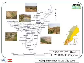
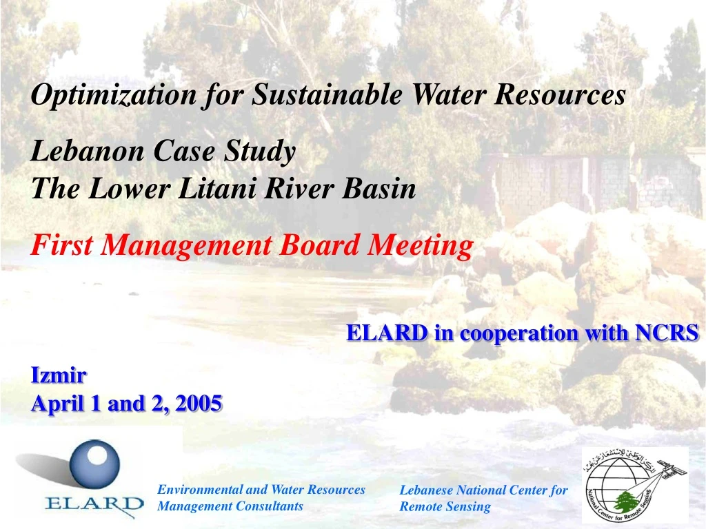
Optimization for Sustainable Water Resources Lebanon Case StudyThe Lower Litani River Basin First Management Board Meeting ELARD in cooperation with NCRS IzmirApril 1 and 2, 2005 Environmental and Water ResourcesManagement Consultants Lebanese National Center forRemote Sensing
OUTLINE • Status of Stakeholders Involvement • Issues Questionnaire • Data Collection Progress • Model Tools and Scenarios
Status of Stakeholders Involvement • Major Stakeholders were identified (<Stakeholders-general list-Lebanon>)Not fully taken into account in D01 • Still need to identify key communities to be involved and other major water users (farmers COOPs) • Key stakeholders are already involved in the project (Litani River Authority (GOV), NGOs, MoE) • Next steps: • Introducing remaining stakeholders to project (letters, issues questionnaires, interviews) • Local participatory workshop (?)
Issues Questionnaires • Already tested by: • ELARD and NCRS • LRA (GOV) • Amwaj of Environment (NGO) • Comprehensiveness • Data availability (?) (under Water management) • R&D (under water management) • DSS (?) (under Water management)
Issues Questionnaires (2) • Clarity: • Water scarcity • Coastal interaction • Coexistance of public and private responsibility, privatization • Gender issues • Technology and investments • Development of demand (generic) • Household/Tourism/Agriculture/Industrial Water Quality under Water Demand • Shipping and flooding (under Water demand, other uses)
Issues Questionnaires (3) • Structure: • Water scarcity under physical conditions (?) or under Water Supply (as water availability)? • Separate groundwater availability and quality • Separate Standards and Quotas • Water Quality Issue within Demand and SupplyWhy not as a stand-alone category (in order to address key issues affecting water quality)?
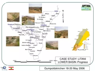
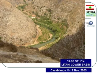
Data Collection and Availability • Identification:Lower Litani River Basin, South Lebanon • Description: • Coastal southern Lebanon along Eastern Mediterranean • Sub-Basin Area: 600 km2 • Elevations from 0 to 600 m amsl • Average annual precipitation: 700 mm • Over 100 springs and increasing number of groundwater wells • Around 120 towns and a total population of about 300,000 persons
Data Collection and Availability (2) • Location: • GIS data and satellite imagery are available
Data Collection and Availability (3) • Basin: • High-resolutionDEM is available
Data Collection and Availability (4) • Land-use:
Data Collection and Availability (5) • Meteorology: • Data available from the Lebanese Meteorological Service • Annual total/average precipitation and temperature; min/max/average, monthly total/average time series of daily values are available • Number of relevant stations being checked with LMS (limited number of stations – 1 or 2) • Hydrology: • Data available from the Litani River Authority
Data Collection and Availability (6) • Monitoring infrastructure: • Major limitation with respect to water quality monitoring • No systematic monitoring of groundwater levels • No monitoring/measurement of water consumption (metering systems) • No systematic monitoring available other than hydrological and meteorological data • Water budget: • Precipitation = 282 million m3/year • Evapo-transpiration = 143 million m3/year • Runoff = 43 million m3/year • River discharge = 130 million m3/year • Different uses = 66 million m3/year • Groundwater storage = 100 million m3/year
Data Collection and Availability (7) • Structures: • One major reservoir: Markaba • No water/wastewater treatment plants available • Water resources: • More than 70% of water consumption goes to irrigation • No environmental water use • Main source of water supply is from surface water • No unconventional sources • Domestic distribution networks need upgrading • Irrigation networks are still deficient and need to be implemented • No treatment facilities
Data Collection and Availability (8) • Demography:
Modeling • Basic review and initiation to manuals • Effective start after long expected modeling training workshop