Download
1 / 47
470 likes | 578 Views
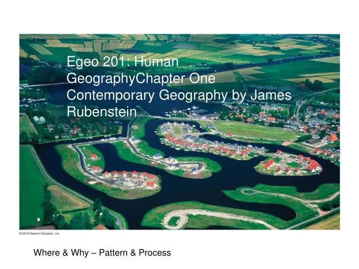
Egeo 201: Human GeographyChapter One Contemporary Geography by James Rubenstein. Where & Why – Pattern & Process. Geography. Is a science that deals with three questions: Where are things – Looks at and for PATTERNS Why/How things are at a location – Looks at and for PROCESSES

E N D
Egeo 201: Human GeographyChapter One Contemporary Geography by James Rubenstein Where & Why – Pattern & Process
Geography • Is a science that deals with three questions: • Where are things – Looks at and for PATTERNS • Why/How things are at a location – Looks at and for PROCESSES • Why they are Significant -- IMPACTS • An introduction to Human Geography http://www.youtube.com/watch?v=1Ce4P05TrNQ&feature=related What is Geography http://www.youtube.com/watch?v=sv2pLYTkwG4&feature=related
Pattern: Crop Circles • What are these strange patterns • By what process were they created • What does this tell us about society in the UK?
Process: Is there intelligent life here on earth? • Investigating Crop Circles http://www.youtube.com/watch?v=3bqNvM7op64
Impact – Who Cares? http://www.youtube.com/watch?v=L2ZxVqdZIiw
Mapping – Providing Location Terms to know • Scale • Projection • Geographic Grid – lat. Long., time zones • Remote sensing • GIS • GPS • Mash-ups
Outline of Additional Concepts • Where • Location • Absolute • Geocodes, coordinate systems, addresses, place names… • Relative • Example “turn where the cow is standing in the field” or Nebraska is next to Kansas • Why • Site & Situation
Where • Maps show us where things are
Why • Variety of tools available they include • Uniqueness of Location • Uniqueness of Regions • Distribution of Features • Connections and Interactions between Places
Uniqueness of Places • Descriptive Characteristics • Site • Situation • Location Characteristics • Toponyms • Mathematical Location
Site • Internal descriptors at a place • Physical – includes climate, topography, quality of soil, existence of natural harbor… • Human Impacts – includes built environment, local cultural impacts, long-term changes due to human occupation
Steps in determining SITE characteristics • Establish clear boundaries around a geographic area or region (“circle the area”) • Political bounds • Natural bounds • Other – market area for a newspaper • Inside the bounded area evaluate characteristics that are available • Could be natural resources • Natural features – hills, rivers, caves… • Human developed features – roads, housing type, • Etc…
Site Examples Whatcom County (political bounds) • Recreational Opportunities: Ocean and Mountain venues • Rainy but Mild Climate • Region dissected by streams, rivers and wetlands • Mainly single family housing • Contains coal and forest resources
Situation External Relations – linkages between place being studied and it surroundings Think Network and links
Steps in determining SITUATION characteristics • Think of a network (like a spider web of activities) • Describe how the location you are focusing on relates to all other locations on the network
Steps in determining SITUATION characteristics 0. Think of a spider web • Change your entities/places (i.e. places) into points • Locate connections between the points (building your web or network) • For each point on this network describe how well it is interconnected, extremes are end-points (dead ends) or hubs (connections between numerous points)
Situation Examples • Access to Economic Inputs – e.g. connections to oil fields • Location on travel routes – airline hub and spoke system
Situation Examples • Access to Economic Inputs – e.g. connections to oil fields • Location on travel routes – airline hub and spoke system Hub and Spoke Airline map
Example Using Battle of Gettysburg Step Back first – Civil War Regions Pattern – Process Toponyms
Toponyms • Naming a place – helps recognizing WHERE • Rough rules Generally naming is based on the following historical progression 1. Natural features (note the remaining Salish names in our region, followed by names left by the Vancouver Expedition, for example Whatcom Creek and Bellingham Bay) 2. Settlements (the lack of large permanent Native American settlements, left this task to primarily European & American settlers) 3. Roads (In Bellingham primarily a late 19th early 20th century task -- note the prominence of State names and even a section of town where streets are named after the Great Lakes (where do you think these people or developers came from?)) 4. Parks, Schools, Public Facilities,... (primarily a 20th century to recent task -- note the recent name change from Washington National Airport the Ronald Reagan Airport) 5. Anything that's left over or added (in Seattle we now have the "Gov. Rosaylene Bridge at Evergreen Point" rather than the original Evergreen Point Bridge or the Haggen Court at Carver Gym some day we might have '" your name here" Recycling Bin in the President Shepard Coffee Shop at the Viking Addition of the Western Student Union" )
How to Organize Space & Describe Space • Regions – relate more to process then pattern • Distribution – descriptors that help us understand patterns
Regions -- spatial organizing tool • Functional or Nodal – organized around a node of focal point – television station market (not satellite) • Formal or Uniform – everything inside shares common characteristic – country with citizens inside (ignore foreign residents) • Vernacular or Perceptual – exist in minds of people as cultural identity – “Midwest” in the US
Functional Region: Television Markets - organized around a node of focal point – broadcast signal (note the outlines of the states and counties are formal regions)
Formal Region from 2008 election County Level Retuns -- everything inside shares common characteristic
Formal Region from 2008 election State Level Retuns -- everything inside shares common characteristic
Formal Region from 2008 election -- everything inside shares common characteristic -- note difference if controlled for by population -- Cartogram http://www-personal.umich.edu/~mejn/election/2008/stateelecredblue1024.png
Vernacular Region: “The South” -- exist in minds of people as cultural identity
Class Exercise: Vernacular Region – The West • Break into groups of about 3 • View the following map and decide what states below to the region called “The West” in the US • Turn in a sheet of paper with your names and a list of Western states in alphabetic order
Add the Vernacular South to the Formal Voting Pattern Region
Distribution - Density – count of objects in a given land area - Concentration – clustered versus dispersed - “Geometric” Pattern – geometric arrangement of objects across space – regular versus irregular or random pattern
Density: count of an object per measure of space Lower Density 24 homes Highly Dispersed Concentration: How clustered or spread/dispersed across the landscape Higher Density 32 homes Highly Dispersed Higher Density 32 homes Clustered -- Concentrated
1950 Concentrated 2009 Dispersed
Geomentric Pattern (2.0) Pattern – geometric arrangement of objects across space – regular versus irregular or random pattern
Suburban Patterns Rectilinear Pattern Curvilinear Pattern Combination
Other Patterns • “Crime Control Suburban • Note there is only one or two ways in our out Rectalinear Oval pattern
Space-Time Compresion Distance Decay Concepts on Distance
Hearth & Diffusion • Hearth – Where did something originate • Diffusion – How did it spread • Relocation Diffusion – result of people moving • Expansion Diffusion – spread of feature in additive process • Hierarchical – from more important to less • Contagious – widespread throughout • Stimulus – only idea or underlying principle spreads
Blue Jeans: Hearth & Diffusion Relocation – starts in San Fran. Moves with miners & others Expansion Three Types • Hierarchical – easier to find in urbanized areas • Contagious – people see what the like & buy • Stimulous – others copy idea – competing brands Levi Straus – not wearing blue jeans!!!
Levi Strauss and His Companyby Susan Saperstein As historians, we like to correct others’ misconceptions of history. Here are some myths about Levi Strauss and his company:MYTHE• Levi Strauss invented jeans when peddling tent canvas material in gold camps. The miners asked for strong pants, and he made pants out of the canvas and used rivets on the pockets.• The company always made jeans.• The name denim comes from a town in France named Nimes.• These pants with the riveted pockets were always called jeans.TRUTHThe actual history goes like this:• A tailor named Jacob Davis was the inventor of the pants later known as Levi’s or jeans. He approached Levi Strauss & Co. with his idea to secure a patent. It is likely that Davis thought that the company could give him the business network needed to market his idea. Ben Davis, his grandson, later founded the Ben Davis Manufacturing Company – still owned by the Davis family.• The company started out selling dry goods such as clothing, buttons, bedding, and other textiles to small stores in the West in the early 1850s. The patent for the pants was not granted until 1873. http://www.sfcityguides.org/public_guidelines.html?article=244&submitted=TRUE&srch_text=levi%20straus&submitted2=TRUE&topic=
Expansion –Contagious & Hierarchical Diffusion: Swine Flu 4/27/2009
Human-Environment Interaction The environment provides a base upon which humans interact • Possibilism – adjusting to the environment • Not environmental determinism Humans alter the landscape • Global climate change, leveling and filling
Maps: Look in Book • Projections • Scale • Mathematical Location –coordinate systems • Mashing • GIS
In Class Exercise • Break into groups of 2 to 3 • Write down all the terms you can remember from Chapter 1 for geographically analysing, mapping and describing the world. (put your names on sheet alphabetically) • Instructor will flash 3 or 4 maps on the screen and you’ll have about 30 sec. to identify as many concepts from your list. • Randomly groups will be selected to share their results.
Other things • Dumb and Dumber Geography Lesson http://www.youtube.com/watch?v=yUNgdkqjI8E&feature=related • What is Science? The Daily Show Definition. http://www.thedailyshow.com/watch/wed-october-26-2011/weathering-fights---science---what-s-it-up-to- • http://www.thedailyshow.com/watch/wed-october-26-2011/lisa-randall • University of British Columbia Okanagan video,"Schist Geographers Say":http://www.youtube.com/watch?v=nqgiNnR9O3k