Download
1 / 46
460 likes | 466 Views
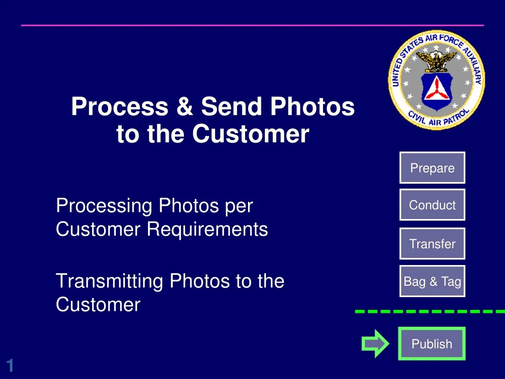
Process & Send Photos to the Customer. Prepare. Conduct. Processing Photos per Customer Requirements Transmitting Photos to the Customer. Transfer. Bag & Tag. Publish. Agenda. Recommended Photo Processing & Transmission Tools Range of Customer Scenarios:

E N D
Process & Send Photos to the Customer Prepare Conduct Processing Photos per Customer Requirements Transmitting Photos to the Customer Transfer Bag & Tag Publish
Agenda • Recommended Photo Processing & Transmission Tools • Range of Customer Scenarios: • Search Assistance missions for County Sheriff • Air Force / CAP SAR or Training missions • Damage Assessment missions for local/state/federal agencies • Each Scenario Will Cover Typical Examples of Customer Deliverables: • Format Requirements • Transmission Requirements
Photo Processing Tools(In addition to Geotagging) • Photo Processing Tools (ViewNX2 recommended) • Nikon ViewNX2 • Same as file transfer program • Alternate: Picasa • Example further training: • http://www.learningelectric.com/picasa2/ • https://www.youtube.com/watch?v=QpQN8Zgy8KI • Photo Labeling Program (ViewNX2 recommended) • Nikon ViewNX2 • Alternates: • CAP Image Processor • Phyllis
ViewNX2 – Photo Adjustments • Use Adjustments side panel to fine tune photo for lighting, contrast etc • Click “Save” or “Save as” to save photo to disk • “Save” will create an “Originals” folder & put a backup copy in it • “Save As” preserves original photo on disk
ViewNX2 - Cropping • Scroll down to cropping on adjustments side panel • Crop photo as desired & click apply • Can reset if desired after applying changes • Click “Save” or “Save as” to save photo to disk • “Save” will create an “Originals” folder & put a backup copy in it • “Save As” preserves original photo on disk
Resize Photo • Click “Convert File” • Enter new horizontal pixel dimension • Click “Convert” • New file will be created with -01 name suffix • Can select option to “Change File Names” for easier file name reference to resized image
ViewNX2 – E-Mail Photo • Use your email program to send phot or group of photos • Option to select photo pixel size • Will open photo(s) as an attachment in your email app
ViewNX2 – “Print to File” w/Label • Select Print • Displays preview of photo with label • Check “Print Information” then select “Settings” • Select Metadata tab & select location, name & date. • Select Footer tab & enter “Civil Air Patrol” in footer • Select “File Output” to save new jpg w/name • Warning: new jpg has no metadata
CAPUploader App & Image Viewer • Beta test phase, will be deployed soon
CAPUploader Notes • CAPUploader was developed with FEMA, and provides an easy method of uploading AFAM photos • Will become standard repository for CAP photos • This program is undergoing development and beta testing • Limited deployment until ready for prime time • Beta: all uploaded photos are shown on a public website. • No sensitive or proprietary photos should be uploaded until further notice. • Photos must be geotagged before upload • Adobe Air must be installed on your computer (Apple or Windows OS) • App & Instructions will be provided to your Squadron
CAPUploader App (Beta Version) - 1 • Open CAPUploader app and select the Event dropdown box (Events are created and assigned by CAP NOC. If you have a special event or customer, contact AZWG to get a special event set up for you.) • Currently, the AZWG has been assigned “CAP AZ Wing Training” Event for our use. So for typical CAP photo uploads, select “CAP AZ Wing Training” as the Event. • Normally for “Team”, enter your Mission Number, space, 4 digit Sortie Number with A or G prefix (e.g. “15T5326 A0006”, note: no dashes in mission number). • For “Project” enter a short description of the target or tasking (e.g. “Bridge Damage”, “Aircraft Search”, “Flooding”, etc.). • For multiple assigned targets, suggest a different upload per each target name, same sortie #
CAPUploader App (Beta Version) - 2 • Once you enter a project, the “Browse” button will be active and you can select a folder in your computer where the images are stored. All images in the folder will be uploaded. • Once a folder is selected, clicking “Upload” will start the upload process. • All files will be listed below the Upload button and any upload errors (e.g. no GPS data) will have an alert symbol (yellow triangle with “!”). • After the upload completes, you can retry uploading any errors using “Retry Errors” and “Upload”. • Once it uploads images, it will remember which ones are uploaded based on folder & file name and not try them again.
CAPUploader Image Viewer (Beta) For beta testing, CAP is using a test map site. Once development is complete, images will go to the FEMA GeoPortal. The following beta map site is shown below (green dots represent images) • Click the “Open” drop down list and select “Open in Map viewer.” You will a see US map with green dots representing all images uploaded to date for all CAP wings. Green dots with arrows have image direction also encoded in their metadata (not required). • You can move and expand the map as needed. You can also select a suitable map background by clicking the “Basemap” icon on the upper left. • Clicking on a green dot will open an image caption box. Clicking on the image thumbnail will open a new window with the image, usually downsized to show full. Clicking on that image will show it in its full size & resolution. Beta Viewer: http://fema.maps.arcgis.com/home/item.html?id=60c4ddad2b0e4fd4964c1d7d301689e0
Customer Sceanarios Usage: Tactical • Search Assistance missions for County Sheriff • Air Force / CAP SAR or Training missions • Damage Assessment missions for local/state/federal agencies Strategic • Lets cover two typical User Categories: • Tactical: Fast photo & info viewing, easy to disseminate, typically a remote user on a cellular connection • Strategic: Needs high tech solution for photo mosaic (info in metadata only), works in an office environment
Example Scenario Variables • Usage scenario / time criticality: • Example user situation & photo turn around time requirements • Target Focus: • How does the customer want the target shot • Photo Size/Resolution: • May be specified by the customer or it may be driven by the situation • Cropping (or other photo adjustments): • Is it desired by the customer? If so, in what situation would you use it? • Photo Labeling: • May be specified by the customer or it may be driven by the situation • Photo Transmission: • Typically specified by the customer or it may be best available method The following scenarios are examples only. Every situation will be different. Apply your training & experience to meet customer needs.
Tactical Scenario - User Requirements • Usage scenario / time criticality: • A sheriff working on the hood of his pickup truck, directing ground teams to target area. Needs photos ASAP. • Target Focus: • Varied perspectives of same target, overview required showing relative location to land marks, ingress routes, etc. • Photo Size/Resolution: • Sized to display whole picture on low res laptop (1024x768) or PED • Cropping: • Not as important unless photo fault is misleading • Photo Labeling: • Only if time permits, simplifies ground tasks • Photo Transmission: • Time critical, typically email or photo sharing site
Tactical: Photo Techniques • Typical Camera settings • Shutter mode: Conditions dictate - Auto or Burst • Focus Mode: Conditions dictate – Auto or Continuous • External Factors • Environment: Position aircraft for best shots and/or use camera exposure settings to compensate for haze, lighting etc. • Target Focus: Overview & different perspectives required, potentially overlap shots to help coverage. Additional photos to see ingress concerns, etc…
Tactical: Photo Process & Transmit • May need to transmit photos “as is” due to time constraints. • Capturing GPS data is vital, have a backup • Direct aircraft to ground capability may be available (TBD). • Can use ViewNX2 to batch geotag photos • If time allows, use ViewNX2 to ensure a quality delivery. • Try to correct geotag for target location if known or can be determined • Use Photo adjustments if required to enhance image • May need to resize image before sending (e.g.: 1024x768) • Check if photo cropping is required • Enter descriptive data & picture direction if required • Send photo to customer (via CAP liaison if required – AFAM rules) • Typically email or photo sharing. Beware of email file size limits - Refer to Chapter 8 of the Airborne Photographer Reference Text for details • May need photo descriptions as separate text as well • Archive photos in CAPUploader as required
Strategic Scenario - User Requirements • Usage scenario / time criticality: • Gov’t agency that will stitch together 100s /1000s of photos for an area mosaic. Time criticality varies by event and/or customer. • FEMA wants them posted w/CAPUploader quickly. • Target Focus: • Images in a matrix pattern (e.g. equally spaced rows), may need to have specific spacing and/or overlapped • FEMA requires 50% overlap on each side & top & bottom • Photo Size/Resolution: • Custom resolution may be specified. • FEMA requires that at normal zoom levels, picture resolution should show 6 inch object with no pixelation (e.g. rough or stair stepped edges). • Cropping: • Typically no cropping • Photo Labeling: • No, geotagged only • Photo Transmission: • CAPUploader, eCopy, web server, FTP, Dropbox, etc.
Strategic: Photo Techniques • Typical Camera settings • Shutter mode: Timed to capture at intervals • Focus Mode: Auto • External Factors • Environment: Fly aircraft on planned pattern (usually dictated by customer). Camera exposure settings to compensate for haze, lighting etc. but remain consistent. Recommend GPS tracking to help fill in any geotag holes. • Target Focus: Series of photos. Specific spacing intervals and overlap (if any) typically specified by customer
Strategic: Photo Process & Transmit • Review captured photos to ensure you are meeting customer expectations on coverage, etc. • Can use ViewNX2 to ensure geotagging • If photo enhancement is used, results should be consistent • Photo enhancement may be restricted by the customer • Use appropriate means to send photos to customer • May be via CAPUploader, eCopy, FTP, etc. - Refer to Chapter 8 of the Airborne Photographer Reference Text for details • In complex missions, multiple sorties and/or targets may be in single delivery - may require target description / delineation • Archive photos in CAP Uploader if required
Typical AZWG Customer Scenarios Customer Drivers vs. Recommended Photo Processor
Picasa - Cropping • Double click to select photo to open picture editing panel, select crop • Use cursor to outline desired area to show • Can Preview photo • Select Apply & edited version added to catalog • Note: Picasa keeps unedited photo in hidden location to undo edits • If you want a visible copy made, select File > “Save a Copy” to save the edited version in the same folder for direct access (with -001, etc. added to file name)
Picasa – Brightness/Contrast • Double click to select photo to open picture editing panel, select desired function • Auto Contrast to sharpen photo • Fill Light slider bar to adjust brightness • Bright Icon tab has more adjustments • Note changes to Histogram • Select Back to Library & edited version is added to catalog • Note: Picasa keeps unedited photo in hidden location to undo edits • If you want a visible copy made, select File > “Save a Copy” to save the edited version (with -001 added to file name) in the same folder for direct access
Picasa – Resizing via Export • Exporting saves resized photo in user selected folder • Select photo (or group of photos), select File>Export Picture to Folder… • Enter desired folder name • Use slider to select image size setting (horizontal pixel dimension) • Option: Can select “Add numbers to file names…” to prefix w/ photo sequence #
Picasa – Resizing via E-Mail • Links to your selected E-Mail program • E-Mailing doesn'tsave resized photo • First, check/set default email settings in Tools> Options> E-Mail, then OK. • Select E-Mail icon. • New E-Mail msg will appear with resized photo(s) attached. • Add any cover notes and send.
CAP Image Processor • PC or Mac App to label CAP photos (similar to what was in WMIRS) • See this website for instructions • http://cap.ttar.org/imageprocessor/ • Requires spreadsheet app for entry of photo data • Open .CSV file • Change CSV for your photos • Save as .CSV file • Create empty output folder • Start CIP, enter folder info & process • New photos created in output folder. CAP logo, info block & photo direction added
Phyllis Photo Processing • Phyllis is a NWG CAP member developed program, uses MSAccess Runtime • Phyllis provides a platform to: • Label the photo with description, location, direction & CAP logo • Calculate & display target position from camera position & lookdown angle • All data stored in photo EXIF • Photo “Normalization” to reduce effects of haze • Resize photos to reduce files sizes for wireless transmission (originals still saved) • Auto generate an enhanced CAPF 104b for upload to WMIRS • Import GPS track file from GPS for automatic photo HDG and target location calculations • Phyllis installation and operation overview covered in Backup material http://www.mncap.org/es/imaging/
Phyllis • See Phyllis User Manual for detailed installation & operating instructions • Included in zip file • The following slides provide a top level overview of typical Phyllis operation
Installing Phyllis • Download Phyllis 3.xx zip file & unzip to the root C drive • http://www.mncap.org/es/imaging/ • Zip folder contains user manual as well • Download & install Access 2007 runtime file (~57MB)http://www.microsoft.com/en-us/download/details.aspx?id=4438 • Practice photos available on the SQ302 website • Squadron302.org, Member Section (Password Required)
Rescale (compress) only when required: - Big savings in file sizes - Useful if sending on wireless connection Phyllis Basic (No GPS Track) Phyllis GPS Track (Useful if photos are not geo-tagged) Phyllis Overview Step 2 Step 1 Copy images from camera/disk and (optionally) import GPS track file Rescale Images (if required) Step 3 Input captions, HDG, camera & target lat/lon no GPSTrack? Step 2a Step 3 Step 4 Create Upload Package and Caption photos Synchronize images with track file for HDG, camera lat/lon, etc. Input captions. Auto load HDG, camera & target lat/lon yes
Phyllis Basic Operation (No GPS Track) • This process is used when no GPS track information is available to upload into Phyllis • Phyllis will use existing GPS data on a geo-tagged photo or it allows for manual entry from photo log data if required • Manual entry of photo HDG required • From above data, Phyllis can calculate target lat/lon • If target lat/lon is known, Phyllis can calculate photo direction
Phyllis Basic Steps - Startup • After uploading photos to PC, start Phyllis • Enter mission & sortie number (numbers only, no letters) • Ensure Greenwich Mean time (UTC) is selected (i.e. Zulu time) • Assumes camera is set to Zulu time • Ensure Expert Mode is selected
Import Photos to Phyllis Enter correct path to your photos (Nikon Picture Transfer folder) Review photosNote photo preview & Geo-tagged photo data Select desired photos to import Click Retrieve to import photos
Re-Scale and Add Sortie Information • Select desired picture size (compression) • D200 photos: 3872 x 2592 (10 mega pixels), 3.3 Mbytes file size • If uploading direct to WMIRS: Select No Size Change • If transmitting: Select 1024x768 (0.8 mega pixels), 0.4 Mbytes file size (8x file size compression) Select which pictures will be rescaled (per scaling selection) and passed to the next step Click on Rescale
Add & Edit Photo Tags Select desired AGL & lookdown angle Note “camera” GPS will be pre-populated if available
Add & Edit Photo Tags – Data Entry Option 1 2. Fill in picture direction Can use drop down or enter a number 1. For each photo, fill in Object description, city (or location) & state 3. Click on Make Estimate to load estimated target location based on AGL & Lookdown angleorEnter target lat/lon manually Perform these steps for each photo
Add & Edit Photo Tags – Data Entry Option 2 • Click on Edit Tags button to open Excel and edit all the photo tags • Good if data is repetitive, use Excel copy & paste function • 1. Clicking on Edit Tag will start Excel and show the below sheet • 2. Enter data in Excel, save file, then close Excel After closing Excel (with Save), Phyllis will see it and give you this message
Add & Edit Photo Tags – Data Entry Option 3 (for use when target lat/lon is known & photo direction unknown) 1. For each photo, fill in Object description, city (or location), state & target lat/lon (leave direction blank) Hint: Use “Map It” feature (via Google Maps) to move map cursor & determine lat/lon of target 2. After all known photo data is entered, click “…Update Camera Direction…”off then on to calculate & save photo direction for all photos
Add & Edit Photo Tags – Saving Data • Optional: Click on WMIRS Data Entry Summary to print out all photo data for later entry into WMIRS • Yes, you still have to enter all of this data into WMIRS again to allow for users to search the WMIRS photo library Select Save Tags when completed with all photos
Merge Captions with Photos Select which photos you want to save with captions merged (usually all of them at this point) Option: Select Custom Captions - Use only if directed Click on Caption when completed Option: Click to auto generate CAPF 104b pdf
Phyllis File Structure • Phyllis is located on the C drive on the Aircrew PCs • Each Mission Number created in Phyllis will have its own folder • Each Sortie Number will have three sub-folders Captioned photo viewed with IrfanView (Full screen, showing EXIF data)